Category:Wasserturm Wermsdorf
Jump to navigation
Jump to search
| Object location | | View all coordinates using: OpenStreetMap |
|---|
| (Wikidata) |
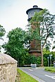
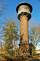
water tower in Wermsdorf, Saxony  | |||||
| Upload media | |||||
| Instance of | |||||
|---|---|---|---|---|---|
| Location | Wermsdorf, Nordsachsen, Saxony, Germany | ||||
| Street address |
| ||||
| Heritage designation | |||||
| Inception |
| ||||
 | |||||
Media in category "Wasserturm Wermsdorf"
The following 6 files are in this category, out of 6 total.
-
 Hubertusburg-turm.jpg 540 × 720; 138 KB
-
 Wasserturm Wermsdorf 1.JPG 4,320 × 2,432; 4.48 MB
-
 Wasserturm Wermsdorf 2.JPG 2,432 × 4,320; 3.74 MB
-
 Wasserturm Wermsdorf 3.JPG 4,320 × 2,432; 4.5 MB
-
 Wermsdorf Wasserturm-01.jpg 4,000 × 6,000; 3.51 MB
-
 Wermsdorf Wasserturm.jpg 2,236 × 3,380; 1.07 MB


