A República de Angola é um país da costa ocidental de África, cujo território principal é limitado a norte e a leste pela República Democrática do Congo, a leste pela Zâmbia, a sul pela Namíbia e a oeste pelo Oceano Atlântico. Angola inclui também o enclave de Cabinda, através do qual faz fronteira com a República do Congo, a norte. Para além dos vizinhos já mencionados, Angola é o país mais próximo da colónia britânica de Santa Helena.
KiKongo
Ngola - Repubilika ya Ngola Repubilika ya Ngola kele nsi mosi ya Afelika ya Sudi. Bansi ya pembeni kele Kongo-Kinsasa, Zambia na Namibia. Kizunga ya Kabinda kele na ndilu na Kongo-Braza. Lwanda kele mbanza-mfumu ya Ngola.
The Republic of Angola is a country in south-central Africa bordering ► Namibia, the ► Democratic Republic of the Congo, and ► Zambia, and with a west coast along the Atlantic Ocean. The exclave province Cabinda has a border with ► Republic of the Congo. A former Portuguese colony, it has considerable natural resources, among which oil and diamonds are the most significant.
This section holds a short summary of the history of the area of present-day Angola, illustrated with maps, including historical maps of former countries and empires that included present-day Angola.
Angola as part of the portuguese colonial empire in the 16th century
Maximun UNITA expansion in Angola civil WAR Angola
SWAPO and South Africa Defence Force operations in Angola and Namibia, 1981-1984
Tribes in 1970
Satellite maps
Satellite map
Maps of divisions
This section holds maps of the administrative divisions.
Bengo
Benguela
Bié
Cabinda
Cuando Cubango
Cuando Cunene
Cuanza Norte
Cuanza Sul
Huambo
Huila
Luanda
Luanda Norte
Luanda Sul
Malanje
Moxico
Namibe
Uige
Zaire
Bengo
Bengo before 2011
Benguela
Bié
Cabinda with special marker
Cabinda
Cubado Cubango
Cuanza Norte
Cuanza Sul
Cunene
Huambo
Huila
Luanda (before 2011) with special marker
Luanda before 2011
Luanda
Lunda Norte
Lunda Sul
Malanje
Moxico
Namibe
Uíge
Zaire
Notes and references
General remarks:
The WIKIMEDIA COMMONS Atlas of the World is an organized and commented collection of geographical, political and historical maps available at Wikimedia Commons. The main page is therefore the portal to maps and cartography on Wikimedia. That page contains links to entries by country, continent and by topic as well as general notes and references.
Every entry has an introduction section in English. If other languages are native and/or official in an entity, introductions in other languages are added in separate sections. The text of the introduction(s) is based on the content of the Wikipedia encyclopedia. For sources of the introduction see therefore the Wikipedia entries linked to. The same goes for the texts in the history sections.
Historical maps are included in the continent, country and dependency entries.
The status of various entities is disputed. See the content for the entities concerned.
The maps of former countries that are more or less continued by a present-day country or had a territory included in only one or two countries are included in the atlas of the present-day country. For example the Ottoman Empire can be found in the Atlas of Turkey.


 Bengo
Bengo Benguela
 Bié
Bié Cabinda
 Cuando Cubango
 Cuando Cunene
 Cuanza Norte
 Cuanza Sul
 Huambo
 Huila
Huila Luanda
 Luanda Norte
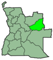 Luanda Sul
 Malanje
 Moxico
 Namibe
 Uige
Uige Zaire
Zaire


 Bengo
Bengo Bengo before 2011
 Benguela
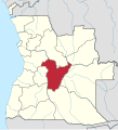 Bié
Bié Cabinda with special marker
 Cabinda
 Cubado Cubango
 Cuanza Norte
 Cuanza Sul
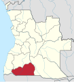 Cunene
 Huambo
 Huila
Huila Luanda (before 2011) with special marker
 Luanda before 2011
 Luanda
 Lunda Norte
 Lunda Sul
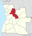 Malanje
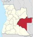 Moxico
 Namibe
 Uíge
Uíge Zaire
Zaire

.svg)


.svg)


.svg)
.svg)


