The Republic of Liberia is a country on the west coast of Africa, bordered by ► Sierra Leone, ► Guinea, and ► Côte d'Ivoire. Liberia, which means "Land of the Free," was founded as an independent nation for free-born and formerly enslaved African Americans. Recently it has witnessed two civil wars, the First Liberian Civil War (1989–1996), and the Second Liberian Civil War (1999–2003), that have displaced hundreds of thousands and destroyed its economy.
This section holds copies of original general maps more than 70 years old.
Map of Liberia 1868
Map of Liberia 1907
Notes and references
General remarks:
The WIKIMEDIA COMMONS Atlas of the World is an organized and commented collection of geographical, political and historical maps available at Wikimedia Commons. The main page is therefore the portal to maps and cartography on Wikimedia. That page contains links to entries by country, continent and by topic as well as general notes and references.
Every entry has an introduction section in English. If other languages are native and/or official in an entity, introductions in other languages are added in separate sections. The text of the introduction(s) is based on the content of the Wikipedia encyclopedia. For sources of the introduction see therefore the Wikipedia entries linked to. The same goes for the texts in the history sections.
Historical maps are included in the continent, country and dependency entries.
The status of various entities is disputed. See the content for the entities concerned.
The maps of former countries that are more or less continued by a present-day country or had a territory included in only one or two countries are included in the atlas of the present-day country. For example the Ottoman Empire can be found in the Atlas of Turkey.


 Bomi County
 Bong County
 Gbarpolu County
 Grand Bassa County
 Grand Cape Mount County
 Grand Gedeh County
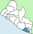 Grand Kru County
 Lofa County
 Margibi County
 Maryland County
 Montserrado County
 Nimba County
 River Cess County
 River Gee County
 Sinoe County


_Map_of_Liberia._West_Africa.jpg)
_Sketch_Map_of_the_Republik_of_Liberia.jpg)