Category:1660s maps of the Netherlands
Jump to navigation
Jump to search
Countries of Europe: Azerbaijan‡ · Belgium · Bulgaria · Denmark · France‡ · Germany · Greece · Hungary · Republic of Ireland · Italy · Lithuania · Netherlands‡ · Norway · Poland · Portugal‡ · Romania · Russia‡ · Serbia · Spain‡ · Switzerland · Turkey‡ · Ukraine
‡: partly located in Europe
‡: partly located in Europe
Media in category "1660s maps of the Netherlands"
The following 9 files are in this category, out of 9 total.
-
 1660 66 Marsdiep Mase Goos.jpg 5,500 × 4,525; 2.33 MB
-
 Geldria ducatus, et Zutfania comitatus (8341846163).jpg 800 × 646; 132 KB
-
 Transisalania provincia (8342903362).jpg 800 × 645; 151 KB
-
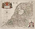 Belgica Foederata (1664).jpg 5,500 × 4,573; 3.78 MB
-
-
 Altena-Blaeu-1665.jpg 1,683 × 1,220; 1.27 MB
-
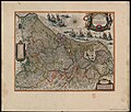
 Foederatae Belgicae tabula (8345415031).jpg 800 × 665; 156 KB
-

-
 Chaerte van de vrye Heerlickheydt Warmondt.jpg 4,000 × 2,756; 2.78 MB

.jpg)
.jpg)
.jpg)

.jpg)
,_RP-P-AO-1-60.jpg)

.jpg)