Category:16th-century maps of Hungary
Jump to navigation
Jump to search
Countries of Europe: Albania · Armenia‡ · Austria · Azerbaijan‡ · Belarus · Belgium · Bosnia and Herzegovina · Bulgaria · Croatia · Cyprus‡ · Czech Republic · Denmark · Estonia · Finland · France‡ · Georgia‡ · Germany · Greece · Hungary · Iceland · Republic of Ireland · Italy · Latvia · Lithuania · Moldova · Netherlands‡ · Norway · Poland · Portugal‡ · Romania · Russia‡ · Serbia · Slovakia · Slovenia · Spain‡ · Sweden · Switzerland · Turkey‡ · Ukraine
Specific status: Isle of Man – Limited recognition: Abkhazia‡
‡: partly located in Europe
Specific status: Isle of Man – Limited recognition: Abkhazia‡
‡: partly located in Europe
Subcategories
This category has the following 9 subcategories, out of 9 total.
- 1530s maps of Hungary (2 F)
- 1540s maps of Hungary (5 F)
- 1550s maps of Hungary (2 F)
- 1570s maps of Hungary (4 F)
M
Media in category "16th-century maps of Hungary"
The following 13 files are in this category, out of 13 total.
-

-
 A New Depiction of the Whole of Hungary WDL6761.png 1,657 × 1,024; 3.59 MB
-
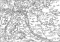
 Atlas Ortelius KB PPN369376781-078av-078br.jpg 3,000 × 2,194; 4.76 MB
-
 Atlas Ortelius KB PPN369376781-079av-079br.jpg 3,000 × 2,194; 4.66 MB
-
 Gemaniae-Tabula-(Sebastian-Muenster).jpg 1,200 × 923; 599 KB
-
 Komárom16thCentury.jpg 1,000 × 706; 567 KB
-
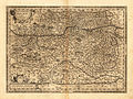 Lazius - Austriae descrip.jpg 2,263 × 1,700; 2.55 MB
-
 Poloniae et Ungariae Münstera.jpg 1,000 × 786; 324 KB
-
 Sambucus Map of Hungary monochrome.jpeg 565 × 400; 102 KB
-
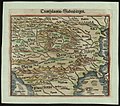
 Sambucus Map of Transsylvania.jpeg 546 × 400; 161 KB
-
 Wolfgang Lazius's great map of the Kingdom of Hungary (1552).jpg 1,200 × 846; 314 KB
-
 BASA-2115K-4-7-1-Transilvania by Sebastian Münster.jpg 719 × 633; 174 KB
-

%27_(11303659015).jpg)


.jpg)


.jpg)
