Category:16th-century maps of Lithuania
Jump to navigation
Jump to search
Countries of Europe: Albania · Armenia‡ · Austria · Azerbaijan‡ · Belarus · Belgium · Bosnia and Herzegovina · Bulgaria · Croatia · Cyprus‡ · Czech Republic · Denmark · Estonia · Finland · France‡ · Georgia‡ · Germany · Greece · Hungary · Iceland · Republic of Ireland · Italy · Latvia · Lithuania · Moldova · Netherlands‡ · Norway · Poland · Portugal‡ · Romania · Russia‡ · Serbia · Slovakia · Slovenia · Spain‡ · Sweden · Switzerland · Turkey‡ · Ukraine
Specific status: Isle of Man – Limited recognition: Abkhazia‡
‡: partly located in Europe
Specific status: Isle of Man – Limited recognition: Abkhazia‡
‡: partly located in Europe
Subcategories
This category has the following 9 subcategories, out of 9 total.
Media in category "16th-century maps of Lithuania"
The following 4 files are in this category, out of 4 total.
-
 1539-Samogethia-and-Lituania.jpg 1,640 × 1,708; 983 KB
-
 Egnazio Danti - Latvia and Lithuania - Google Art Project.jpg 6,674 × 7,911; 28.35 MB
-
 Lithuanian trade ship Vytinė on Carta Marina.png 806 × 673; 1.15 MB
-
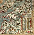
 Olaus Magnus' Map of Scandinavia 1539, Section I, Livonia.jpg 1,678 × 1,233; 498 KB


