Category:1830s maps
Jump to navigation
Jump to search
| 19th-century maps: ← 1800s 1810s 1820s 1830s 1840s 1850s 1860s 1870s 1880s 1890s → |
Not to be confused with maps depicting the 1830s.
Subcategories
This category has the following 20 subcategories, out of 20 total.
*
1
A
E
O
Media in category "1830s maps"
The following 8 files are in this category, out of 8 total.
-
 Branwell Brontë, Map of Angria (c. 1830–1831).jpg 6,761 × 4,204; 15.92 MB
-
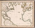 Der Atlantische Ocean, 1835.jpg 4,377 × 3,460; 2.36 MB
-
 Hobart Town Map (1838?) (15205244415).jpg 3,425 × 2,200; 1.68 MB
-
 Kaart Geesteren met huis- en boerderijnamen ECAL 1835 1394-40.jpg 5,222 × 7,390; 12.13 MB
-
 Kaart Gelselaar met huis- en boerderijnamen 1835 ECAL 1394-41.jpg 11,902 × 6,146; 18.89 MB
-
 Khalili Collection Hajj and Arts of Pilgrimage arc.pt 0454.1.jpg 2,500 × 3,333; 694 KB
-
 Khalili Collection Hajj and Arts of Pilgrimage arc.pt 0454.2.jpg 2,500 × 3,333; 534 KB
-
 Stadtplan von München ca. 1833.jpg 6,246 × 6,132; 11.43 MB
.jpg)

_(15205244415).jpg)


