Category:1890s maps
Jump to navigation
Jump to search
| 19th-century maps: ← 1800s 1810s 1820s 1830s 1840s 1850s 1860s 1870s 1880s 1890s → |
Not to be confused with maps depicting the 1890s.
Subcategories
This category has the following 20 subcategories, out of 20 total.
Media in category "1890s maps"
The following 24 files are in this category, out of 24 total.
-
 87 of '(A class book of physical geography.)' (11148993433).jpg 1,297 × 2,031; 712 KB
-
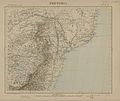 Carte de l'Afrique, Pretoria (région australe).jpeg 3,472 × 2,928; 2.06 MB
-
 Ernst Georg Ravenstein, Palestine (FL27929769 2369477).jpg 5,700 × 6,776; 47.59 MB
-
 Heisterburg Schuchhardt Hauptburg.jpg 1,212 × 1,164; 197 KB
-
 Heisterburg Schuchhardt südöstliches Tor.jpg 696 × 1,041; 177 KB
-
 Islacristina1890.jpg 1,453 × 868; 324 KB
-
 Jerusalem (FL64494475 4729975).jpg 3,306 × 2,777; 6.27 MB
-
 Körmöcbánya térképe Borovszky szerint.jpg 2,271 × 1,945; 725 KB
-
 Liancourt1894.png 1,515 × 868; 2.12 MB
-
 Map of Bar Harbor, Maine (2674646627).jpg 2,000 × 1,481; 2.14 MB
-
 Map of River Park, Newton Upper Falls (2674519012).jpg 2,000 × 1,461; 2.67 MB
-
 Meyers b11 s0051.jpg 800 × 1,275; 434 KB
-
 Meyers b19 s0779a.jpg 3,176 × 2,701; 7.16 MB
-
 Nyitra,térkép,1899, Borovszky szerint.jpg 1,750 × 1,999; 359 KB
-
 Map of Porto Rico (Puerto Rico) (NYPL Hades-2314175-ps map 125).jpg 3,020 × 1,958; 5.21 MB
-
-

-
 PSM V42 D182 Contour and glacial map of the british isles.jpg 2,054 × 2,562; 971 KB
-
 PSM V57 D434 Map showing the regions traversed by nansen.png 1,732 × 2,456; 2.46 MB
-
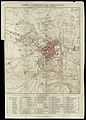
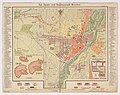
 Stadtplan München aus Meyers Konversationslexikon 1893.jpg 3,382 × 2,734; 2.04 MB
-
 Stadtplan von München 1890.jpg 10,240 × 8,113; 41.87 MB
-
 Stadtplan von München 1891.jpg 2,186 × 2,917; 4.39 MB
-
 Wuerttemberg.jpg 2,537 × 3,308; 7.16 MB
-
 מחנה ישראל.jpg 846 × 720; 471 KB
%27_(11148993433).jpg)
.jpeg)
.jpg)


.jpg)


.jpg)
.jpg)


_(NYPL_Hades-2314175-ps_map_125).jpg)

._(3528647346).jpg)


