Category:1840s maps of Florida
Jump to navigation
Jump to search
States of the United States: Alabama · Alaska · Arkansas · California · Connecticut · Delaware · Florida · Georgia · Hawaii · Idaho · Illinois · Indiana · Iowa · Kentucky · Louisiana · Maine · Maryland · Massachusetts · Michigan · Minnesota · Mississippi · Missouri · Montana · Nebraska · New Hampshire · New Mexico · New York · North Dakota · Ohio · Oklahoma · Oregon · Pennsylvania · Rhode Island · South Carolina · South Dakota · Tennessee · Texas · Utah · Vermont · Virginia · Washington · Wisconsin · Wyoming – Washington, D.C.
Puerto Rico
Puerto Rico
Subcategories
This category has the following 2 subcategories, out of 2 total.
- 1841 maps of Florida (3 F)
- 1849 maps of Florida (1 F)
Media in category "1840s maps of Florida"
This category contains only the following file.
-
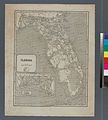 Florida (NYPL b13692629-1401774).jpg 4,936 × 5,475; 6.9 MB
.jpg)