Category:1860s maps of Florida
Jump to navigation
Jump to search
States of the United States: Alabama · Alaska · Arizona · Arkansas · California · Colorado · Connecticut · Delaware · Florida · Georgia · Idaho · Illinois · Indiana · Iowa · Kansas · Kentucky · Louisiana · Maine · Maryland · Massachusetts · Michigan · Minnesota · Mississippi · Missouri · Montana · Nebraska · Nevada · New Hampshire · New Jersey · New Mexico · New York · North Carolina · North Dakota · Ohio · Oklahoma · Oregon · Pennsylvania · Rhode Island · South Carolina · South Dakota · Tennessee · Texas · Utah · Vermont · Virginia · Washington · West Virginia · Wisconsin · Wyoming – Washington, D.C.
Puerto Rico
Puerto Rico
Subcategories
This category has the following 4 subcategories, out of 4 total.
- 1860 maps of Florida (4 F)
- 1861 maps of Florida (5 F)
- 1862 maps of Florida (8 F)
- 1864 maps of Florida (15 F)
Media in category "1860s maps of Florida"
The following 14 files are in this category, out of 14 total.
-
 Birds eye view of Florida and part of Georgia and Alabama LOC 99447266.jpg 9,420 × 6,671; 8.2 MB
-
 1862 Johnson Map of Florida - Geographicus - FL-johnson-1862.jpg 4,000 × 3,226; 3.93 MB
-

-

-

-
 1864 Johnson Map of Florida - Geographicus - Florida-johnson-1864.jpg 4,000 × 3,206; 3.86 MB
-
 Johnson's Florida (NYPL b13663522-5578043).tiff 7,760 × 10,328, 2 pages; 229.61 MB
-

-
 1866 Johnson Map of Florida - Geographicus - Florida-johnson-1866.jpg 3,500 × 2,724; 2.8 MB
-
-

-
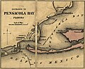 Entrance to Pensacola Bay 1862 from Colton's maps of U.S. harbors.jpg 919 × 746; 266 KB
-

-


_family_atlas,_with_descriptions,_geographical,_statistical,_and_historical_LOC_2006458033-38.jpg)
_(NYPL_b13663520-1510810).jpg)


_(14803153023).jpg)


_F.P%27_(11074200354).jpg)