Category:1840s maps of New York City
Jump to navigation
Jump to search
Subcategories
This category has the following 2 subcategories, out of 2 total.
Media in category "1840s maps of New York City"
The following 17 files are in this category, out of 17 total.
-
 1847 Lower Manhattan map (cropped).jpg 1,049 × 942; 798 KB
-
 1847 Lower Manhattan map.jpg 1,596 × 1,811; 1.96 MB
-
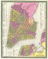 1848 Mitchell Map of New York City - Geographicus - NewYorkCity-mitchell-1848.jpg 2,826 × 3,500; 3.56 MB
-
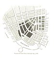
 19 of 'New York; past, present, and future ... Second edition' (11031027946).jpg 2,520 × 2,203; 1.68 MB
-
-
-
 City of New-York - by David H. Burr. NYPL1260987.tiff 4,976 × 6,235; 88.77 MB
-
 City of New-York - by David H. Burr. NYPL433958.tiff 5,248 × 6,300; 94.6 MB
-
 City of New-York - W. Kemble. NYPL434710.tiff 4,288 × 5,219; 64.03 MB
-

-
 Nautical Chart of New York Bay and Harbor and the Environs - NARA - 31491088.jpg 21,600 × 17,073; 31.86 MB
-

-
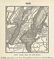
 New York, 1842.jpg 1,004 × 1,236; 396 KB
-
 New York. NYPL434683.tiff 6,300 × 5,228; 94.23 MB
-
 New York. NYPL434684.tiff 6,328 × 5,700; 64.72 MB
-
 New-York. NYPL434689.tiff 3,588 × 3,251; 33.38 MB
-
.jpg)


.jpg)
.jpg)
%27_(11225496964).jpg)

