Category:1860s maps of Kansas
Jump to navigation
Jump to search
States of the United States: Alabama · Alaska · Arizona · Arkansas · California · Colorado · Connecticut · Delaware · Florida · Georgia · Idaho · Illinois · Indiana · Iowa · Kansas · Kentucky · Louisiana · Maine · Maryland · Massachusetts · Michigan · Minnesota · Mississippi · Missouri · Montana · Nebraska · Nevada · New Hampshire · New Jersey · New Mexico · New York · North Carolina · North Dakota · Ohio · Oklahoma · Oregon · Pennsylvania · Rhode Island · South Carolina · South Dakota · Tennessee · Texas · Utah · Vermont · Virginia · Washington · West Virginia · Wisconsin · Wyoming – Washington, D.C.
Puerto Rico
Puerto Rico
Subcategories
This category has the following 2 subcategories, out of 2 total.
- 1860 maps of Kansas (empty)
- 1862 maps of Kansas (2 F)
Media in category "1860s maps of Kansas"
The following 23 files are in this category, out of 23 total.
-

-

-
 1862 Johnson Map of Kansas, Nebraska and Dakota - Geographicus - NEKADK-johnson-1862.jpg 4,000 × 3,238; 4.44 MB
-
 Johnson's Nebraska, Dakota, Colorado & Kansas - DPLA - 8a8b41c015afe2f6d95877fa12c5e3e4.jpg 8,015 × 6,004; 8.04 MB
-
 1862 Johnson Map of Kansas and Missouri - Geographicus - KAMO-johnson-1862.jpg 5,000 × 3,748; 7.33 MB
-

-

-
 1864 Mitchell Map of Colorado, Kansas ^ Nebraska - Geographicus - COKANE-mitchell-1864.jpg 4,000 × 3,292; 2.32 MB
-
 1866 Johnson's Map of Missouri and Kansas - Geographicus - MIKA-j-64.jpg 4,000 × 3,011; 3.4 MB
-

-

-

-
 Bird's eye view of the city of Lawrence, Kansas 1869. LOC 73693409.jpg 8,736 × 6,816; 12.85 MB
-
 Bird's eye view of the city of Leavenworth, Kansas 1869. LOC 73693410.jpg 8,944 × 6,960; 13.76 MB
-
 Bird's eye view of the city of Topeka, the capital of Kansas 1869. LOC 73693411.jpg 8,480 × 6,496; 11.41 MB
-
 Bird's eye view of Wyandotte, Wyandotte Co., Kansas 1869. LOC 73693408.jpg 6,032 × 4,112; 5.91 MB
-
 COCANE-j-64.jpg 600 × 490; 167 KB
-
 Kansaspacificgrants.jpg 5,304 × 3,497; 2.71 MB
-
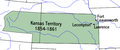 Kansasterritory.PNG 560 × 234; 35 KB
-
 Map of Kansas and Nebraska. LOC 98688397.jpg 8,719 × 6,964; 8.28 MB
-

-
-
 Topeka 1869.jpg 1,933 × 1,491; 585 KB


_LOC_73693406.jpg)


_(page_160_crop).jpg)
