Category:1861 maps of Florida
Jump to navigation
Jump to search
States of the United States: California · Delaware · Florida · Georgia · Illinois · Iowa · Louisiana · Maryland · Massachusetts · Michigan · Nevada · North Carolina · Ohio · South Carolina · Texas · Utah · Virginia · West Virginia – Washington, D.C.
| ← 1860 1861 1862 1864 |
Media in category "1861 maps of Florida"
The following 5 files are in this category, out of 5 total.
-
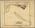
 Cedar Keys, Florida LOC 99447268.jpg 5,866 × 7,864; 5.57 MB
-
 Cedar Keys, Florida LOC 99447268.tif 5,866 × 7,864; 131.98 MB
-
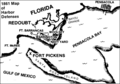 Nps pensacola bay sketch.PNG 458 × 321; 29 KB
-
 Sketch of Pensacola Navy Yard and Fort Pickens from U.S. coast surveys (5961394226).jpg 2,000 × 1,583; 2.63 MB
-
 Sketch showing the positions of the beacons on the Florida reefs LOC 99447276.jpg 6,032 × 4,656; 2.83 MB


.jpg)