Category:1887 maps of Vermont
Jump to navigation
Jump to search
States of the United States: California · Connecticut · Florida · Georgia · Iowa · Kansas · Louisiana · Maine · Massachusetts · Michigan · Minnesota · Mississippi · Missouri · New Hampshire · New Jersey · New York · North Carolina · Ohio · Pennsylvania · South Dakota · Tennessee · Texas · Utah · Vermont · Virginia · Washington · Wisconsin · Wyoming
| 1880 1884 1885 1886 1887 1889 → |
Media in category "1887 maps of Vermont"
The following 11 files are in this category, out of 11 total.
-
 Bennington, VT (L. R. Burleigh print, 1887).jpg 10,080 × 6,096; 10.39 MB
-
 Bennington, Vt. (2675876866).jpg 2,000 × 1,248; 1.95 MB
-
 Bennington, Vt. 1887. LOC 75696619.jpg 10,080 × 6,096; 13.67 MB
-
 Bennington, Vt. 1887. LOC 75696619.tif 10,080 × 6,096; 175.8 MB
-

-
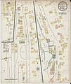 Sanborn Fire Insurance Map from Bethel, Windsor County, Vermont. LOC sanborn08907 001.jpg 6,450 × 7,650; 3.94 MB
-
 Sanborn Fire Insurance Map from Bradford, Orange County, Vermont. LOC sanborn08908 001.jpg 6,450 × 7,650; 3.58 MB
-

-
 Sanborn Fire Insurance Map from North Troy, Orleans County, Vermont. LOC sanborn08934 001.tif 6,450 × 7,650; 141.17 MB
-

-
 Sanborn Fire Insurance Map from South Royalton, Windsor County, Vermont. LOC sanborn08949 001.tif 6,450 × 7,650; 141.17 MB
.jpg)
.jpg)


