Category:1900 maps of West Virginia
Jump to navigation
Jump to search
States of the United States: California · Connecticut · Florida · Georgia · Idaho · Illinois · Indiana · Iowa · Kansas · Massachusetts · Michigan · Minnesota · Missouri · Nebraska · New Jersey · New York · North Carolina · North Dakota · Ohio · Oklahoma · Pennsylvania · Rhode Island · South Carolina · South Dakota · Tennessee · Texas · Utah · Vermont · Virginia · Washington · West Virginia · Wisconsin · Wyoming – Washington, D.C.
| ← 1900 1905 1906 1908 |
Media in category "1900 maps of West Virginia"
The following 4 files are in this category, out of 4 total.
-
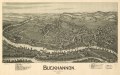
 Buckhannon, West Virginia 1900. LOC 75696674.jpg 7,216 × 4,544; 7.51 MB
-
 Buckhannon, West Virginia 1900. LOC 75696674.tif 7,216 × 4,544; 93.81 MB
-
 Weston, West Virginia 1900. LOC 75696697.jpg 7,072 × 4,128; 6.79 MB
-
 Weston, West Virginia 1900. LOC 75696697.tif 7,072 × 4,128; 83.52 MB

