Category:3rd Military Mapping Survey of Austria-Hungary
.jpg)
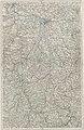
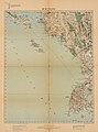
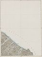
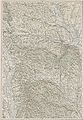
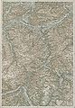
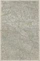
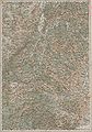
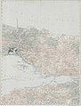
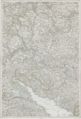
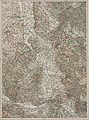
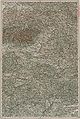
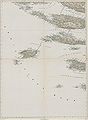
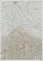
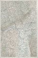
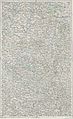
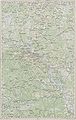
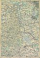
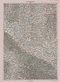
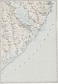
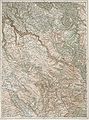
The 3rd Military Mapping Survey of Austria-Hungary took place before and during the first years of the first World War, starting in the years 1869 to 1887. Basic sheets are the „Aufnahmeblätter“, scale 1:25.000 or 1:12.500. Other parts are the „Spezialkarte“ 1:75.000. Additionally there are some other sheets of different scales existing (Sonderformate, see Subcategory)
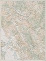
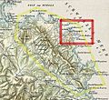
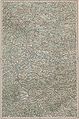
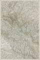
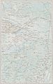
There exist 267 sheets called „Generalkarte von Mitteleuropa“ resulting from this enormous mapping enterprise, covering not only the Monarchy, but the surrounding European territories also, from Berlin to Istanbul, from Nizza to Chernobyl.
The longitude is counted ab Ferro (El Hierro Island), which is about 18° West of Greenwich, and 20° West of Paris. The maps were created by order of the Austrian Ministry of War in 1868. Maps of Bohemia were created between 1877 and 1880. Maps of Moravia and Silesia were created between 1876 and 1878. Maps used the scale 1:25 000.
Legends:
- See:
- Category:First Military Mapping Survey of Austrian Empire („Josephinische Landesaufnahme“ or „Erste Landesaufnahme“ 1764 – 1768)
- Category:Second Military Mapping Survey of Austrian Empire („Franziszäische Landesaufnahme“ or „Zweite Landesaufnahme“ 1836 – 1852)
- Category:3rd Military Mapping Survey of Austria-Hungary („Franzisco-Josephinische Landesaufnahme“ or „Dritte Landesaufnahme“ 1868 – 1880)
- Sources
- A Monarchia III. katonai felmérése. 3rd Military Mapping Survey of Austria-Hungary, ELTE Térképtudományi és Geoinformatikai Tanszék, lazarus.elte.hu
| Upload media | |||||
| Instance of |
| ||||
|---|---|---|---|---|---|
| Location |
| ||||
| Start time |
| ||||
| End time |
| ||||
| Follows | |||||
| |||||
Subcategories
This category has the following 7 subcategories, out of 7 total.
Media in category "3rd Military Mapping Survey of Austria-Hungary"
The following 200 files are in this category, out of 314 total.
(previous page) (next page)-
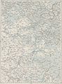
 Index sheet of the general map of Central Europe (1-200 000).jpg 1,181 × 1,050; 333 KB
-
 16-th Infantry Regiment 1940 incidents area in 1916.jpg 2,299 × 1,701; 1.15 MB
-
 Leipzig - 30-51.jpg 3,242 × 4,989; 3.47 MB
-
 IAN 0179 Dokaupil 1912 Preveza.jpg 5,853 × 7,887; 41.34 MB
-
 1914 ZONE 9 KOL XXXII MONASTERZYSKA.jpg 13,020 × 10,162; 25.85 MB
-
 35 43 Mostar Topographic Map, Published 1894.jpg 11,308 × 15,986; 50.32 MB
-
 Abkürzungsverzeichnis, Zeichenschlüssel der GKM.jpg 5,581 × 7,898; 6.16 MB
-
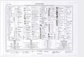 Abkürzungsverzeichnis, Zeichenschlüssel der Spezialkarte.jpg 8,268 × 5,656; 6.18 MB
-
 Adrianopel - 44-42.jpg 3,773 × 4,991; 3.55 MB
-
 Alessandria - 26-45.jpg 3,603 × 4,988; 3.43 MB
-
 Almopia 1904.jpg 2,491 × 1,970; 2 MB
-
 Ananiew - 48-48.jpg 3,427 × 4,982; 2.37 MB
-
 Ancona - 31-44.jpg 3,649 × 5,001; 5.18 MB
-
 Ansbach - 28-49.jpg 3,328 × 4,972; 3.3 MB
-
 Arta - 39-39.jpg 3,905 × 4,993; 3.32 MB
-
 Aschaffenburg - 27-50.jpg 3,274 × 5,025; 3.59 MB
-
 Ascoli - 31-43.jpg 3,701 × 4,949; 3.82 MB
-
 Asos(Athos) - 42-40.jpg 3,863 × 5,000; 1.58 MB
-
 Aufnahmeblatt 4658-3 ungar Zohor, Stampfen.jpg 9,270 × 7,163; 57.49 MB
-
 Aufnahmeblatt 4758-2 Pressburg.jpg 9,306 × 7,139; 37.44 MB
-
 Aufnahmeblatt 4758-4 Kroatisch Jahrndorf, Karlburg, Engerau.jpg 9,454 × 7,398; 34.28 MB
-
 Aufnahmeblatt 4758-4 Sommerein, Waltersdorf, Schildern, Nordwesten der Schüttinsel.jpg 9,358 × 7,242; 28.53 MB
-
 Balta - 47-48.jpg 3,397 × 4,994; 2.64 MB
-
 Bamberg - 29-50.jpg 3,274 × 4,968; 3.65 MB
-
 Banja Luka - 35-45.jpg 3,583 × 4,960; 4.78 MB
-
 Bautzen - 32-51.jpg 3,194 × 4,985; 3.51 MB
-
 Belgrád - 38-45 (cropped).jpg 1,079 × 809; 249 KB
-
 Belgrád - 38-45.jpg 3,591 × 4,952; 4.36 MB
-
 Belluno - 30-46.jpg 3,541 × 5,007; 4.07 MB
-
 Bendery - 47-47.jpg 3,460 × 4,995; 2.48 MB
-
 Berlin - 31-53.jpg 3,056 × 4,995; 3.02 MB
-
 Besztercze - 42-47.jpg 3,478 × 4,968; 4.68 MB
-
 Bielostok - 41-53.jpg 3,113 × 4,991; 3 MB
-
 Bitola map 1890.jpg 3,560 × 4,528; 3.29 MB
-
 Bobrujsk - 47-53.jpg 3,062 × 5,044; 2 MB
-
 Bolgrad - 46-46.jpg 3,530 × 4,997; 2.77 MB
-
 Braclaw - 47-49.jpg 3,340 × 5,027; 2.84 MB
-
 Brassó - 43-46.jpg 3,539 × 4,960; 4.57 MB
-
 Breslau - 35-51.jpg 3,197 × 5,018; 3.45 MB
-
 Brest Litowsk - 41-52.jpg 3,137 × 5,001; 2.93 MB
-
 Brod - 36-45.jpg 3,587 × 4,933; 4.82 MB
-
 Brody - 43-50.jpg 3,276 × 4,977; 3.12 MB
-
 Bruneck - 30-47.jpg 3,444 × 4,971; 4.04 MB
-
 Brünn - 34-49.jpg 3,360 × 4,949; 4.61 MB
-
 Budapest - Kecskemét - 37-47.jpg 3,463 × 4,948; 4.48 MB
-
 Budapest - Losoncz - 37-48.jpg 3,413 × 4,943; 4.38 MB
-
 Budweis - 32-49.jpg 3,319 × 4,968; 3.66 MB
-
 Bukarest - 44-44.jpg 3,633 × 4,971; 2.86 MB
-
 Burgas - 45-42.jpg 3,778 × 4,993; 3.14 MB
-
 Burgas Region 1903.jpg 1,153 × 471; 246 KB
-
 Buzau - 45-45.jpg 3,593 × 5,004; 2.5 MB
-
 Békéscsaba - 39-47.jpg 3,473 × 4,918; 4.01 MB
-
 Cassel - 27-51.jpg 3,206 × 4,997; 3.44 MB
-
 Cataldza - 46-41.jpg 3,843 × 4,991; 2.49 MB
-
 Cattaro - 36-42.jpg 3,731 × 4,986; 1.88 MB
-
 Chabnoje - 47-51.jpg 3,215 × 5,014; 2.45 MB
-
 Chur - 27-47.jpg 3,457 × 4,998; 3.58 MB
-
 Cilli - 33-46.jpg 3,507 × 4,944; 4.98 MB
-
 Civitavecchia - 29-42.jpg 3,739 × 4,999; 1.89 MB
-
 Como - 27-46.jpg 3,512 × 4,986; 3.76 MB
-
 Constanta - 46-44.jpg 3,673 × 4,991; 2.27 MB
-
 Czernobyl - 48-51.jpg 3,225 × 5,033; 2.52 MB
-
 Czernowitz - 44-48.jpg 3,413 × 4,968; 4.69 MB
-
 Czestochowa - 37-51.jpg 3,195 × 4,979; 2.82 MB
-
 Debrecen - 39-48.jpg 3,407 × 4,948; 3.79 MB
-
 Dimotika - 44-41.jpg 3,835 × 4,971; 2.92 MB
-
 Dresden - 31-51.jpg 3,229 × 4,981; 3.32 MB
-
 Drogiczyn - 43-52.jpg 3,154 × 4,982; 2.33 MB
-
 Durazzo - 37-41.jpg 3,809 × 5,001; 2.26 MB
-
 Dzumaja - 41-42.jpg 3,748 × 4,998; 3.14 MB
-
 Edessa and Environs 1890.jpg 3,496 × 4,464; 4.44 MB
-
 Egri Palanka - 40-42.jpg 3,740 × 5,020; 3.14 MB
-
 Elba - 28-43.jpg 3,761 × 4,997; 2.09 MB
-
 Elbasan - 38-41.jpg 3,835 × 4,996; 3.11 MB
-
 Florenz - 29-44.jpg 3,702 × 5,035; 4.08 MB
-
 Focsani - 45-46.jpg 3,539 × 4,984; 3.09 MB
-
 Franzisco-Josephinische Landesaufnahme - Berchtesgadener Alpen.jpg 6,757 × 7,777; 23.74 MB
-
 Galati - 46-45.jpg 3,623 × 5,000; 2.71 MB
-
 Galați-Reni area in 1901.jpg 1,225 × 517; 107 KB
-
 Gallipoli - 44-40.jpg 3,928 × 5,037; 1.79 MB
-
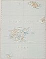
 Generalkarte von Mitteleuropa Scutari - 37-42 (Zadrima).jpg 1,135 × 1,677; 580 KB
-
 Genua 27-44.jpg 3,637 × 5,005; 2.49 MB
-
 Giurtelec.jpg 451 × 338; 60 KB
-
 Glogau - 34-52.jpg 3,185 × 5,000; 2.92 MB
-
 Glurns - 28-47.jpg 3,443 × 4,986; 3.82 MB
-
 Glusk - 46-53.jpg 3,083 × 4,966; 1.83 MB
-
 Graz - 33-47.jpg 3,461 × 4,952; 5.15 MB
-
 Gyergyósztmiklós - 43-47.jpg 3,480 × 4,960; 4.58 MB
-
 Gyula-Fehérvár - 41-46.jpg 3,544 × 4,950; 5.3 MB
-
 Halkiziki - 41-40.jpg 3,862 × 4,992; 2.43 MB
-
 Hofgastein - 31-47.jpg 3,474 × 4,972; 4.19 MB
-
 Husiatyn - 44-49.jpg 3,379 × 4,989; 3.05 MB
-
 I. Lemnos - 43-40.jpg 3,893 × 5,017; 2.14 MB
-
 IAN 0180 Dokaupil 1912 Preveza.jpg 5,800 × 7,968; 52.65 MB
-
 Iasi - 45-47.jpg 3,453 × 4,980; 3.44 MB
-
 Iglau - 33-49.jpg 3,340 × 4,958; 4.44 MB
-
 Ingolstadt - 29-49.jpg 3,404 × 5,040; 3.24 MB
-
 Innsbruck - 29-47.jpg 3,442 × 4,960; 3.87 MB
-
 Insel Selve - 32-44.jpg 3,601 × 4,939; 1.63 MB
-
 Janina - 39-40.jpg 3,862 × 4,997; 2.54 MB
-
 Josefstadt - 34-50.jpg 3,264 × 5,023; 3.7 MB
-
 Kalisz - 36-52.jpg 3,125 × 4,970; 3.01 MB
-
 Karlsruhe - 26-49.jpg 3,371 × 4,991; 3.16 MB
-
 Kassa - 39-49.jpg 3,358 × 4,934; 4.67 MB
-
 Katarzy - 48-47.jpg 3,458 × 4,987; 2.28 MB
-
 Kavala - 42-41.jpg 3,837 × 4,965; 2.86 MB
-
 Kielce - 38-51.jpg 3,191 × 4,990; 3.13 MB
-
 Kijew - 48-50.jpg 3,258 × 5,005; 2.65 MB
-
 Kiszinyew - 46-47.jpg 3,454 × 5,057; 2.96 MB
-
 Klagenfurt - 32-47.jpg 3,444 × 4,984; 3.9 MB
-
 Kobrin - 42-52.jpg 3,177 × 5,001; 2.48 MB
-
 Kolin - 33-50.jpg 3,284 × 4,971; 3.83 MB
-
 Kolomea - 43-49.jpg 3,344 × 4,933; 4.11 MB
-
 Kolozsvár - 41-47.jpg 3,457 × 4,944; 4.87 MB
-
 Komárom - 36-48.jpg 3,406 × 4,952; 4.29 MB
-
 Konstantinopel - 47-41.jpg 3,816 × 5,010; 2.65 MB
-
 Konstanz - 27-48.jpg 3,388 × 4,995; 3.47 MB
-
 Korfu - 38-40.jpg 3,869 × 5,033; 2.85 MB
-
 Kostajnica - 34-45.jpg 3,582 × 4,941; 5.18 MB
-
 Kowel - 42-51.jpg 3,231 × 5,021; 2.51 MB
-
 Kragujevac - 39-44.jpg 3,657 × 4,949; 4.98 MB
-
 Krakau - 38-50.jpg 3,272 × 4,961; 4.5 MB
-
 Kufstein - 30-48.jpg 3,390 × 4,959; 3.61 MB
-
 Kézdi-Vásárhely - 44-46.jpg 3,528 × 4,981; 4.9 MB
-
 Laibach - 32-46.jpg 3,526 × 4,957; 4.62 MB
-
 Landesberg - 33-53.jpg 3,082 × 5,019; 2.86 MB
-
 Larisa - 40-40.jpg 3,867 × 5,028; 2.36 MB
-
 Lechtalheiden Karte 1904.jpg 532 × 1,608; 499 KB
-
 Lemberg - 42-50.jpg 3,289 × 4,981; 3.23 MB
-
 Leutschau - 38-49.jpg 3,339 × 4,969; 4.87 MB
-
 Linz - 32-48.jpg 3,395 × 4,945; 3.78 MB
-
 Lissa - 34-43.jpg 3,686 × 5,024; 2.32 MB
-
 Livorno - 28-44.jpg 3,618 × 4,990; 3.56 MB
-
 Lomza - 40-53.jpg 3,074 × 5,012; 3.26 MB
-
 Lublin - 40-51.jpg 3,195 × 4,996; 3.07 MB
-
 Luck - 43-51.jpg 3,215 × 4,968; 2.41 MB
-
 Lugos - 40-46.jpg 3,516 × 4,953; 4.92 MB
-
 Lundenburg - 35-49.jpg 3,326 × 4,957; 4.66 MB
-
 Lódz - 37-52.jpg 3,127 × 5,021; 2.87 MB
-
 Mailand - 27-45.jpg 3,555 × 5,005; 3.85 MB
-
 Mainz - 26-50.jpg 3,278 × 5,007; 3.25 MB
-
 Mantua - 28-45.jpg 3,580 × 4,982; 3.88 MB
-
 Map 44-42 erkesia.jpg 3,773 × 4,991; 6.6 MB
-
 Map 45-42 erkesia.jpg 3,777 × 4,992; 5.97 MB
-
 Map 45-42 Sozopol Detail 1.jpg 482 × 303; 68 KB
-
 Map 45-42 Sozopol Detail.jpg 1,149 × 951; 475 KB
-
 Map 45-42 Sozopol.jpg 1,437 × 1,333; 809 KB
-
 Map 45-42 Sozopol1.jpg 1,396 × 1,273; 1.75 MB
-
 Map 45-42 Sozopol2.jpg 1,388 × 1,278; 1.65 MB
-
 Maramaros-Sziget - 42-48.jpg 3,405 × 4,965; 4.69 MB
-
 Meiningen - 28-51.jpg 3,188 × 5,008; 3 MB
-
 Midia - 46-42.jpg 3,783 × 4,980; 2.05 MB
-
 Miskolcz - 38-48 (Szuha-patak, Kazincbarcika és Sajószentpéter térképmetszete).jpg 1,528 × 1,448; 1.13 MB
-
 Miskolcz - 38-48.jpg 3,409 × 4,961; 3.93 MB
-
 Mistrowitz - 37-45.jpg 3,582 × 4,941; 4.48 MB
-
 Mlawa - 38-53.jpg 3,079 × 5,022; 3.11 MB
-
 Mogilew - 45-48.jpg 3,409 × 5,013; 2.13 MB
-
 Monastir - 39-41.jpg 3,801 × 4,988; 2.88 MB
-
 Mostar - 35-43.jpg 3,705 × 4,987; 2.46 MB
-
 Mozyr - 47-52.jpg 3,150 × 4,975; 2.24 MB
-
 Munkács - 40-48.jpg 3,408 × 4,932; 4.32 MB
-
 München - 29-48.jpg 3,385 × 4,965; 3.49 MB
-
 Nagy-Szeben - 42-46.jpg 3,528 × 4,980; 4.84 MB
-
 Nagykanizsa - 35-46.jpg 3,803 × 5,210; 4.72 MB
-
 Nagyvárad - 40-47.jpg 3,457 × 4,925; 4.47 MB
-
 Nakel - 35-53.jpg 3,079 × 4,991; 3.01 MB
-
 Neusohl - 37-49.jpg 3,335 × 4,945; 4.87 MB
-
 Nieswiez - 44-53.jpg 3,081 × 4,987; 2.18 MB
-
 Nis - 40-43.jpg 3,689 × 4,990; 4.16 MB
-
 Nizza - 25-44.jpg 3,652 × 4,969; 3.31 MB
-
 Novipazar - 38-43.jpg 3,701 × 4,997; 3.11 MB
-
 Nowogeorgiewsk - 38-52.jpg 3,147 × 5,018; 2.81 MB
-
 Odessa - 48-46.jpg 3,537 × 5,049; 2.12 MB
-
 Olmütz - 35-50.jpg 3,272 × 4,973; 4.65 MB
-
 Oppeln - 36-51.jpg 3,182 × 4,986; 3.17 MB
-
 Orsova - 40-45.jpg 3,590 × 4,966; 5.37 MB
-
 Ostrog - 44-50.jpg 3,285 × 4,970; 2.99 MB
-
 Ostroleka - 39-53.jpg 3,118 × 4,995; 4.69 MB
-
 Oswiecim - 37-50.jpg 3,292 × 4,969; 4.5 MB
-
 Owrucz - 46-51.jpg 3,195 × 4,983; 2.26 MB
-
 Passau - 31-49.jpg 3,309 × 4,953; 3.64 MB
-
 Perugia - 30-43.jpg 3,685 × 4,998; 3.7 MB
-
 Petrikowo - 46-52.jpg 3,131 × 5,024; 1.8 MB
-
 Piatra - 44-47.jpg 3,496 × 4,964; 4.44 MB
-
 Pinsk - 44-52.jpg 3,151 × 4,961; 1.66 MB
-
 Pleven - 42-43.jpg 3,689 × 4,973; 2.85 MB
-
 Plevlje - 37-43.jpg 3,685 × 4,988; 3.45 MB
-
 Plock - 37-53.jpg 3,073 × 5,017; 3 MB
-
 Ploesti - 44-45.jpg 3,590 × 4,974; 4.1 MB
-
 Plovdiv - 42-42.jpg 3,741 × 4,988; 3.51 MB
-
 Pola - 32-45.jpg 3,581 × 4,932; 3.17 MB
-
 Posen - 35-52.jpg 3,140 × 4,993; 3.28 MB
-
 Pressburg - 35-48.jpg 3,387 × 4,972; 3.61 MB
-
 Prevenza - 38-39.jpg 3,897 × 5,001; 1.46 MB
-
 Pristina - 39-43.jpg 3,674 × 4,969; 4.09 MB
-
 Prizren - 38-42.jpg 3,733 × 5,017; 2.99 MB
-
 Proskurow - 45-49.jpg 3,379 × 4,997; 2.96 MB
-
 Przemysel - 40-50.jpg 3,268 × 4,976; 4.37 MB
-
 Pápa - 35-47.jpg 3,462 × 4,932; 4.59 MB
-
 Pécs - 36-46.jpg 3,535 × 4,961; 4.51 MB


_-_42-40.jpg)


.jpg)


.jpg)


.jpg)


- Old maps of Austria-Hungary
- 19th-century maps of Austria-Hungary
- 19th-century maps of Germany
- Maps of Prussia
- 19th-century maps of Italy
- 19th-century maps of Austria
- 19th-century maps of Czechia
- 19th-century maps of Hungary
- Survey drawings
- Maps by land survey office
- Military maps of Slovenia
- Generalkarte von Mitteleuropa
- Institute of Military Geography, Vienna