Category:Aerial photographs of Aomori prefecture
Jump to navigation
Jump to search

Subcategories
This category has only the following subcategory.
Media in category "Aerial photographs of Aomori prefecture"
The following 44 files are in this category, out of 44 total.
-
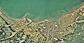
 Ajigasawa town center area Aerial photograph.1975.jpg 8,255 × 3,038; 13.84 MB
-
 Along Niida river in Hachinohe, CTO20125-C8-31.jpg 2,560 × 4,608; 1.44 MB
-
 Aomori Airport Aerial photograph.1975.jpg 4,034 × 2,289; 7.72 MB
-
 Aomori Bay 17-Sept-2018 p2.jpg 6,016 × 4,016; 2.77 MB
-
 Farmland in Aomori, Japan; June 2009.jpg 3,328 × 1,872; 2.89 MB
-
 Find47 Aomori-Golden carpet and Mt. Iwaki-m.jpg 1,920 × 1,279; 2.87 MB
-
 Find47 Aomori-Mt.iwaki-m.jpg 1,920 × 1,279; 2 MB
-
 Fukaura town center area Aerial photograph.1975.jpg 4,728 × 3,417; 24.46 MB
-
 Gangara ana(Hukaura mati).jpg 4,000 × 2,250; 4.03 MB
-
 Hachinohe.airbase.jpg 3,648 × 2,736; 4.31 MB
-
 Higashidōri Nuclear Power Plant.jpg 1,968 × 2,573; 3.83 MB
-
 Hirosaki Castle aerial photo.jpg 600 × 600; 123 KB
-
 Hirosaki Castle Aerial photograph 2011.jpg 2,262 × 2,500; 9.96 MB
-
 Hirosaki city center area Aerial photograph.1975.jpg 6,756 × 5,879; 37.81 MB
-
 Hirosaki city center area Aerial photograph.2016.jpg 8,247 × 7,874; 22.78 MB
-
 Hyakuzawa and Takaoka Area, Hirosaki, AomoriAerial photograph 2011.jpg 4,628 × 4,465; 4.83 MB
-
 Ichinowatari power station survey 1975.jpg 917 × 687; 155 KB
-
 Japan, Aomori, Hirosaki - Iwakisan 1970.jpg 3,548 × 3,090; 2.97 MB
-
 Japan, Aomori- downtown Inakadate 2016.jpg 4,714 × 5,184; 4.51 MB
-
 Japan, Aomori- Inakadate city hall, tanbo art 2016 2.jpg 600 × 760; 346 KB
-
 Kazamaura village center area Aerial photograph.1975.jpg 3,389 × 2,442; 5.89 MB
-
 Kuroishi city center area Aerial photograph.1975.jpg 7,812 × 3,191; 20.54 MB
-
 Kyuroku-jima island aerial photograph.JPG 966 × 730; 390 KB
-
 Lake Juniko district Aerial photograph.1975.jpg 3,182 × 3,785; 9.99 MB
-
 Lake Ogawara NASA Photo ISS039.jpg 1,570 × 2,212; 2.11 MB
-
 Lake Usori Aerial photograph.1975.jpg 4,061 × 4,204; 15.54 MB
-
 Mawarizeki-Otameike water reservoir Aerial photograph.1975.jpg 6,082 × 3,367; 16.33 MB
-
 Misawa airbase-Aerial Shoot.jpg 3,648 × 2,542; 2.78 MB
-
 MisawaShi2005-1-23.jpg 640 × 480; 84 KB
-
 Moriyamasiro ato(Hukaura mati) Kûsatu.jpg 4,000 × 2,250; 4.09 MB
-
 Mutsu ooshima aerial shot.jpg 3,648 × 2,736; 4.44 MB
-
 Natsudomari Golf Links, Hiranai Aomori Aerial photograph.1975.jpg 4,555 × 3,885; 6.04 MB
-
 Noheji town center area Aerial photograph.1975.jpg 6,227 × 3,212; 14.95 MB
-
 Oomazaki Cto-75-13 c39 3.jpg 3,632 × 3,529; 858 KB
-
 Port of Aomori Aerial photograph.1975.jpg 15,609 × 3,496; 30.19 MB
-
 Port of Aomori Aerial photograph.2011.jpg 15,251 × 4,327; 16.39 MB
-
 Sai village center area Aerial photograph.1975.jpg 3,847 × 2,786; 8.12 MB
-
 Shimokita pen. 下北半島 (3537756279).jpg 1,280 × 853; 307 KB
-
 Shiriyazaki cto-75-13 c45 2.jpg 3,352 × 4,440; 1.2 MB
-
 Shitsukari Area Aerial Photograph.JPG 2,763 × 2,846; 4.91 MB
-
 Takateru-jinja Aerial photograph 2011.jpg 1,730 × 984; 1.31 MB
-
 Tappizaki cto-75-19 c1 2.jpg 3,943 × 3,513; 1.84 MB
-
 Tsugaru-Iwaki Skyline toll road Aerial Photograph.jpg 3,416 × 2,560; 3.19 MB
-
 Zigomoriiwa.jpg 4,000 × 2,250; 3.96 MB


.jpg)


_K%C3%BBsatu.jpg)


.jpg)