Category:Aerial photographs of Kagawa prefecture
Jump to navigation
Jump to search

Media in category "Aerial photographs of Kagawa prefecture"
The following 79 files are in this category, out of 79 total.
-
 Aerial Photo of the Southern Suburbia of Takamatsu City, Lined.jpg 4,660 × 5,650; 7.28 MB
-
 Aerial Photo of the Southern Suburbia of Takamatsu City.jpg 4,660 × 5,650; 7.19 MB
-
 Aerial Photo of the Western Suburbia of Takamatsu City.jpg 3,597 × 3,604; 3.46 MB
-
 Aerial photo of Yoshima Island Tonosho Kagawa.jpg 3,200 × 2,393; 6.93 MB
-
 Aerial photograph of Kagawa prefecture Marugame Hospital.jpg 750 × 600; 392 KB
-
 Aerial photograph of Kochi city east sports park.jpg 1,200 × 1,000; 1.01 MB
-
 Aerial photograph of Shikoku Polytechnic college.jpg 750 × 750; 467 KB
-
 Aerial photograph of Shirotori-Ochi interchange.jpg 1,500 × 1,200; 890 KB
-
 Aerial photograph of Takamatsu Freight Terminal.jpg 1,500 × 1,800; 1.59 MB
-
 Aerial photograph of Takamatsu Kyodo Hospital.jpg 600 × 450; 204 KB
-
 Aerial photograph of Takamatsu Municipal Hospital.jpg 600 × 600; 347 KB
-
 Bannosu Coastal Industrial Park taken from ISS on 20090409.jpg 1,250 × 1,250; 164 KB
-
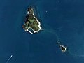
 Benten-jima Island, Shiwaku Islands.jpg 600 × 284; 134 KB
-
 Dream Island Kozai Aerial photograph.2007.jpg 2,745 × 2,059; 1.42 MB
-
 Firebombing of Takamatsu.jpg 850 × 685; 74 KB
-
 Higashikagawa city main district area Aerial photograph.2014.jpg 6,919 × 4,155; 7.71 MB
-
 Hitsuishi-jima Island.jpg 1,912 × 2,305; 775 KB
-
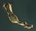
 Ibuki-jima Island.jpg 2,200 × 1,650; 604 KB
-
 Ishima.jpg 337 × 441; 45 KB
-
 Iwakuro-jima Island.jpg 720 × 810; 114 KB
-
 Iwaseo Mountains (Aerial).jpg 1,095 × 1,096; 1.21 MB
-
 Kamibun, Kamiyama, Myozai District, Tokushima Prefecture 771-3422, Japan - panoramio.jpg 3,448 × 4,592; 3.77 MB
-
 Kan-onji city center area Aerial photograph.2015.jpg 3,183 × 2,388; 2.67 MB
-
 Kinujima Island and Marukamejima Island, Higashikagawa Kagawa Aerial photograph.2007.jpg 2,358 × 1,769; 706 KB
-
 Kite photo big Suspension Bridge.jpg 2,400 × 1,800; 233 KB
-
 Komata-shima Island.jpg 223 × 252; 20 KB
-
 KompiraSan.jpg 2,816 × 2,112; 1.2 MB
-
 Kosei-jima Island.jpg 800 × 855; 97 KB
-
 Koteshima Island, Kagawa Aerial photograph.1992.jpg 1,175 × 881; 259 KB
-
 Landsat Takamatsu -Yashima 01.jpg 421 × 503; 62 KB
-
 Manno-ike pond Aerial photograph.jpg 3,382 × 2,501; 7.26 MB
-
 Marugame city center area Aerial photograph.2007.jpg 6,611 × 4,911; 12.68 MB
-
 Marugami-shima Island.jpg 490 × 490; 50 KB
-
 Mata-shima Island.jpg 420 × 550; 56 KB
-
 Matajima Island, Kan-onji Kagawa Aerial photograph.2009.jpg 2,235 × 1,677; 319 KB
-
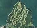
 Megi-jima Island Aerial photograph.1980.jpg 3,212 × 4,905; 8.91 MB
-
 Mitsugo-shima Island.jpg 314 × 640; 30 KB
-
 Moroki-shima Islasnd.jpg 720 × 620; 36 KB
-
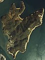 Mukae-jima Island.jpg 1,678 × 2,209; 596 KB
-
 Mukai-jima Island, Shiwaku Islands.jpg 1,570 × 1,000; 250 KB
-
 Naga-shima Island, Shiwaku Islands.jpg 1,230 × 580; 67 KB
-
 Naoshima Islands, Naoshima Kagawa Aerial photograph.2007.jpg 12,000 × 11,542; 80.11 MB
-
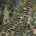 Nishikasuga danchi air with word.jpg 728 × 716; 188 KB
-
 Odeshima Island Aerial photograph.1992.jpg 1,303 × 977; 248 KB
-
 Ogi-jima Island.jpg 1,730 × 2,740; 1.01 MB
-
 OgiShimaMegiShima.jpg 1,280 × 960; 145 KB
-
 Okinoshima Island, Kagawa Aerial photograph.1992.jpg 716 × 537; 123 KB
-
 Oshima Island, Takamatsu Kagawa Aerial photograph.2007.jpg 3,916 × 2,937; 2.63 MB
-
 Oyo-shima Island.jpg 840 × 1,340; 156 KB
-
 Sakaide city center area Aerial photograph.2007.jpg 6,891 × 5,591; 13.2 MB
-
 Sakaide jouriikou.png 1,209 × 1,080; 3.56 MB
-
 Sakaide power station - aerial.jpg 1,243 × 909; 264 KB
-
 Sanagishima Island Aerial photograph.1992.jpg 2,672 × 2,004; 855 KB
-
 SanukiHeiya.JPG 2,816 × 2,112; 2.64 MB
-
 Sei-jima Island.jpg 1,720 × 1,947; 848 KB
-
 SetonaiKaiTagged.jpg 1,280 × 960; 166 KB
-
 Shami-jima Island.jpg 1,169 × 1,403; 254 KB
-
 Shido Country Club, Sanuki Kagawa Aerial photograph.2007.jpg 3,576 × 2,682; 2.22 MB
-
 Shido district Sanuki city center area Aerial photograph.2007.jpg 3,433 × 2,575; 3.16 MB
-
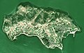 Shishi-jima Island.jpg 2,440 × 1,540; 739 KB
-
 Shodoshima Sea Side Golf Club, Shodoshima Kagawa Aerial photograph.1992.jpg 2,111 × 1,584; 1.15 MB
-
 Sogojo07.jpg 855 × 707; 115 KB
-
 Takamatsu Airport Aerial photograph.2009.jpg 2,807 × 1,871; 1.59 MB
-
 Takamatsu Castle air nawabari.jpg 1,439 × 1,384; 601 KB
-
 Takamatsu Castle air.jpg 1,439 × 1,384; 695 KB
-
 Takamatsu Country Club, Sakaide Kagawa Aerial photograph.2007.jpg 3,548 × 2,661; 3.32 MB
-
 Takamijima Island Aerial photograph.1992.jpg 2,437 × 1,828; 711 KB
-
 Takase district Mitoyo city center area Aerial photograph.2015.jpg 2,049 × 1,537; 1.35 MB
-
 Teshima Island, Kagawa Aerial photograph.1992.jpg 2,719 × 2,039; 1.2 MB
-
 Ushi-jima Island, Shiwaku Islands.jpg 1,780 × 1,700; 449 KB
-
 Wasa-shima Island.jpg 266 × 758; 47 KB
-
 Yaegaki-shinchi satellite.jpg 461 × 614; 113 KB
-
 Yamashirocho Shirakawa, Miyoshi, Tokushima Prefecture 779-5324, Japan - panoramio.jpg 4,592 × 3,448; 5.41 MB
-
 Yo-shima Island.jpg 1,660 × 2,040; 562 KB
-
 Yoshima Island Tonosho Kagawa Aerial photograph.1992.jpg 1,322 × 992; 215 KB
-
 Zentsuji city center area Aerial photograph.2009.jpg 3,842 × 2,882; 3.75 MB
-
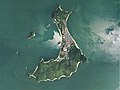
 Ōzuchi-jima Island.jpg 810 × 920; 124 KB
-
 香川県の風景.jpg 1,024 × 682; 383 KB
-
 高松市街と瀬戸内海の島々.jpg 1,280 × 853; 468 KB


.jpg)


