Category:Burgäschisee
Jump to navigation
Jump to search
| Object location | | View all coordinates using: OpenStreetMap |
|---|
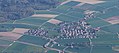
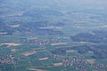
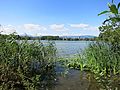
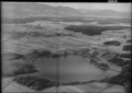
lake in Aeschi in the canton of Solothurn, Switzerland  | |||||
| Upload media | |||||
| Instance of | |||||
|---|---|---|---|---|---|
| Part of | |||||
| Location | Aeschi, Wasseramt District, Bucheggberg-Wasseramt, Solothurn, Switzerland | ||||
| Heritage designation | |||||
| Width |
| ||||
| Length |
| ||||
| Area |
| ||||
| Elevation above sea level |
| ||||
| Drainage basin | |||||
| Basin country | |||||
 | |||||
Media in category "Burgäschisee"
The following 44 files are in this category, out of 44 total.
-
 2011-04-16-Balonveturo (Foto Dietrich Michael Weidmann) 118.JPG 3,872 × 2,592; 3.57 MB
-
 2011-04-16-Balonveturo (Foto Dietrich Michael Weidmann) 119.JPG 3,872 × 2,592; 3.72 MB
-
 2011-04-17 Balonveturo (Foto Dietrich Michael Weidmann) 093.JPG 3,872 × 2,592; 3.74 MB
-
 2011-04-17 Balonveturo (Foto Dietrich Michael Weidmann) 093cropped.jpg 460 × 204; 114 KB
-
 2011-04-17 Balonveturo (Foto Dietrich Michael Weidmann) 094.JPG 3,872 × 2,592; 3.49 MB
-
 2011-04-17 Balonveturo (Foto Dietrich Michael Weidmann) 133.JPG 3,872 × 2,592; 3.6 MB
-
 Aeschimitsee.jpg 2,560 × 1,920; 638 KB
-
 Burgäschisee Ausfluss.jpg 2,335 × 1,486; 458 KB
-
 Burgäschisee.JPG 4,000 × 3,000; 3.82 MB
-
 Burgäschisee02.jpg 2,156 × 1,484; 467 KB
-
 ETH-BIB-Burgäschi-See, Nordufer von Osten-Dia 247-14508.tif 3,705 × 2,757; 29.35 MB
-
 ETH-BIB-Burgäschi-See, Pfahlbau, Südwest, Ausgrabung, von Südost-Dia 247-14509.tif 3,699 × 2,793; 29.71 MB
-
 ETH-BIB-Burgäschi-See, von Norden, Seebach-Dia 247-14507.tif 3,694 × 2,781; 29.51 MB
-
 ETH-BIB-Burgäschi-See, Zufluss zur Südost-Ecke-Dia 247-14510.tif 3,729 × 2,787; 29.87 MB
-
 ETH-BIB-Burgäschisee, Aeschi v. S. O. aus 300 m-Inlandflüge-LBS MH01-005098.tif 6,446 × 4,620; 85.35 MB
-
 ETH-BIB-Burgäschisee, Aeschi, Bolken-Inlandflüge-LBS MH01-005099.tif 6,464 × 4,622; 85.54 MB
-
 ETH-BIB-Burgäschisee-LBS H1-011913.tif 6,282 × 4,461; 80.37 MB
-
 ETH-BIB-Burgäschisee-LBS H1-014732.tif 6,457 × 4,430; 81.96 MB
-
 ETH-BIB-Burgäschisee-LBS H1-016905.tif 6,890 × 4,870; 96.17 MB
-
 ETH-BIB-Burgäschisee-LBS H1-016906.tif 6,949 × 4,811; 95.84 MB
-
 ETH-BIB-Bürgäschisee, Berner, Mittelland-LBS H1-016907.tif 6,875 × 4,919; 96.9 MB
-
 ETH-BIB-Grasswil Seeberg, Bürgäschisee-Inlandflüge-LBS MH01-003197.tif 6,906 × 4,875; 96.41 MB
-
 ETH-BIB-Seeberg, Burgäschisee aus 400 m-Inlandflüge-LBS MH01-004510.tif 6,318 × 4,757; 86.14 MB
-
 ETH-BIB-Strandbad, Burgäschisee-Inlandflüge-LBS MH01-008086.tif 6,338 × 4,722; 85.75 MB
-
 Schilfaeschisee.jpg 2,459 × 1,674; 737 KB
-
 The little Sea.jpg 5,760 × 3,240; 7.57 MB
-
 WanderwegweiserBurgäschiBurgäschi.jpg 1,427 × 1,054; 629 KB
-
 Zentralbibliothek Solothurn Ernst Klöti 0698 Aeschiseeabfluss.jpg 6,415 × 4,184; 17.76 MB
-
 Zentralbibliothek Solothurn Ernst Klöti 1359.jpg 6,415 × 4,184; 17.76 MB
-
 Zentralbibliothek Solothurn Ernst Klöti 1360.jpg 6,415 × 4,184; 19.24 MB
-
 Zentralbibliothek Solothurn Ernst Klöti 1361.jpg 6,415 × 4,184; 20.3 MB
-
 Zentralbibliothek Solothurn Ernst Klöti 1362.jpg 6,415 × 4,184; 19.05 MB
-
 Zentralbibliothek Solothurn Ernst Klöti 1363.jpg 6,415 × 4,184; 19.41 MB
-
 Zentralbibliothek Solothurn Ernst Klöti 1364.jpg 6,415 × 4,184; 20.12 MB
-
 Zentralbibliothek Solothurn Ernst Klöti 1383.jpg 4,184 × 6,400; 22.95 MB
-
 Zentralbibliothek Solothurn Ernst Klöti 1384.jpg 4,176 × 6,415; 17.77 MB
-
 Zentralbibliothek Solothurn Ernst Klöti 1385.jpg 4,184 × 6,400; 19.21 MB
-
 Zentralbibliothek Solothurn Ernst Klöti 1386.jpg 6,415 × 4,184; 19.37 MB
-
 Zentralbibliothek Solothurn Ernst Klöti 1387.jpg 6,415 × 4,184; 18.74 MB
-
 Zentralbibliothek Solothurn Ernst Klöti 1391.jpg 6,415 × 4,184; 17.45 MB
-
 Zentralbibliothek Solothurn Ernst Klöti 1399.jpg 6,415 × 4,184; 17.72 MB
-
 Zentralbibliothek Solothurn Ernst Klöti 1417.jpg 6,415 × 4,184; 19.47 MB
-
 Zentralbibliothek Solothurn Ernst Klöti 1418.jpg 6,415 × 4,184; 19.21 MB
-
 Zentralbibliothek Solothurn Ernst Klöti 2621 Aeschi.jpg 6,415 × 4,184; 16.47 MB
_118.JPG)
_119.JPG)
_093.JPG)
_093cropped.jpg)
_094.JPG)
_133.JPG)


