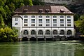
Category:Centrale énergétique de la Maigrauge, Usine hydroélectrique de l’Oelberg (Karrweg 12, Fribourg)
Jump to navigation
Jump to search
| Object location | | View all coordinates using: OpenStreetMap |
|---|
industrial buildings in the city of Fribourg, Switzerland  | |||||
| Upload media | |||||
| Instance of |
| ||||
|---|---|---|---|---|---|
| Part of | |||||
| Location | Fribourg, Sarine District, Canton of Fribourg, Switzerland | ||||
| Street address |
| ||||
| Owned by |
| ||||
| Heritage designation | |||||
 | |||||
Media in category "Centrale énergétique de la Maigrauge, Usine hydroélectrique de l’Oelberg (Karrweg 12, Fribourg)"
The following 7 files are in this category, out of 7 total.
-
 Barrage de la Maigrauge Fribourg.jpg 3,840 × 2,880; 7 MB
-
 Centrale electrique.jpg 4,000 × 3,000; 7.11 MB
-
 Centrale énergétique de la Maigrauge.jpg 3,648 × 2,736; 3.26 MB
-
 Fribourg Centrale énergétique de la Maigrauge 855.jpg 7,728 × 5,152; 38.13 MB
-
 Fribourg Centrale énergétique de la Maigrauge 856.jpg 5,152 × 7,728; 31.08 MB
-
 Fribourg usine de Oelberg.jpg 3,888 × 2,592; 6.78 MB
-
 Ölbergwerk.jpg 4,800 × 4,800; 4.55 MB


