Category:Church in Hangelsberg
Jump to navigation
Jump to search
| Object location | | View all coordinates using: OpenStreetMap |
|---|
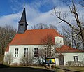
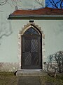
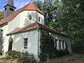
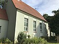
church building in Oder-Spree district, Brandenburg state, Germany  | |||||
| Upload media | |||||
| Instance of | |||||
|---|---|---|---|---|---|
| Location | Hangelsberg, Grünheide (Mark), Oder-Spree District, Brandenburg, Germany | ||||
| Heritage designation | |||||
 | |||||
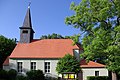
This is the category of the Brandenburger Baudenkmal (cultural heritage monument) with the ID 09115004 (Wikidata)
|
Deutsch: Bilder der Kirche in Hangelsberg, Gemeinde Grünheide (Mark), Landkreis Oder-Spree, Land Brandenburg, Deutschland.
English: Pictures of the church in Hangelsberg, Grünheide (Mark) municipality, Oder-Spree district, Brandenburg state, Germany
Français : Photos de l'église à Hangelsberg, commune de Grünheide (Mark), arrondissement de Oder-Spree, état fédéral de Brandebourg, Allemagne
Subcategories
This category has only the following subcategory.
I
Media in category "Church in Hangelsberg"
The following 20 files are in this category, out of 20 total.
-
 Church in Hangelsberg (1).jpg 4,608 × 3,456; 4.34 MB
-
 Church in Hangelsberg (2).jpg 3,456 × 4,608; 3.82 MB
-
 Church in Hangelsberg (4).jpg 3,456 × 4,608; 3.52 MB
-
 Church in Hangelsberg (5).jpg 3,456 × 4,608; 3.72 MB
-
 Dorfkirche Hangelsberg 2018 ESE.jpg 4,864 × 3,648; 7.98 MB
-
 Dorfkirche Hangelsberg 2018 NE.jpg 5,900 × 4,771; 13.32 MB
-
 Dorfkirche Hangelsberg 2018 S.jpg 5,000 × 4,311; 9.47 MB
-
 Dorfkirche Hangelsberg 2018 SW.jpg 3,768 × 4,329; 8.57 MB
-
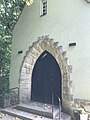
 Dorfkirche Hangelsberg 2018 Südportal.jpg 3,648 × 4,864; 6.8 MB
-
 Dorfkirche Hangelsberg 2018 Westportal.jpg 4,259 × 4,719; 6.71 MB
-
 Dorfkirche Hangelsberg Gemeinderaum Nordansicht.jpg 4,032 × 3,024; 4.1 MB
-
 Dorfkirche Hangelsberg Gemeinderaum Südostansicht.jpg 4,032 × 3,024; 3.88 MB
-
 Dorfkirche Hangelsberg Kirchenschiff Südansicht.jpg 4,032 × 3,024; 3.66 MB
-
 Dorfkirche Hangelsberg Nordostansicht.jpg 3,024 × 4,032; 4.2 MB
-
 Dorfkirche Hangelsberg Südostansicht Hochformat.jpg 3,024 × 4,032; 3.28 MB
-
 Dorfkirche Hangelsberg Südostansicht.jpg 4,032 × 3,024; 3.63 MB
-
 Dorfkirche Hangelsberg Südwestansicht.jpg 3,024 × 4,032; 3.04 MB
-
 Dorfkirche Hangelsberg Westportal.jpg 3,024 × 4,032; 3.29 MB
-
 Dorfkirche Hangelsberg Westvorbau Nordansicht.jpg 3,024 × 4,032; 3.9 MB
-
 Gruenheide Hangelberg Kirche.JPG 3,872 × 2,592; 3.42 MB
.jpg)
.jpg)
.jpg)
.jpg)


