Category:Crofton, London
Jump to navigation
Jump to search
area in London Borough of Bromley, UK | |||||
| Upload media | |||||
| Instance of | |||||
|---|---|---|---|---|---|
| Location | London Borough of Bromley, Greater London, London, England | ||||
 | |||||
Subcategories
This category has the following 2 subcategories, out of 2 total.
C
- Crofton Roman Villa (19 F)
P
- St Paul's Church, Crofton (19 F)
Media in category "Crofton, London"
The following 17 files are in this category, out of 17 total.
-
 Abbots Close - geograph.org.uk - 2901750.jpg 640 × 425; 309 KB
-
 Beckford Drive - geograph.org.uk - 1196858.jpg 640 × 480; 80 KB
-
 Crofton Court - geograph.org.uk - 666743.jpg 480 × 640; 134 KB
-
 Crofton Lane - geograph.org.uk - 2901777.jpg 640 × 425; 298 KB
-
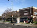
 Crofton Lane shops.jpg 2,016 × 1,512; 1.04 MB
-
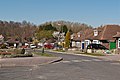
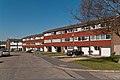
 Crofton Road (A232), BR6 - geograph.org.uk - 2435903.jpg 640 × 480; 113 KB
-
 Kelvin Parade.jpg 2,016 × 1,512; 1.48 MB
-
 Monks Way - geograph.org.uk - 2901742.jpg 640 × 425; 290 KB
-
 Romany Rise - geograph.org.uk - 2901755.jpg 640 × 425; 319 KB
-
 Shopping Parade, Crofton - geograph.org.uk - 666719.jpg 640 × 480; 90 KB
-
 Sparrow Drive - geograph.org.uk - 2901655.jpg 640 × 425; 323 KB
-
 Sparrow Drive - geograph.org.uk - 2901663.jpg 640 × 425; 348 KB
-
 St Thomas' Drive - geograph.org.uk - 2901713.jpg 640 × 425; 269 KB
-
 St Thomas' Drive - geograph.org.uk - 2901738.jpg 640 × 425; 374 KB
-
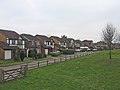
 Tandridge Drive - geograph.org.uk - 2901796.jpg 640 × 425; 340 KB
-
 Tandridge Drive, Orpington, Kent - geograph.org.uk - 768579.jpg 640 × 480; 77 KB
-
 Turnberry Way - geograph.org.uk - 2901785.jpg 640 × 425; 276 KB


,_BR6_-_geograph.org.uk_-_2435903.jpg)


