Category:Dorfkirche Altmädewitz
Jump to navigation
Jump to search
| Object location | | View all coordinates using: OpenStreetMap |
|---|
church building in Oderaue, Brandenburg state, Germany  | |||||
| Upload media | |||||
| Instance of | |||||
|---|---|---|---|---|---|
| Location | Altmädewitz, Oderaue, Märkisch-Oderland District, Brandenburg, Germany | ||||
| Street address |
| ||||
| Heritage designation | |||||
| Width |
| ||||
| Length |
| ||||
 | |||||
This is the category of the Brandenburger Baudenkmal (cultural heritage monument) with the ID 09180217 (Wikidata)
|
Deutsch: Bilder der Kirche in Altmädewitz, Gemeinde Oderaue, Landkreis Märkisch-Oderland, Land Brandenburg, Deutschland.
English: Pictures of the church in Altmädewitz, Oderaue municipality, Märkisch-Oderland district, Brandenburg state, Germany
Français : Photos de l'église à Altmädewitz, commune de Oderaue, arrondissement de Märkisch-Oderland, état fédéral de Brandebourg, Allemagne
Pages in category "Dorfkirche Altmädewitz"
This category contains only the following page.
Media in category "Dorfkirche Altmädewitz"
The following 9 files are in this category, out of 9 total.
-
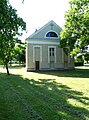 Dorfkirche Altmädewitz 2023 E.jpg 2,654 × 3,572; 2.45 MB
-
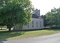
 Dorfkirche Altmädewitz 2023 N.jpg 3,648 × 2,736; 3.59 MB
-
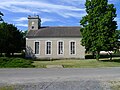
 Dorfkirche Altmädewitz 2023 NE.jpg 3,451 × 2,487; 2.22 MB
-
 Dorfkirche Altmädewitz 2023 Portal W.jpg 2,039 × 2,719; 1.07 MB
-
 Dorfkirche Altmädewitz 2023 S.jpg 3,648 × 2,736; 3.32 MB
-
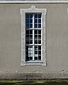 Dorfkirche Altmädewitz 2023 Südfenster.jpg 2,189 × 2,736; 1.6 MB
-
 Dorfkirche Altmädewitz 2023 Turm.jpg 2,691 × 3,588; 1.59 MB
-
 Dorfkirche Altmädewitz Oderaue.jpg 3,872 × 2,592; 3.72 MB
-
 IMG 8363AltmädewitzDorfkirche.jpg 600 × 400; 100 KB


