Category:Dorfkirche Möglenz
Jump to navigation
Jump to search
| Object location | | View all coordinates using: OpenStreetMap |
|---|
church building in Bad Liebenwerda, Brandenburg state, Germany  | |||||
| Upload media | |||||
| Instance of | |||||
|---|---|---|---|---|---|
| Location | Möglenz, Bad Liebenwerda, Elbe-Elster District, Brandenburg, Germany | ||||
| Street address |
| ||||
| Heritage designation | |||||
| Inception |
| ||||
| Religion or worldview | |||||
 | |||||
This is the category of the Brandenburger Baudenkmal (cultural heritage monument) with the ID 09135432 (Wikidata)
|
Media in category "Dorfkirche Möglenz"
The following 3 files are in this category, out of 3 total.
-
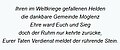 Inschrift Gefallenendenkmal Möglenz.jpg 344 × 143; 11 KB
-
 Kirche Möglenz.JPG 3,168 × 4,752; 5.44 MB
-
 Möglenz Kirche.JPG 3,168 × 4,752; 5.93 MB

