Category:Dorfkirche Schilde
Jump to navigation
Jump to search
| Object location | | View all coordinates using: OpenStreetMap |
|---|
 | |||||
| Upload media | |||||
| Instance of | |||||
|---|---|---|---|---|---|
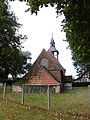
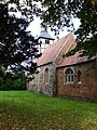
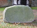
| Location | Schilde, Weisen, Prignitz District, Brandenburg, Germany | ||||
| Heritage designation | |||||
 | |||||
This is the category of the Brandenburger Baudenkmal (cultural heritage monument) with the ID 09160605 (Wikidata)
|
Media in category "Dorfkirche Schilde"
The following 13 files are in this category, out of 13 total.
-
 70840 Schilde Kirche.JPG 4,000 × 3,000; 4.7 MB
-
 70843 Schilde Kirche.JPG 2,849 × 2,648; 4.17 MB
-
 70844 Schilde Kirche.JPG 4,000 × 3,000; 4.85 MB
-
 Schilde Dorfkirche 1.JPG 4,000 × 3,000; 3.43 MB
-
 Schilde Dorfkirche 10.JPG 3,000 × 4,000; 1.46 MB
-
 Schilde Dorfkirche 11.JPG 4,000 × 3,000; 3.21 MB
-
 Schilde Dorfkirche 2.JPG 3,000 × 4,000; 3.13 MB
-
 Schilde Dorfkirche 3.JPG 4,000 × 3,000; 3.33 MB
-
 Schilde Dorfkirche 4.JPG 3,000 × 4,000; 3.12 MB
-
 Schilde Dorfkirche 5.JPG 4,000 × 3,000; 3.38 MB
-
 Schilde Dorfkirche 6.JPG 4,000 × 3,000; 3.49 MB
-
 Schilde Dorfkirche 8.JPG 3,000 × 4,000; 2.92 MB
-
 Schilde Dorfkirche 9.JPG 3,000 × 4,000; 3.19 MB


