Category:Election maps of Brandenburg
Jump to navigation
Jump to search
Federal states of Germany:
Deutsch: Karten zu Wahlen im Bundesland Brandenburg
· English: maps of elections in the German federal state of Brandenburg
· Subcategories
This category has the following 2 subcategories, out of 2 total.
Media in category "Election maps of Brandenburg"
The following 20 files are in this category, out of 20 total.
-
 1990 Brandenburg state election.svg 565 × 592; 2.78 MB
-
 1994 Brandenburg state election.svg 565 × 592; 4.83 MB
-
 1999 Brandenburg state election.svg 565 × 592; 4.87 MB
-
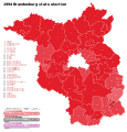
 2004 Brandenburg state election.svg 565 × 592; 929 KB
-
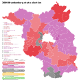 2009 Brandenburg state election.svg 565 × 592; 941 KB
-
 2014 Brandenburg state election.svg 565 × 592; 951 KB
-
 2019 Brandenburg state election.svg 565 × 592; 951 KB
-
 Brandebourg (2009).png 526 × 525; 51 KB
-
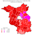
 BrandenburgWahl2009 Beteiligung.svg 550 × 600; 93 KB
-
 BrandenburgWahl2009 Erststimmen.svg 550 × 600; 94 KB
-
 BrandenburgWahl2009 Zweitstimmen.svg 550 × 600; 93 KB
-
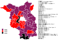
 Kommunalwahlergebnis BVB FREIE WAEHLER 25.05.2014.svg 1,022 × 1,075; 503 KB
-
 Kommunalwahlergebnis BVB FREIE WAEHLER 26.05.2019.svg 1,022 × 1,075; 482 KB
-
 Landtagswahlkarte Brandenburg 1994.svg 1,042 × 708; 483 KB
-
 Landtagswahlkarte Brandenburg 1999.svg 1,042 × 708; 483 KB
-
 Landtagswahlkarte Brandenburg 2004.svg 1,042 × 708; 329 KB
-
 Landtagswahlkarte Brandenburg 2009.svg 1,042 × 708; 329 KB
-
 Landtagswahlkarte Brandenburg 2014.svg 1,042 × 708; 326 KB
-
 Landtagswahlkarte Brandenburg 2019.svg 1,042 × 708; 329 KB
-
 Landtagswahlkreise Brandenburg 2014.svg 1,042 × 708; 293 KB


.png)


