Category:Gawsworth
Jump to navigation
Jump to search
English: Gawsworth is a civil parish and village in the unitary authority of Cheshire East and the ceremonial county of Cheshire, England. It is one of the eight ancient parishes of Macclesfield Hundred. Twenty acres of the civil parish were transferred to Macclesfield civil parish in 1936
civil parish and village in Cheshire East, England  | |||||
| Upload media | |||||
| Instance of | |||||
|---|---|---|---|---|---|
| Location | Cheshire East, Cheshire, North West England, England | ||||
 | |||||
Subcategories
This category has the following 7 subcategories, out of 7 total.
G
- Gawsworth Old Hall (21 F)
- Gawsworth Old Rectory (2 F)
- Gawsworth War Memorial (1 F)
H
- Harrington Arms, Gawsworth (2 F)
J
- St James' Church, Gawsworth (30 F)
M
N
- Gawsworth New Hall (3 F)
Media in category "Gawsworth"
The following 200 files are in this category, out of 218 total.
(previous page) (next page)-
 'No footpath' - geograph.org.uk - 3172379.jpg 3,456 × 2,304; 5.6 MB
-

-
 'They shall not pass ...' - geograph.org.uk - 3172564.jpg 3,456 × 2,304; 5.92 MB
-
 A darker shade of dark - geograph.org.uk - 2828788.jpg 5,184 × 3,456; 5.15 MB
-
 A536 at Tidnock Lane - geograph.org.uk - 2830430.jpg 5,184 × 3,456; 6.21 MB
-
 Above the rooftops looking towards Goosetree Farm - geograph.org.uk - 3172371.jpg 3,456 × 2,304; 1.81 MB
-
 Across the field - geograph.org.uk - 2387721.jpg 4,000 × 3,000; 3.22 MB
-
 Alongside Tidnock Wood from Marton Lane - geograph.org.uk - 2825595.jpg 5,184 × 3,456; 4.57 MB
-
 Ancient Cross, Gawsworth - geograph.org.uk - 4607435.jpg 1,200 × 1,600; 992 KB
-
 Approaching Great Tidnock Farm - geograph.org.uk - 2828804.jpg 5,184 × 3,456; 5.93 MB
-
 Approaching the canal bridge at Fools Nook - geograph.org.uk - 2733456.jpg 4,000 × 3,000; 4.22 MB
-
 Barn at New Hall Farm, Gawsworth.jpg 1,800 × 1,350; 554 KB
-
 Big Cheshire sky - geograph.org.uk - 2830476.jpg 5,184 × 3,456; 3.55 MB
-
 Boardwalk in Danes Moss Nature Reserve - geograph.org.uk - 5178131.jpg 800 × 610; 153 KB
-
 Car park for Gawsworth Hall - geograph.org.uk - 6167458.jpg 1,024 × 768; 183 KB
-
 Church Lane Gawsworth - geograph.org.uk - 2830551.jpg 3,456 × 5,184; 7.8 MB
-
 Church Lane, Gawsworth - geograph.org.uk - 3898634.jpg 640 × 480; 99 KB
-
 Church Lane, Gawsworth - geograph.org.uk - 5178138.jpg 800 × 600; 243 KB
-
 Church Lane, Gawsworth - geograph.org.uk - 6167449.jpg 1,024 × 768; 343 KB
-
 Churchyard cross, Gawsworth - geograph.org.uk - 5075293.jpg 960 × 1,280; 398 KB
-
 Churchyard gateway, Gawsworth - geograph.org.uk - 5075263.jpg 640 × 480; 216 KB
-
 Clouds above The Cloud - geograph.org.uk - 2447097.jpg 4,432 × 2,472; 5 MB
-
 Clover Bank Organic Farm's power station - geograph.org.uk - 2828707.jpg 3,456 × 5,184; 5.22 MB
-
 Clover Bank Organic Farm, Gawsworth - geograph.org.uk - 2828685.jpg 5,184 × 3,456; 3.3 MB
-

-
 Colourful vegetation around pond by New Hall Farm, Gawsworth - geograph.org.uk - 5248338.jpg 5,184 × 2,920; 6.08 MB
-
 Congleton Road at Shellow Lane - geograph.org.uk - 3898677.jpg 640 × 480; 57 KB
-
 Congleton Road, Macclesfield - geograph.org.uk - 2731633.jpg 4,000 × 3,000; 2.55 MB
-
 Cow Brook - geograph.org.uk - 3314545.jpg 640 × 428; 49 KB
-
 Cow Brook - geograph.org.uk - 4382785.jpg 640 × 430; 45 KB
-
 Cowbrook Farm, Cowbrook Lane - geograph.org.uk - 2205374.jpg 640 × 430; 110 KB
-
 Cowbrook Lane - closed - geograph.org.uk - 2905821.jpg 5,184 × 3,456; 2.4 MB
-
 Cowbrook Lane - powerline re-stringing - geograph.org.uk - 2905828.jpg 5,184 × 3,456; 2.37 MB
-
 Crabmoss - geograph.org.uk - 4565830.jpg 5,184 × 2,347; 1.99 MB
-
 Danes Moss - geograph.org.uk - 4111176.jpg 1,800 × 1,200; 1,009 KB
-
 Danes Moss Landfill Site, Macclesfield - geograph.org.uk - 2731623.jpg 4,000 × 3,000; 3.98 MB
-
 Danes Moss Nature Reserve - geograph.org.uk - 5383087.jpg 3,430 × 2,552; 3.2 MB
-
 Dark Lane at Congleton Road junction - geograph.org.uk - 3898623.jpg 640 × 480; 75 KB
-

-
 Dirt road at Rough Hey Quarry - geograph.org.uk - 2068488.jpg 1,024 × 768; 206 KB
-
 Drive to the gatehouse at Gawsworth - geograph.org.uk - 6167366.jpg 1,024 × 768; 374 KB
-
 Duckboards - geograph.org.uk - 5383101.jpg 3,766 × 2,824; 4.32 MB
-
 East Cheshire Countryside - geograph.org.uk - 4873531.jpg 640 × 340; 42 KB
-
 Entering Tidnock Lane - geograph.org.uk - 2830435.jpg 5,184 × 3,456; 6.79 MB
-
 Farmland - geograph.org.uk - 4836554.jpg 640 × 315; 23 KB
-
 Farmland by the WCML - geograph.org.uk - 3314533.jpg 640 × 292; 25 KB
-
 Farmland near Cow Brook - geograph.org.uk - 4745096.jpg 640 × 426; 39 KB
-
 Farmyard at The Harrington Arms, Gawsworth - geograph.org.uk - 5076175.jpg 1,280 × 960; 352 KB
-
 Field near Gawsworth - geograph.org.uk - 4605620.jpg 1,600 × 1,200; 627 KB
-
 Field path running N from Marton Ln, Gawsworth - geograph.org.uk - 6015525.jpg 5,184 × 2,920; 2.22 MB
-
 Fingerpost at Nancy's Wood - geograph.org.uk - 5075030.jpg 960 × 1,280; 420 KB
-
 Fodens Farm - geograph.org.uk - 4564959.jpg 4,744 × 2,787; 1.91 MB
-
 Fodens Farm - geograph.org.uk - 4564962.jpg 5,184 × 3,456; 1.78 MB
-
 Fodens Farm - geograph.org.uk - 4570782.jpg 5,184 × 3,456; 1.99 MB
-
 Fools Nook - geograph.org.uk - 4564966.jpg 5,184 × 2,787; 1.85 MB
-
 Footpath diverted - geograph.org.uk - 3172471.jpg 3,456 × 2,304; 5.13 MB
-
 Footpath from Woodhouse End Road - geograph.org.uk - 4111198.jpg 1,800 × 1,200; 1.18 MB
-
 Footpath junction - geograph.org.uk - 3172372.jpg 3,456 × 2,304; 5.68 MB
-
 Footpath to Danes Moss Nature Reserve - geograph.org.uk - 5760381.jpg 1,280 × 960; 559 KB
-
 Footpath to Danes Moss Nature Reserve - geograph.org.uk - 5760403.jpg 1,280 × 960; 637 KB
-
 Footpath to Danes Moss Nature Reserve - geograph.org.uk - 5760479.jpg 1,280 × 960; 581 KB
-
 Footpath towards Danes Moss Farm - geograph.org.uk - 5760433.jpg 1,280 × 960; 613 KB
-
 Footpath towards Macclesfield Canal - geograph.org.uk - 4111209.jpg 1,800 × 1,200; 1.09 MB
-
 Footpath west of Danes Moss - geograph.org.uk - 4111184.jpg 1,800 × 1,200; 1.26 MB
-
 Footpath west of Danes Moss - geograph.org.uk - 4111187.jpg 1,800 × 1,200; 1.24 MB
-
 From the path to Danes Moss - geograph.org.uk - 5760436.jpg 1,280 × 960; 235 KB
-
 Garden wall at Gawsworth Hall.jpg 1,800 × 1,350; 499 KB
-
 Garden wall, Gawsworth Old Hall.jpg 1,800 × 1,350; 488 KB
-
 Gardens at Gawsworth Hall - geograph.org.uk - 5380242.jpg 1,280 × 884; 384 KB
-
 Gatehouse, Gawsworth.JPG 2,048 × 1,536; 1.4 MB
-
 Gawsworth - geograph.org.uk - 4564938.jpg 5,184 × 1,917; 1.45 MB
-
 Gawsworth church hall - geograph.org.uk - 6167446.jpg 1,024 × 768; 259 KB
-
 Gawsworth Common - geograph.org.uk - 4285174.jpg 3,888 × 2,592; 1.59 MB
-
 Gawsworth Cross.jpg 4,000 × 3,000; 4.91 MB
-
 Gawsworth Fisheries - geograph.org.uk - 503241.jpg 640 × 480; 125 KB
-
 Gawsworth Fisheries - geograph.org.uk - 503248.jpg 640 × 480; 102 KB
-
 Gawsworth Hall - gate to churchyard - geograph.org.uk - 6167404.jpg 1,024 × 768; 471 KB
-
 Gawsworth Hall - geograph.org.uk - 5075214.jpg 1,280 × 960; 416 KB
-
 Gawsworth Hall - laburnum trees - geograph.org.uk - 6167390.jpg 768 × 1,024; 390 KB
-
 Gawsworth Hall - old font - geograph.org.uk - 6167398.jpg 1,024 × 768; 370 KB
-
 Gawsworth Hall - yew tree - geograph.org.uk - 6167396.jpg 1,024 × 768; 418 KB
-
 Gawsworth Hall and its many gables - geograph.org.uk - 6167387.jpg 1,024 × 768; 235 KB
-
 Gawsworth Hall from across the pond - geograph.org.uk - 6167382.jpg 1,016 × 768; 269 KB
-
 Gawsworth Hall, garden front - geograph.org.uk - 5380289.jpg 1,280 × 885; 378 KB
-
 Gawsworth Hall, garden front - geograph.org.uk - 5380301.jpg 1,280 × 900; 271 KB
-
 Gawsworth Hall, south wing sundial - geograph.org.uk - 5380278.jpg 960 × 1,280; 416 KB
-
 Gawsworth New Hall - geograph.org.uk - 5380224.jpg 1,280 × 960; 389 KB
-
 Gawsworth New Hall - geograph.org.uk - 6167456.jpg 1,024 × 768; 183 KB
-
 Gawsworth New Hall at dusk - geograph.org.uk - 5380314.jpg 1,280 × 960; 330 KB
-
 Gawsworth Old Rectory - geograph.org.uk - 6167444.jpg 1,024 × 768; 339 KB
-
 Gawsworth Parish Church - geograph.org.uk - 3388745.jpg 1,600 × 1,200; 833 KB
-
 Gawsworth Rectory - geograph.org.uk - 6167448.jpg 1,024 × 768; 305 KB
-
 Gawsworth Road - geograph.org.uk - 2387686.jpg 4,000 × 3,000; 2.88 MB
-

-
 Gawsworth Road-Dark Lane junction - geograph.org.uk - 2387772.jpg 4,000 × 3,000; 3.35 MB
-
 Gawsworth Village Hall - geograph.org.uk - 4607450.jpg 1,600 × 1,200; 475 KB
-
 Gawsworth Village Sign - geograph.org.uk - 4607481.jpg 1,600 × 1,200; 920 KB
-
 Grazing Land, Trees and Heron, Cheshire - geograph.org.uk - 551473.jpg 640 × 640; 165 KB
-
 Grazing sheep - geograph.org.uk - 4382911.jpg 640 × 430; 36 KB
-
 Great Tidnock farmhouse - geograph.org.uk - 2830460.jpg 5,184 × 3,456; 4.1 MB
-
 Handy sand quarry - geograph.org.uk - 3172332.jpg 3,456 × 2,304; 2.29 MB
-
 Harbour Lane at entrance of sewage works - geograph.org.uk - 2830502.jpg 5,184 × 3,456; 6.37 MB
-
 Henbury High - geograph.org.uk - 2626911.jpg 891 × 483; 118 KB
-
 High Speed - geograph.org.uk - 5383117.jpg 3,527 × 2,659; 3.37 MB
-
 High Tension - geograph.org.uk - 5383129.jpg 3,856 × 2,833; 4.39 MB
-
 Hollow trackway off Woodhouse End Road, Gawsworth - geograph.org.uk - 2732662.jpg 3,000 × 4,000; 5.57 MB
-
 Into Tidnock Wood - geograph.org.uk - 2825587.jpg 5,184 × 3,456; 6.52 MB
-

-
 Landscape near Oakgrove - geograph.org.uk - 5380198.jpg 1,280 × 858; 330 KB
-
 Lay-by on the A536 - geograph.org.uk - 1083270.jpg 640 × 480; 96 KB
-
 Layby on Woodhouse End Road - geograph.org.uk - 4111191.jpg 1,800 × 1,200; 1.08 MB
-

-
 Little Tidnock entrance Tidnock Lane - geograph.org.uk - 2830440.jpg 5,184 × 3,456; 5.88 MB
-
 Little Walkers Heath Farm - geograph.org.uk - 4565833.jpg 5,184 × 3,064; 2.01 MB
-
 Looking across to Shellow Wood - geograph.org.uk - 2828661.jpg 5,184 × 3,456; 4.6 MB
-
 Lowes Lane, Gawsworth - geograph.org.uk - 2731627.jpg 4,000 × 3,000; 3.37 MB
-
 Lowes Lane, Gawsworth - geograph.org.uk - 2731649.jpg 4,000 × 3,000; 3.16 MB
-
 Lowes Lane-Woodhouse End Road junction, Gawsworth - geograph.org.uk - 2731643.jpg 4,000 × 3,000; 3.08 MB
-
 Maggotty Johnson grave, Gawsworth - geograph.org.uk - 4351007.jpg 1,024 × 768; 338 KB
-
 Maggotty Johnson's Grave in 1905.jpg 2,560 × 1,920; 2.63 MB
-
 Maggoty Johnson's Grave 2.jpg 4,000 × 3,000; 1.77 MB
-
 Maggoty Johnson's Grave.jpg 3,456 × 5,184; 6.16 MB
-
 Maggoty Wood Gawsworth - geograph.org.uk - 2830584.jpg 5,184 × 3,456; 7.04 MB
-
 Mainline railway from Woodhouse Bridge, Gawsworth - geograph.org.uk - 2733026.jpg 4,000 × 3,000; 2.11 MB
-
 Marton Lane - geograph.org.uk - 4565831.jpg 5,033 × 3,355; 1.69 MB
-
 Milestone at the Harrington Arms (1) - geograph.org.uk - 5076181.jpg 1,280 × 960; 456 KB
-
 Milestone at the Harrington Arms (2) - geograph.org.uk - 5076183.jpg 1,280 × 960; 384 KB
-
 Mill End Farm - geograph.org.uk - 3171316.jpg 3,456 × 2,304; 2.99 MB
-
 Mill End Farm fields - geograph.org.uk - 3171309.jpg 3,456 × 2,304; 2.14 MB
-
 Mill House Farm entrance Marton Lane, Gawsworth - geograph.org.uk - 2825614.jpg 5,184 × 3,456; 5.86 MB
-
 Modern sculpture, Underbank Farm near Gawsworth - geograph.org.uk - 6009480.jpg 2,920 × 5,184; 3.97 MB
-
 Moss Houses - geograph.org.uk - 216478.jpg 640 × 480; 100 KB
-
 Mount Farm - geograph.org.uk - 4564949.jpg 5,015 × 2,779; 1.75 MB
-
 Nancy's Wood, Gawsworth - geograph.org.uk - 5075079.jpg 1,280 × 960; 546 KB
-
 Near Cowbrook Lane - geograph.org.uk - 3314542.jpg 640 × 430; 40 KB
-
 Near Dane Moss - geograph.org.uk - 3314548.jpg 640 × 293; 39 KB
-
 New Farm, Pexhill Road - geograph.org.uk - 2389596.jpg 4,000 × 3,000; 3.61 MB
-
 New Hall Farm at Gawsworth - geograph.org.uk - 4755421.jpg 1,024 × 768; 192 KB
-
 New Hall Farm ^ pond, Gawsworth - geograph.org.uk - 5248337.jpg 5,184 × 2,920; 5.08 MB
-
 New Hall Farm ^ pond, Gawsworth - geograph.org.uk - 5248340.jpg 5,184 × 2,920; 4.59 MB
-
 North from Great Tidnock Farm - geograph.org.uk - 2830415.jpg 5,184 × 3,456; 3.39 MB
-

-
 Old Milestone, A536, Congleton Road, Gawsworth - geograph.org.uk - 6115181.jpg 1,200 × 1,565; 241 KB
-
 Owl Box - geograph.org.uk - 5391716.jpg 3,531 × 2,524; 4.51 MB
-
 Parish of Gawsworth - geograph.org.uk - 2387677.jpg 4,000 × 3,000; 4.42 MB
-

-
 Pexhill Road at New Farm - geograph.org.uk - 3898521.jpg 640 × 480; 76 KB
-
 Pexhill Road near Henbury Farm - geograph.org.uk - 2771693.jpg 640 × 480; 95 KB
-
 Pexhill Road near Hopedale Farm - geograph.org.uk - 2771697.jpg 640 × 480; 84 KB
-
 Picnicking on the lawn - geograph.org.uk - 3171236.jpg 2,272 × 1,704; 1.4 MB
-
 Power lines cross Pexhill Road - geograph.org.uk - 2771703.jpg 640 × 480; 77 KB
-
 Private moorings near Oakgrove, Cheshire - geograph.org.uk - 4274891.jpg 1,280 × 865; 777 KB
-
 Pylon power and Post Office Tower - geograph.org.uk - 2389627.jpg 3,000 × 4,000; 4.57 MB
-
 Quarry access road Whitemoor Hollow - geograph.org.uk - 2905837.jpg 5,184 × 3,456; 5.26 MB
-
 Quarry Lodge - geograph.org.uk - 230500.jpg 640 × 456; 102 KB
-
 Railway bridge at Woodhouse-end - geograph.org.uk - 5076188.jpg 1,280 × 960; 436 KB
-
 Rankers Ford, Marton Lane - geograph.org.uk - 2825605.jpg 5,184 × 3,456; 4.43 MB
-
 Recently ploughed - geograph.org.uk - 2387753.jpg 3,736 × 2,802; 4.93 MB
-
 Rising Sun Motel, Congleton Road, Macclesfield - geograph.org.uk - 2731610.jpg 3,909 × 2,932; 3.42 MB
-
 Road junction at the Harrington Arms, Gawsworth - geograph.org.uk - 5076168.jpg 1,280 × 960; 261 KB
-
 Sheep in a very snowy landscape - geograph.org.uk - 2205397.jpg 640 × 430; 115 KB
-
 Sheep near Cow Brook - geograph.org.uk - 4382909.jpg 640 × 430; 38 KB
-
 Shellow Farm, Gawsworth - geograph.org.uk - 2828653.jpg 5,184 × 3,456; 6.35 MB
-
 Shellow Lane at Shellow Farm - geograph.org.uk - 3898683.jpg 640 × 480; 89 KB
-
 Shellow Lane, Shellow Farm, Shellow Wood - geograph.org.uk - 2828762.jpg 5,184 × 3,456; 6.87 MB
-
 Signpost by Harrington Arms, Gawsworth - geograph.org.uk - 5076174.jpg 960 × 1,280; 448 KB
-
 Signs in Moss Houses - geograph.org.uk - 216484.jpg 640 × 480; 146 KB
-
 Silver copse at Crabtree Moss Farm entrance, Marton Lane - geograph.org.uk - 2825577.jpg 5,184 × 3,456; 7.85 MB
-
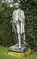 Sir Robert Peel, Gawsworth, East Cheshire.JPG 1,191 × 1,900; 1.57 MB
-
 Snowy landscape south of Cowbrook Farm - geograph.org.uk - 2205375.jpg 640 × 430; 111 KB
-

-
 Spring Bank Pool - geograph.org.uk - 503234.jpg 640 × 480; 116 KB
-
 Tarmac's concrete plant, Gawsworth - geograph.org.uk - 1129097.jpg 640 × 480; 61 KB
-

-
 The disputed tiltyard at Gawsworth - geograph.org.uk - 6167379.jpg 1,024 × 768; 188 KB
-
 The Fools Nook at Oakgrove, Cheshire - geograph.org.uk - 4274913.jpg 1,024 × 768; 546 KB
-
 The lake at Gawsworth Hall - geograph.org.uk - 5178134.jpg 800 × 428; 109 KB
-
 The new brood - geograph.org.uk - 6167454.jpg 1,024 × 768; 229 KB
-
 The Old Rectory, Gawsworth - geograph.org.uk - 5075227.jpg 1,280 × 960; 403 KB
-
 The road from Mill End Farm - geograph.org.uk - 3171291.jpg 2,304 × 3,456; 2.99 MB
-
 The view from Rough Hey - geograph.org.uk - 3172493.jpg 3,456 × 2,304; 3.07 MB
-
 The Watch Tower, Gawsworth.jpg 1,800 × 1,350; 619 KB
-
 Towards Sutton Common - geograph.org.uk - 2130747.jpg 640 × 425; 76 KB
-
 Towards The Cloud - geograph.org.uk - 2130761.jpg 640 × 425; 66 KB
-
 Victorian postbox, Church Lane, Gawsworth - geograph.org.uk - 6167452.jpg 1,024 × 768; 240 KB
-

-
 View from land at Rough Hey Quarry - geograph.org.uk - 2306369.jpg 1,024 × 768; 172 KB
-
 View north from St James church tower - geograph.org.uk - 6167442.jpg 1,024 × 768; 213 KB
-
 View south-west from St James church tower - geograph.org.uk - 6167440.jpg 1,023 × 768; 204 KB
-
 View through trees to Gawsworth Church from path to W - geograph.org.uk - 5248335.jpg 5,184 × 2,920; 6.32 MB
-
 View towards Pastures - geograph.org.uk - 1083269.jpg 640 × 480; 80 KB
-
 Virgin train heading towards Manchester - geograph.org.uk - 5076193.jpg 1,280 × 960; 496 KB
-
 Wardle Crescent, Gawsworth - geograph.org.uk - 5075069.jpg 1,280 × 960; 310 KB
-
 Warren - geograph.org.uk - 4564945.jpg 4,888 × 3,131; 1.72 MB
-
 Warren - geograph.org.uk - 4565838.jpg 4,829 × 2,920; 1.89 MB
-
 West Coast Mainline by Danes Moss - geograph.org.uk - 4006609.jpg 1,800 × 1,200; 1.23 MB
-
 Weston Park - geograph.org.uk - 2818216.jpg 861 × 480; 56 KB
-
 Winter's day, Lowes Lane, Mosshouses, Gawsworth - geograph.org.uk - 6083470.jpg 5,184 × 2,920; 6.46 MB
-
 Within Danes Moss Nature Reserve - geograph.org.uk - 4006822.jpg 1,200 × 1,800; 1.31 MB
-


_near_Gawsworth_-_geograph.org.uk_-_4755418.jpg)


_-_geograph.org.uk_-_5076181.jpg)
_-_geograph.org.uk_-_5076183.jpg)


