Category:Borough of Cheshire East
Jump to navigation
Jump to search
unitary authority area with borough status in England   | |||||
| Upload media | |||||
| Instance of | |||||
|---|---|---|---|---|---|
| Named after | |||||
| Location | Cheshire, North West England, England | ||||
| Capital | |||||
| Legislative body |
| ||||
| Inception |
| ||||
| Population |
| ||||
| Area |
| ||||
| official website | |||||
 | |||||
Subcategories
This category has the following 135 subcategories, out of 135 total.
A
- Arclid (32 F)
- Aston juxta Mondrum (36 F)
- Austerson (17 F)
B
- Bexton (16 F)
- Brindley (31 F)
- Broomhall, Cheshire (35 F)
C
- Cholmondeston (65 F)
- Chorley, Alderley (43 F)
- Chorley, Cholmondeley (41 F)
- Coole Pilate (52 F)
- Cranage (211 F)
D
E
- Egerton, Cheshire (28 F)
F
G
H
- Hatherton, Cheshire (31 F)
- Haughton, Cheshire (26 F)
- Hulme Walfield (22 F)
K
L
- Little Warford (4 F)
- Lower Withington (166 F)
M
N
O
- Ollerton, Cheshire (58 F)
P
R
- Rope, Cheshire (15 F)
S
- Sound, Cheshire (31 F)
T
W
- Walgherton (23 F)
- Wettenhall (40 F)
- Woolstanwood (31 F)
Pages in category "Borough of Cheshire East"
The following 2 pages are in this category, out of 2 total.
Media in category "Borough of Cheshire East"
The following 200 files are in this category, out of 533 total.
(previous page) (next page)-

-
 A49 Crossing Quoisley Canal Bridge - geograph.org.uk - 5045622.jpg 640 × 427; 313 KB
-
 A49, Welcome to Shropshire - geograph.org.uk - 5058828.jpg 640 × 427; 340 KB
-
 A51 towards Chester - geograph.org.uk - 5225223.jpg 640 × 480; 107 KB
-
 A51 towards Chester - geograph.org.uk - 5225228.jpg 640 × 480; 54 KB
-
 A51 towards Chester - geograph.org.uk - 5225237.jpg 640 × 480; 98 KB
-
 A51, Henhull Bridge - geograph.org.uk - 5225233.jpg 640 × 480; 79 KB
-
 A534, Burland - geograph.org.uk - 5225246.jpg 640 × 480; 62 KB
-
 A6 towards Lymm - geograph.org.uk - 5183425.jpg 640 × 480; 79 KB
-
 Abandoned farmhouse - geograph.org.uk - 5778318.jpg 2,272 × 1,704; 1.19 MB
-
 AlderleyEdgeDrone.jpg 1,000 × 622; 744 KB
-
 Ancient Oak at Tatton Park - geograph.org.uk - 6234193.jpg 640 × 853; 1.04 MB
-

-
 Arthill - geograph.org.uk - 5853135.jpg 1,024 × 683; 449 KB
-
 Arthill Heath Farm - geograph.org.uk - 5183450.jpg 640 × 480; 65 KB
-
 Ashley Road - geograph.org.uk - 5184326.jpg 640 × 480; 126 KB
-
 Ashley Road - geograph.org.uk - 5184337.jpg 640 × 480; 86 KB
-
 Astbury Mere Country Park - geograph.org.uk - 158433.jpg 640 × 480; 49 KB
-
 Autumn colours SW of Bowden Bank Farm, Over Peover - geograph.org.uk - 6015526.jpg 5,184 × 2,920; 7.26 MB
-
 Aythya fuligula Couple (31855721664).jpg 1,600 × 900; 519 KB
-
 Back Lane Farm near Tilstone Fearnal - geograph.org.uk - 5911758.jpg 4,000 × 3,000; 4.1 MB
-
 Back Lane, Alpraham - geograph.org.uk - 5911706.jpg 4,000 × 3,000; 4.29 MB
-
 Back Lane, Alpraham - geograph.org.uk - 5911713.jpg 4,000 × 3,000; 4.4 MB
-

-
 Barn at Hill Farm - geograph.org.uk - 5911735.jpg 4,000 × 3,000; 3.32 MB
-
 Barns at Diglane Farm - geograph.org.uk - 6012393.jpg 5,184 × 3,888; 4.45 MB
-
 Bate Mill Farm - geograph.org.uk - 4925529.jpg 1,024 × 768; 112 KB
-

-
 Bill and Ben greeting visitors - geograph.org.uk - 5474929.jpg 640 × 446; 79 KB
-
 Birkenheath Covert - geograph.org.uk - 5183778.jpg 480 × 640; 156 KB
-
 Blackden Lane - geograph.org.uk - 4997701.jpg 640 × 480; 83 KB
-
 Bollin Valley Way - geograph.org.uk - 90493.jpg 640 × 480; 116 KB
-
 Bottle Lodge - geograph.org.uk - 5864419.jpg 4,608 × 3,456; 3.8 MB
-
 Bottle Lodge - geograph.org.uk - 5864428.jpg 4,608 × 3,456; 3.83 MB
-
 Bottle Lodge - geograph.org.uk - 5864515.jpg 4,608 × 3,456; 3.94 MB
-
 Bottle Lodge - geograph.org.uk - 5864517.jpg 4,608 × 3,456; 3.82 MB
-
 Bottle Lodge - geograph.org.uk - 5864520.jpg 4,608 × 3,456; 3.81 MB
-
 Boys and their toys - geograph.org.uk - 5473760.jpg 640 × 480; 77 KB
-
 Bradfield Road - geograph.org.uk - 386699.jpg 640 × 480; 103 KB
-
 Brains Lane near Tilstone Fearnal - geograph.org.uk - 5901981.jpg 4,000 × 3,000; 3.46 MB
-
 Bridleway off Coole Lane - geograph.org.uk - 461078.jpg 640 × 480; 87 KB
-
 Bucklow hundred map.svg 1,785 × 1,485; 40 KB
-
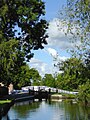
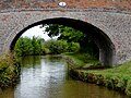
 Bunbury locks. - geograph.org.uk - 5454624.jpg 640 × 360; 61 KB
-
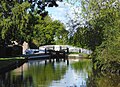
 Bunbury Staircase Locks - geograph.org.uk - 5772777.jpg 1,600 × 1,200; 517 KB
-
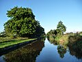
 Bywash below Quoisley Lock, Llangollen Canal - geograph.org.uk - 5220283.jpg 1,024 × 768; 455 KB
-
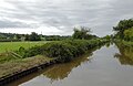
 Canal north of Bradeley Green, Cheshire - geograph.org.uk - 5464440.jpg 1,281 × 805; 896 KB
-

-
 Canal Warehouse - geograph.org.uk - 5772747.jpg 1,600 × 1,200; 386 KB
-
 Cat at Hawthorn Avenue, Crewe Road - geograph.org.uk - 258935.jpg 640 × 497; 188 KB
-
 Chelford Lane - geograph.org.uk - 4997843.jpg 640 × 480; 70 KB
-
 Chelford Lane - geograph.org.uk - 4997849.jpg 640 × 480; 105 KB
-
 Cheshire countryside - geograph.org.uk - 5676658.jpg 6,032 × 4,014; 3.27 MB
-
 Cheshire East Council 2023.svg 360 × 185; 6 KB
-
 Cheshire East UK ward map 2019.svg 720 × 676; 686 KB
-
 Cheshire East UK ward map 2023.svg 720 × 676; 686 KB
-
 Cheshire farmland and woods near Bradeley Green - geograph.org.uk - 5273731.jpg 1,280 × 907; 887 KB
-
 Cheshire Farmland near Wirswall - geograph.org.uk - 5271305.jpg 1,280 × 838; 734 KB
-
 Cheshire Farmland near Wirswall - geograph.org.uk - 5271494.jpg 1,280 × 643; 445 KB
-
 Cheshire hills - geograph.org.uk - 5674609.jpg 20,000 × 2,358; 7.3 MB
-
 Clearway - geograph.org.uk - 131703.jpg 640 × 426; 59 KB
-

-
 Close up, Elizabeth II postbox on Reddy Lane, Booth Bank - geograph.org.uk - 5185096.jpg 2,136 × 2,848; 1.17 MB
-
 Coat of arms of Cheshire East Borough Council.png 1,500 × 1,461; 1.09 MB
-
 Coming to investigate - geograph.org.uk - 416499.jpg 640 × 480; 118 KB
-
 Construction camp, A556 - geograph.org.uk - 5853117.jpg 1,024 × 683; 269 KB
-
 Cottage at George's Lane Farm - geograph.org.uk - 400370.jpg 640 × 480; 147 KB
-
 Countryside at Bridgemere - geograph.org.uk - 5544561.jpg 1,600 × 1,200; 883 KB
-
 Crewe Hall - geograph.org.uk - 5003759.jpg 1,600 × 1,200; 317 KB
-
 Crewe Hall Hotel - geograph.org.uk - 5003788.jpg 1,600 × 1,200; 337 KB
-
 Crop field beside Yew Wood - geograph.org.uk - 5184338.jpg 640 × 486; 61 KB
-
 Crop field near Grotto Farm - geograph.org.uk - 4997700.jpg 640 × 480; 62 KB
-
 Crop field near Park Farm - geograph.org.uk - 4997702.jpg 640 × 480; 70 KB
-
 Cumberland cottage - geograph.org.uk - 329321.jpg 640 × 480; 94 KB
-
 Cycle bridge over the Weaver - geograph.org.uk - 344878.jpg 640 × 480; 143 KB
-
 Dangerous bridge - geograph.org.uk - 5778327.jpg 2,272 × 1,704; 1.38 MB
-
 David Harber's sculpture - geograph.org.uk - 5474411.jpg 571 × 640; 103 KB
-

-
 Den Lane, near junction with Mill Lane - geograph.org.uk - 249679.jpg 640 × 467; 139 KB
-

-

-
-

-
 Driveway off Holmes Chapel Road (A50) - geograph.org.uk - 5174774.jpg 640 × 480; 119 KB
-
 Elizabeth II postbox on Holmes Chapel Road - geograph.org.uk - 5175371.jpg 2,848 × 2,136; 1.23 MB
-

-
 Elizabeth II postbox on Reddy Lane, Booth Bank - geograph.org.uk - 5185094.jpg 2,136 × 2,848; 1.43 MB
-
 End of the 30 zone through Stapeley - geograph.org.uk - 5236688.jpg 800 × 624; 162 KB
-
 Entering Ashley - geograph.org.uk - 5184328.jpg 640 × 394; 94 KB
-
 Exhibitors at Four Oaks Show - geograph.org.uk - 949737.jpg 640 × 480; 117 KB
-
 Exit from Arclid Green industrial units (geograph 1918506).jpg 640 × 480; 223 KB
-
 Fallow field - geograph.org.uk - 5341655.jpg 640 × 426; 54 KB
-
 Fancy an ice cream^ - geograph.org.uk - 5474068.jpg 640 × 427; 83 KB
-
 Farm access road - geograph.org.uk - 248383.jpg 640 × 480; 135 KB
-
 Farm at beginning of Dooleys lane,Morley - geograph.org.uk - 89715.jpg 640 × 480; 131 KB
-
 Farm buildings, Higher Hall Farm, Norbury - geograph.org.uk - 380644.jpg 640 × 378; 135 KB
-
 Farm buildings, Ridley Bank Farm - geograph.org.uk - 5225396.jpg 640 × 480; 57 KB
-
 Farmland and fence, Over Peover - geograph.org.uk - 4997847.jpg 640 × 480; 64 KB
-
 Farmland east of Ryebank - geograph.org.uk - 5220319.jpg 1,024 × 768; 153 KB
-
 Farmland near Badeley Green in Cheshire - geograph.org.uk - 5271496.jpg 1,280 × 722; 623 KB
-
 Farmland near Middlewood, Cheshire.jpg 4,160 × 3,120; 3.09 MB
-
 Farmland near Norbury in Cheshire - geograph.org.uk - 5464528.jpg 1,280 × 877; 793 KB
-
 Farmland north of Marbury Heyes - geograph.org.uk - 5220318.jpg 1,024 × 768; 165 KB
-
 Farmland south of High Lane near Stockport - geograph.org.uk - 6289904.jpg 1,600 × 900; 1.77 MB
-
 Field and hedgerow - geograph.org.uk - 5225224.jpg 640 × 480; 86 KB
-
 Field entrance off Chelford Lane - geograph.org.uk - 4997850.jpg 640 × 480; 79 KB
-
 Field entrance off the Lymm Road (A56) - geograph.org.uk - 5183418.jpg 640 × 480; 120 KB
-
 Field, Burford - geograph.org.uk - 5225235.jpg 640 × 480; 40 KB
-
 Fields and hedgerows in springtime - geograph.org.uk - 5788133.jpg 1,080 × 810; 186 KB
-

-
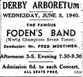 Fodens Band advert 1940.jpg 300 × 277; 11 KB
-
 Footbridge over Todd Brook - geograph.org.uk - 5778291.jpg 2,272 × 1,704; 1.51 MB
-
 Footbridge over Wybunbury Brook - geograph.org.uk - 416002.jpg 640 × 480; 99 KB
-
 Footpath from Willeymoor Lock - geograph.org.uk - 5342418.jpg 1,280 × 851; 600 KB
-
 For The Love of It garden (1) - geograph.org.uk - 5473977.jpg 640 × 427; 108 KB
-
 For The Love of It garden (2) - geograph.org.uk - 5473987.jpg 640 × 427; 95 KB
-
 For The Love of It garden (3) - geograph.org.uk - 5474407.jpg 640 × 480; 114 KB
-
 Ford in Dunge Clough - geograph.org.uk - 5778323.jpg 2,272 × 1,704; 1.38 MB
-
 Forge Brook from bridge - geograph.org.uk - 416548.jpg 640 × 480; 118 KB
-
 Gateway to Old Vicarage, Peover Heath - geograph.org.uk - 4997845.jpg 640 × 480; 112 KB
-
 Grassland near Road Side Farm - geograph.org.uk - 5174781.jpg 640 × 480; 67 KB
-
 Grazing and hedgerow, Gradeley Green - geograph.org.uk - 5193054.jpg 640 × 434; 56 KB
-
 Grazing and pond, Gradeley Green - geograph.org.uk - 5193051.jpg 640 × 480; 83 KB
-
 Grazing north of Springe Lane - geograph.org.uk - 5193056.jpg 640 × 480; 46 KB
-
 Grazing of Holmes Chapel Road (A50) - geograph.org.uk - 5174777.jpg 640 × 453; 59 KB
-
 Grazing off Chelford Lane - geograph.org.uk - 4997848.jpg 640 × 480; 54 KB
-
 Grazing off Wrexham Road (A534) - geograph.org.uk - 5225391.jpg 640 × 480; 57 KB
-
 Grazing towards Half Plantation - geograph.org.uk - 5184334.jpg 640 × 480; 67 KB
-
 Grazing towards Poole Hook Woodland - geograph.org.uk - 6090112.jpg 800 × 546; 67 KB
-
 Grazing towards Spodegreen Farm - geograph.org.uk - 5183427.jpg 640 × 480; 53 KB
-
 Greenhouses off Stocks Lane - geograph.org.uk - 5174787.jpg 640 × 480; 72 KB
-
 Growing Oldham, feeding ambition - geograph.org.uk - 5473878.jpg 640 × 427; 99 KB
-
 Hampton Springs Fishery, Egerton Hall - geograph.org.uk - 457706.jpg 640 × 480; 94 KB
-
 Hedgerow and fields - geograph.org.uk - 4997699.jpg 640 × 480; 78 KB
-
 Heron and Friends (31450136974).jpg 1,600 × 1,200; 866 KB
-
 Higher Sutton - geograph.org.uk - 314888.jpg 640 × 480; 166 KB
-
 Hill Farm, Alpraham - geograph.org.uk - 5911724.jpg 4,000 × 3,000; 3.53 MB
-
 Hillside grazing near Southley Farm - geograph.org.uk - 5197636.jpg 640 × 420; 54 KB
-
 HM Prison Styal.jpg 3,024 × 4,032; 3.64 MB
-
 Hollowcowhey Farm - geograph.org.uk - 5778339.jpg 2,256 × 1,692; 1.12 MB
-
 Holmes Chapel Road (A50) - geograph.org.uk - 5174775.jpg 640 × 480; 99 KB
-
 Holmes Chapel Road (A50) - geograph.org.uk - 5174778.jpg 640 × 480; 62 KB
-

-
 Horseshoe Inn, closed - geograph.org.uk - 5881708.jpg 1,024 × 367; 73 KB
-
 Hurleston Bottom Lock in Cheshire - geograph.org.uk - 5513311.jpg 1,280 × 960; 921 KB
-

-
 Hurleston Junction - geograph.org.uk - 5211934.jpg 1,024 × 768; 148 KB
-
 Hurleston Locks - geograph.org.uk - 5342248.jpg 1,280 × 851; 366 KB
-

-
 Hurleston Locks south-east of Barbridge in Cheshire - geograph.org.uk - 5513301.jpg 1,280 × 960; 1.25 MB
-
 Hurleston Locks south-east of Barbridge in Cheshire - geograph.org.uk - 5513305.jpg 1,280 × 960; 1.04 MB
-
 Hurleston Top Lock - geograph.org.uk - 5342252.jpg 1,280 × 851; 406 KB
-
-
 JackieOatesPriddy2008.jpg 858 × 1,094; 513 KB
-
 Jude's ice cream - geograph.org.uk - 5474042.jpg 640 × 427; 58 KB
-
 Kissing Gate - geograph.org.uk - 345011.jpg 480 × 640; 108 KB
-
 Layby on Southbound A49 - geograph.org.uk - 5022828.jpg 640 × 480; 374 KB
-

-
 Liquid refreshments on sale - geograph.org.uk - 5473814.jpg 640 × 480; 66 KB
-

-
-

-

-
 Llangollen Canal ar Quoisley Bridge, Cheshire - geograph.org.uk - 5235313.jpg 1,280 × 960; 1.15 MB
-
 Llangollen Canal at Hurleston - geograph.org.uk - 5211932.jpg 1,024 × 768; 431 KB
-

-
 Llangollen Canal at top of Hurleston Locks - geograph.org.uk - 5219268.jpg 5,184 × 2,920; 5.68 MB
-
 Llangollen Canal below Quoisley Lock in Cheshire - geograph.org.uk - 5235410.jpg 1,280 × 841; 718 KB
-
 Llangollen Canal near Bradeley Green, Cheshire - geograph.org.uk - 5271914.jpg 1,280 × 933; 931 KB
-
 Llangollen Canal near Bradeley Green, Cheshire - geograph.org.uk - 5271920.jpg 960 × 1,280; 1.18 MB
-
 Llangollen Canal near Quoisley - geograph.org.uk - 5342399.jpg 1,280 × 851; 495 KB
-
 Llangollen Canal near Quoisley Bridge, Cheshire - geograph.org.uk - 5235151.jpg 1,280 × 838; 1,018 KB
-
 Llangollen Canal near Willey Moor in Cheshire - geograph.org.uk - 5464467.jpg 1,280 × 867; 826 KB
-
-
-
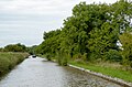
 Llangollen Canal north of Burland in Cheshire - geograph.org.uk - 5501667.jpg 1,280 × 847; 1.1 MB
-
 Llangollen Canal north of Quoisley in Cheshire - geograph.org.uk - 5234766.jpg 1,280 × 847; 880 KB
-

-

-

-
-

-
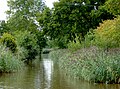
 Llangollen Canal south of Norbury Common in Cheshire - geograph.org.uk - 5235135.jpg 1,280 × 875; 1.02 MB
-
 Llangollen Canal south of Norbury Common in Cheshire - geograph.org.uk - 5235137.jpg 1,280 × 921; 1.05 MB
-

-
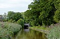
 Llangollen Canal, between bridges 22 and 23 - geograph.org.uk - 5220316.jpg 1,024 × 768; 127 KB
-
 Llangollen Canal, Burland - geograph.org.uk - 5225244.jpg 640 × 480; 65 KB
-
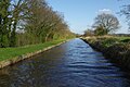
 Llangollen Canal, looking westwards - geograph.org.uk - 5220321.jpg 1,024 × 768; 175 KB
-
 Lodge house on the Sandstone Trail - geograph.org.uk - 4878715.jpg 1,024 × 768; 369 KB
-
 Long Tailed Fat Birds (32107877375).jpg 1,600 × 1,200; 702 KB
-
 Lyme Park NT - The Cage - geograph.org.uk - 5232548.jpg 5,184 × 2,920; 4.53 MB
-
 Lymm Road (A56) - geograph.org.uk - 5183420.jpg 640 × 480; 77 KB
-
 M56 bridge over Reddy Lane - geograph.org.uk - 5183453.jpg 640 × 480; 120 KB
-
 Mangers Carr Farm - geograph.org.uk - 5778309.jpg 2,272 × 1,704; 1.23 MB
-
 Manor Farm BandB - geograph.org.uk - 489589.jpg 640 × 427; 150 KB
-
 Mayor of Cheshire East Council.jpg 640 × 346; 183 KB
-
 Mereheath Drive - geograph.org.uk - 5184349.jpg 640 × 480; 111 KB
-
 Mereheath Lodge - geograph.org.uk - 5184348.jpg 623 × 640; 117 KB
-

-
 Midfield, looking towards Kettleshulme - geograph.org.uk - 5778249.jpg 2,272 × 1,704; 996 KB
-
 Milestone along the Macclesfield Canal - geograph.org.uk - 5985025.jpg 1,836 × 3,264; 2.39 MB


.jpg)


,_near_Ridley_Bank_Farm_-_geograph.org.uk_-_5225401.jpg)


_-_geograph.org.uk_-_5174774.jpg)


.jpg)


_-_geograph.org.uk_-_5183418.jpg)


_-_geograph.org.uk_-_5473977.jpg)
_-_geograph.org.uk_-_5473987.jpg)
_-_geograph.org.uk_-_5474407.jpg)


_-_geograph.org.uk_-_5174777.jpg)

_-_geograph.org.uk_-_5225391.jpg)


.jpg)


_-_geograph.org.uk_-_5174775.jpg)
_-_geograph.org.uk_-_5174778.jpg)
_near_Road_Side_Farm_-_geograph.org.uk_-_5174784.jpg)


_at_Tatton_Park_-_geograph.org.uk_-_6234202.jpg)


.jpg)

_-_geograph.org.uk_-_5183420.jpg)


