Category:Geological maps of Turkey
Jump to navigation
Jump to search
Countries of Asia: Afghanistan · Armenia‡ · Azerbaijan‡ · Bangladesh · People's Republic of China · Cyprus‡ · East Timor · Egypt‡ · Georgia‡ · India · Indonesia‡ · Iran · Iraq · Israel · Japan · Kazakhstan‡ · Laos · Malaysia · Mongolia · Myanmar · Nepal · Pakistan · Philippines · Russia‡ · Saudi Arabia · South Korea · Sri Lanka · Syria · Tajikistan · Thailand · Turkey‡ · Vietnam
Limited recognition: Taiwan – Other territories: Hong Kong
‡: partly located in Asia
Limited recognition: Taiwan – Other territories: Hong Kong
‡: partly located in Asia
Countries of Europe: Albania · Andorra · Armenia‡ · Austria · Azerbaijan‡ · Belgium · Bosnia and Herzegovina · Bulgaria · Croatia · Cyprus‡ · Czech Republic · Denmark · Estonia · Finland · France‡ · Georgia‡ · Germany · Greece · Hungary · Iceland · Republic of Ireland · Italy · Kazakhstan‡ · Latvia · Liechtenstein · Lithuania · Luxembourg · Moldova · Montenegro · Netherlands‡ · Norway · Poland · Portugal‡ · Romania · Russia‡ · Serbia · Slovakia · Slovenia · Spain‡ · Sweden · Switzerland · Turkey‡ · Ukraine · United Kingdom
Specific status: Svalbard
‡: partly located in Europe
Specific status: Svalbard
‡: partly located in Europe
Subcategories
This category has the following 3 subcategories, out of 3 total.
Media in category "Geological maps of Turkey"
The following 44 files are in this category, out of 44 total.
-
-
 A Grace gravity model, showing Europe and Africa.jpg 500 × 500; 57 KB
-
 Acıgöl-Vulkankomplex.jpg 1,884 × 1,117; 617 KB
-
 Carte géologique de la mer Egée par Mr L. de Launay et des régions avoisinantes.jpg 5,992 × 4,313; 3.22 MB
-
 Dedegölfoto.png 415 × 510; 279 KB
-
 Dedegölfotoo.png 415 × 478; 293 KB
-
 Die geographische Großgliederung der Çukurova.jpg 1,540 × 1,116; 286 KB
-
 Entwicklung des unteren Sakarya und des Bosporus seit dem späten Tertiär.jpg 1,823 × 1,548; 833 KB
-
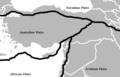
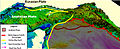 Eurasian & Anatolian Plate.jpg 837 × 344; 148 KB
-
 Geo-tektonische Strukturen des Inneranatolischen Vulkanbogens.jpg 2,054 × 947; 672 KB
-
 Geol Anatolia-fr.jpg 2,909 × 876; 2.08 MB
-
 Geological map marmara island - hochstetter.jpg 3,306 × 3,729; 606 KB
-
 Geologisch-tektonische Karte des Sivas-Beckens.jpg 770 × 816; 290 KB
-
 Geologisch-tektonische Situationsskizze des Menderes Massivs (korrigiert).jpg 1,535 × 979; 584 KB
-
 Geologisch-tektonische Situationsskizze des Menderes Massivs.jpg 1,535 × 979; 587 KB
-
 Geologisch-topographische Grundstrukturen des Karadağ.jpg 1,980 × 1,175; 870 KB
-
 Geologisch-topographische Situationsskizze des Bozdağlar-Massivs.jpg 1,468 × 1,132; 789 KB
-
 Geologische Kartenskizze des Nemrut Dağı-Vulkangebietes.jpg 2,557 × 2,285; 1.63 MB
-
 Geologische Situation der kappadokischen Vulkanregion.jpg 1,163 × 1,072; 349 KB
-
 GPS copy.gif 970 × 569; 97 KB
-
 Gpsavrasya.png 646 × 453; 219 KB
-
 Kars-Ardahan Yaylası geograpisch-geologische Situation.jpg 1,724 × 1,278; 777 KB
-
 Karstkomplex Antalya-Kestel.jpg 782 × 1,102; 440 KB
-
 Kıyı ilerlemesi.jpg 616 × 510; 63 KB
-

-
 Laufentwicklung des Sakarya in der Adapazarı Ovası.jpg 1,374 × 808; 349 KB
-
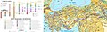
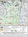
 Ländliche Siedlungen im Raum Eskişehir (1959).jpg 1,024 × 1,125; 232 KB
-
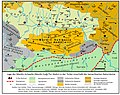 Mardinschwelle.jpg 1,776 × 1,403; 726 KB
-
 Mountain systems of Turkey.svg 5,867 × 2,640; 654 KB
-
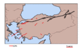
 Rupturemap.jpeg 750 × 445; 55 KB
-
 Slip-dist-1999.png 760 × 380; 26 KB
-
 Slip-dist.png 798 × 441; 192 KB
-
 Tectonic Map of Turkey.png 1,102 × 607; 64 KB
-
 Tektonik Kurve von Isparta.jpg 1,193 × 1,282; 487 KB
-
 TEKTONİK BÖLGELER.jpg 1,502 × 1,127; 150 KB
-
 The Quarterly journal of the Geological Society of London (1904) (14762074146).jpg 3,040 × 2,084; 982 KB
-
 Topographisch-geologische Situation des Kümbet-Plateaus.jpg 1,725 × 1,097; 521 KB
-
 Turkey blank faults.png 1,104 × 510; 25 KB
-
 Turkey-faults-nolabel.png 600 × 385; 24 KB
-
 Turkey-faults-platenames ku.svg 555 × 379; 199 KB
-
 Turkey-faults-platenames.png 600 × 385; 28 KB
-
 Turkey-faults-platenames.svg 555 × 379; 174 KB
-
 Türkiye'nin Genç Tektonik Ovaları.jpg 5,846 × 4,133; 1.8 MB
-
 Urfa-Harran Ovası.jpg 876 × 1,142; 519 KB
.jpg)


.jpg)


_in_ihrem_naturr%C3%A4umlichen_Umfeld.jpg)

.jpg)


_(14762074146).jpg)


