Category:Haven 6, Breda
Jump to navigation
Jump to search
| Object location | | View all coordinates using: OpenStreetMap |
|---|
house in Breda, Netherlands  | |||||
| Upload media | |||||
| Instance of | |||||
|---|---|---|---|---|---|
| Location | Breda, North Brabant, Netherlands | ||||
| Street address |
| ||||
| Heritage designation |
| ||||
 | |||||
|
This is a category about rijksmonument number 10200
|
| Address |
|
Media in category "Haven 6, Breda"
The following 5 files are in this category, out of 5 total.
-
 Overzicht naar 't zuiden - Breda - 20041208 - RCE.jpg 1,200 × 1,181; 285 KB
-
 RM10199 Breda - Haven 5.jpg 2,592 × 1,944; 1.64 MB
-
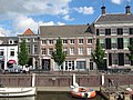
 RM10200 Breda - Haven 6.jpg 2,592 × 1,944; 1.59 MB
-
 RM10201 RM10202 Breda - Haven 7 en 8.jpg 1,944 × 2,592; 1.54 MB
-
 Voorgevels - Breda - 20041225 - RCE.jpg 820 × 1,200; 230 KB


