Category:Hohenlandin
Jump to navigation
Jump to search
| Object location | | View all coordinates using: OpenStreetMap |
|---|
 | |||||
| Upload media | |||||
| Instance of |
| ||||
|---|---|---|---|---|---|
| Location | Mark Landin, Schwedt/Oder, Uckermark District, Brandenburg, Germany | ||||
 | |||||
English: The village Hohenlandin belongs to en:Schwedt/Oder municipality, Uckermark district, Brandenburg state, Germany
Deutsch: Das Dorf Hohenlandin gehört zur Stadt Schwedt/Oder, Landkreis Uckermark, Land Brandenburg, Deutschland.
Français : Le village de Hohenlandin fait partie de la ville de Schwedt/Oder, arrondissement Uckermark, état fédéral de Brandebourg, Allemagne
Subcategories
This category has the following 2 subcategories, out of 2 total.
C
- Church in Hohenlandin (3 F)
S
- Schloss Hohenlandin (9 F)
Media in category "Hohenlandin"
The following 14 files are in this category, out of 14 total.
-
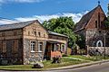 Hohenlandin 06 15 05 jiw.jpg 1,800 × 1,201; 672 KB
-
 Hohenlandin Brennerei.jpg 2,800 × 2,100; 1.01 MB
-
 Schloss Hohenlandin Adler groß.jpg 3,321 × 2,414; 5.14 MB
-
 Schloss Hohenlandin Adler.jpg 3,716 × 2,928; 8.46 MB
-
 Schloss Hohenlandin Ansicht.jpg 6,048 × 4,024; 11.96 MB
-
 Schloss Hohenlandin Front Farbe.jpg 6,048 × 4,024; 16.8 MB
-
 Schloss Hohenlandin Front.jpg 6,048 × 4,024; 15.13 MB
-
 Schloss Hohenlandin Hauptfront o. Farbe.jpg 4,994 × 3,323; 8.62 MB
-
 Schloss Hohenlandin Hauptfront.jpg 5,045 × 3,361; 10.68 MB
-
 Schloss Hohenlandin Kuhstall.jpg 5,865 × 3,903; 7.71 MB
-
 Schloss Hohenlandin Turm o. Farbe.jpg 6,048 × 4,024; 16.61 MB
-
 Schloss Hohenlandin Turm ohne Farbe.jpg 6,048 × 4,024; 16.94 MB
-
 Schloss Hohenlandin Turm SW.jpg 6,048 × 4,024; 8.23 MB
-
 Schloss Hohenlandin Turm.jpg 6,048 × 4,024; 11.74 MB


