Category:Idaho State Highway 36
Jump to navigation
Jump to search
 | number: | (thirty-six) |
|---|---|---|
| State highways in Idaho: | 16 · 19 · 21 · 22 · 24 · 25 · 27 · 28 · 29 · 31 · 32 · 33 · 34 · 36 · 37 · 38 · 39 · 40 · 41 · 43 · 44 · 45 · 46 · 47 · 48 · 50 · 51 · 52 · 53 · 54 · 55 |
state highway in Oneida, Franklin, and Bear Lake counties in Idaho, United States  | |||||
| Upload media | |||||
| Instance of | |||||
|---|---|---|---|---|---|
| Location |
| ||||
| Transport network | |||||
| Owned by | |||||
| Maintained by | |||||
| Length |
| ||||
| Terminus | |||||
| Partially coincident with | |||||
| |||||
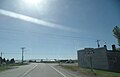
English: Media related to Idaho State Highway 36, a 73.3113-mile (117.9831 km) state highway in Oneida, Franklin, and Bear Lake counties in Idaho, United States, that connects Interstate 15 (north of Malad City) with U.S. Route 89 (in Ovid), via Preston.
Subcategories
This category has only the following subcategory.
Media in category "Idaho State Highway 36"
The following 3 files are in this category, out of 3 total.
-
 Idaho 36.svg 601 × 601; 3 KB
-
 ID 36 eastern terminus.jpg 4,608 × 2,966; 2.14 MB
-
 ID-36.svg 600 × 600; 33 KB
