Category:Idaho State Highway 38
Jump to navigation
Jump to search
 | number: | (thirty-eight) |
|---|---|---|
| State highways in Idaho: | 19 · 21 · 22 · 24 · 25 · 27 · 28 · 29 · 31 · 32 · 33 · 34 · 36 · 37 · 38 · 39 · 40 · 41 · 43 · 44 · 45 · 46 · 47 · 48 · 50 · 51 · 52 · 53 · 54 · 55 · 57 · 58 |
state highway in Oneida County, Idaho, United States  | |||||
| Upload media | |||||
| Instance of | |||||
|---|---|---|---|---|---|
| Location | Oneida County, Idaho | ||||
| Transport network | |||||
| Owned by | |||||
| Maintained by | |||||
| Inception |
| ||||
| Length |
| ||||
| Terminus | |||||
 | |||||
English: Media related to Idaho State Highway 38, a 23.438-mile (37.720 km) state highway in Oneida County, Idaho, United States, that connects 2100 West and Old Highway 37 (northwest of Holbrook) with Interstate 15 (just east of Malad City).
Subcategories
This category has only the following subcategory.
Media in category "Idaho State Highway 38"
The following 3 files are in this category, out of 3 total.
-
 Idaho 38.svg 601 × 601; 4 KB
-
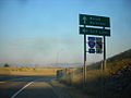 ID 38 eastern terminus.jpg 1,024 × 768; 146 KB
-
 ID-38.svg 600 × 600; 33 KB
