Category:Kerridge
Jump to navigation
Jump to search
English: Kerridge is a village in Cheshire, England, part of the parish of Bollington. Kerridge borders the neighbouring parish of Rainow.
village in Cheshire, UK | |||||
| Upload media | |||||
| Instance of | |||||
|---|---|---|---|---|---|
| Location | Bollington, Cheshire East, Cheshire, North West England, England | ||||
 | |||||
Media in category "Kerridge"
The following 23 files are in this category, out of 23 total.
-
 Boundary Stone NHLE1138964.jpg 3,000 × 4,000; 3.14 MB
-
 Boundary Stone, Kerridge.jpg 1,800 × 1,350; 2.4 MB
-
 Clayton's chimney - geograph.org.uk - 61836.jpg 640 × 480; 136 KB
-
 Clayton's Tower.jpg 1,800 × 1,377; 868 KB
-
 Endon Hall, Kerridge, Cheshire - geograph.org.uk - 261330.jpg 640 × 480; 198 KB
-
 Endon Lodge, Bollington.jpg 3,927 × 2,945; 4.99 MB
-
 Estate boundary stone near White Nancy.jpg 4,000 × 3,000; 4.86 MB
-
 Footpath to Saddle of Kerridge - geograph.org.uk - 2167806.jpg 640 × 480; 155 KB
-
 Higher Lane cottages, Kerridge (geograph 2803856).jpg 4,000 × 3,000; 3.13 MB
-
 Higher Lane, Kerridge - geograph.org.uk - 2803844.jpg 4,000 × 3,000; 3.6 MB
-
 Kerridge Hill and White Nancy - geograph.org.uk - 1276554.jpg 640 × 480; 57 KB
-
 Kerridge Hill path south of White Nancy - geograph.org.uk - 3490107.jpg 2,048 × 1,536; 504 KB
-

-
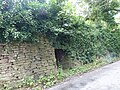 Kiln near Ivy House 01.jpg 4,000 × 3,000; 5.18 MB
-
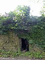 Kiln near Ivy House 02.jpg 3,000 × 4,000; 2.1 MB
-
 Oak Lane spring, Kerridge, Bollington - geograph.org.uk - 2803836.jpg 4,000 × 3,000; 4.5 MB
-

-
 Quarry workings on Kerridge Hill - geograph.org.uk - 2754828.jpg 1,024 × 768; 243 KB
-
 Stone wall on Kerridge Hill - geograph.org.uk - 2754833.jpg 1,024 × 768; 171 KB
-
 Sunken narrowboat at Kerridge - geograph.org.uk - 2054650.jpg 1,280 × 856; 286 KB
-
 Sunken narrowboat at Kerridge - geograph.org.uk - 2054660.jpg 1,280 × 856; 284 KB
-
 Sunken narrowboat at Kerridge - geograph.org.uk - 2054666.jpg 1,280 × 856; 232 KB
-
 Walkers on Kerridge Hill - geograph.org.uk - 2754824.jpg 1,024 × 768; 230 KB


.jpg)


