Category:Kirche Weißenberg
Jump to navigation
Jump to search
| Object location | | View all coordinates using: OpenStreetMap |
|---|
.jpg) | |||||
| Upload media | |||||
| Instance of | |||||
|---|---|---|---|---|---|
| Location | Weißenberg, Bautzen District, Saxony, Germany | ||||
| Street address |
| ||||
| Connects with | |||||
| Heritage designation | |||||
| Inception |
| ||||
 | |||||
Subcategories
This category has the following 2 subcategories, out of 2 total.
F
- Friedhof Weißenberg (9 F)
I
Media in category "Kirche Weißenberg"
The following 25 files are in this category, out of 25 total.
-
 Kirche Weißenberg Februar 2017 (1).jpg 3,648 × 5,472; 4.12 MB
-
 Kirche Weißenberg Februar 2017 (10).jpg 5,472 × 3,648; 3.84 MB
-
 Kirche Weißenberg Februar 2017 (11).jpg 3,648 × 5,472; 4.19 MB
-
 Kirche Weißenberg Februar 2017 (2).jpg 3,648 × 5,472; 3.82 MB
-
 Kirche Weißenberg Februar 2017 (3).jpg 3,648 × 5,472; 3.67 MB
-
 Kirche Weißenberg Februar 2017 (4).jpg 5,472 × 3,648; 4.36 MB
-
 Kirche Weißenberg Februar 2017 (5).jpg 3,648 × 5,472; 4.27 MB
-
 Kirche Weißenberg Februar 2017 (6).jpg 3,648 × 5,472; 4.11 MB
-
 Kirche Weißenberg Februar 2017 (7).jpg 3,648 × 5,472; 3.88 MB
-
 Kirche Weißenberg Februar 2017 (8).jpg 5,472 × 3,648; 3.71 MB
-
 Kirche Weißenberg Februar 2017 (9).jpg 3,648 × 5,472; 4.11 MB
-
 Kirche weißenberg1.JPG 3,264 × 2,448; 1.76 MB
-
 Kirche weißenberg2.JPG 3,264 × 2,448; 1.87 MB
-
 Kirche weißenberg3.JPG 2,448 × 3,264; 1.78 MB
-
 Kirche weißenberg4.JPG 2,448 × 3,264; 1.66 MB
-
 Kirche weißenberg5.JPG 3,264 × 2,448; 1.83 MB
-
 Kirche weißenberg6.JPG 3,264 × 2,448; 1.81 MB
-
 Kirche weißenberg7.JPG 3,264 × 2,448; 1.88 MB
-
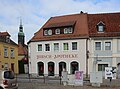 Weißenberg, die Hirsch-Apotheke.jpg 4,652 × 3,438; 3.33 MB
-
 Weißenberg, die Kirche und die Hirsch-Apotheke.jpg 3,237 × 5,168; 3.28 MB
-
 Weißenberg - Kirchgasse - Friedhof+Kirche 01 ies.jpg 5,616 × 3,744; 12.14 MB
-
 Weißenberg - Kirchgasse - Kirche 01 ies.jpg 5,616 × 3,744; 15.04 MB
-
 Weißenberg - Kirchgasse - Kirche 02 ies.jpg 5,616 × 3,744; 16.33 MB
-
 Weißenberg - Kirchgasse 02 ies.jpg 5,616 × 3,744; 18.9 MB
-
 Weißenberger Kirche.jpg 1,024 × 683; 394 KB
.jpg)
.jpg)
.jpg)
.jpg)
.jpg)
.jpg)
.jpg)
.jpg)
.jpg)
.jpg)


