Category:Krafla (volcanic system)
Jump to navigation
Jump to search
Deutsch: Das Vulkansystem der de:Krafla Krafla, in dem die letzten Ausbrüche 1984 stattfanden, liegt im Nordosten von Island. Der dazugehörige Zentralvulkan befindet sich beim See Mývatn. Das Vulkansystem hat eine Länge von eines ca. 100 km.
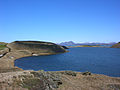
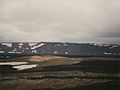
English: Krafla is located in the northeast of Iceland near the lake Mývatn. It is a 100 km long volcanic system which reaches northwards into the fjord Öxarfjörður. The last volcanic eruptions in the system took place in 1984. Krafla is also the name of the central volcano in form of a caldera to the northeast of the village of Reykjahlíð and of the highest mountain at its rim.
Français : The volcanic system du Krafla se trouve dans le nord-est de l'Islande près du lac Mývatn et s'étend jusque dans le fjord Öxarfjörður. Les dernières éruptions dans ce système volcanique eurent lieu en 1984. Le volcan central du même nom se trouve dans la partie sud du système près du Mývatn.
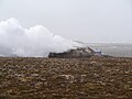
Íslenska: Krafla er eldfjallakerfi á Norðurlandi. Í megineldstöðinni nálægt Mývatni er sigketill eða askja sem er 10 km í þvermál. Á Kröflusvæðinu eru háhitasvæði með leirhverum og gufuhverum, t.d. við Námafjall eða Leirhnjúk.
mountain and volcano in Iceland  | |||||
| Upload media | |||||
| Instance of | |||||
|---|---|---|---|---|---|
| Part of | |||||
| Made from material | |||||
| Location | Skútustaðahreppur, Northeastern Region, Iceland | ||||
| Significant event |
| ||||
| Elevation above sea level |
| ||||
 | |||||
Subcategories
This category has the following 32 subcategories, out of 32 total.
Pages in category "Krafla (volcanic system)"
The following 14 pages are in this category, out of 14 total.
Media in category "Krafla (volcanic system)"
The following 55 files are in this category, out of 55 total.
-
Krafla pronunciation.ogg 1.9 s; 118 KB
-
 2008-05-19 09 Krafla seen from Leirhnjúkur.jpg 5,276 × 1,908; 2.84 MB
-
 2008-05-20 11-31-12 Iceland Norðurland Eystra Hallbjarnarstaðir.JPG 2,048 × 1,536; 2.4 MB
-
 2008-05-21 11 On Top of Námafjall.jpg 5,742 × 1,366; 8.79 MB
-
 2008-05-21 13 16 18 Iceland-Skútustaðir.jpg 2,048 × 1,536; 2.5 MB
-
 2014-04-28 17-17-09 Iceland - Mývatni Reykjahlíð.JPG 4,288 × 2,848; 7.76 MB
-
 2014-05-03 13-13-18 Iceland - Mývatni Reykjahlíð 12h 360°.JPG 26,655 × 2,538; 40.04 MB
-
 2014-05-03 13-44-48 Iceland - Mývatni Reykjahlíð.jpg 4,288 × 2,848; 4.94 MB
-
 Aerial View North of Krafla 21.05.2008 15-32-38.JPG 2,048 × 1,536; 1.12 MB
-
 Aerial View of Hverfjall 21.05.2008 16-03-35.JPG 2,048 × 1,536; 1.2 MB
-
 Aerial View of Mývatn and Reykjalið 21.05.2008 16-04-34.JPG 2,048 × 1,536; 1.04 MB
-
 Aerial View of Námafjall and Hverir 21.05.2008 15-28-49.JPG 2,048 × 1,536; 970 KB
-
 Aerial View of Reykjalið 21.05.2008 16-04-03.JPG 2,048 × 1,064; 711 KB
-
 Between Krafla and Detifoss - panoramio.jpg 1,354 × 838; 351 KB
-
 Colada krafla.jpg 600 × 450; 127 KB
-
 Diamond Circle banner.jpg 4,207 × 600; 1.02 MB
-
 Fissure vent Krafla-system.jpg 2,816 × 2,112; 1.75 MB
-
 Fumarola.jpg 1,460 × 1,096; 218 KB
-
 Geothermal-iceland.JPG 3,072 × 2,304; 1.11 MB
-
 GrasInLava.jpg 1,984 × 2,978; 870 KB
-
 HistoireDesMétéores - p414.jpg 1,803 × 1,191; 931 KB
-
 HPHT-O&G and Geothermal wells.png 4,840 × 2,389; 542 KB
-
 Hverir (6808115445).jpg 4,272 × 2,848; 4.39 MB
-
 Iceland (19410432313).jpg 3,264 × 2,448; 2.72 MB
-
 Iceland (20004718996).jpg 3,264 × 2,448; 1.83 MB
-
 Iceland - panoramio (39).jpg 2,432 × 3,648; 10.88 MB
-
 Iceland Impressions (130130379).jpeg 1,024 × 683; 63 KB
-
 Iceland Krafla.JPG 1,540 × 1,161; 380 KB
-
 Iceland-Krafla1-July 2000.jpg 1,733 × 1,179; 331 KB
-
 Iceland-Krafla3-July 2000.jpg 1,754 × 1,195; 333 KB
-
 Island Kleiner Krater an der Krafla 1.JPG 3,444 × 2,586; 1.82 MB
-
 Island Kleiner Krater an der Krafla 2.JPG 3,444 × 2,586; 1.63 MB
-
 Island Lava-Wüste 2.JPG 3,444 × 2,586; 2.5 MB
-
 Island1984 093.jpg 3,255 × 1,795; 1.05 MB
-
 Jörundur.JPG 1,632 × 1,088; 491 KB
-
 Krafla - Schwefelfeld 2.jpg 2,560 × 1,920; 1.46 MB
-
 Krafla - Schwefelfeld 4.jpg 2,560 × 1,920; 1.44 MB
-
 Krafla - Schwefelfeld 5.jpg 2,560 × 1,920; 1.66 MB
-
 Krafla - Schwefelfeld 6.jpg 2,560 × 1,920; 1.79 MB
-
 Krafla Geothermal Plant 2 (14602744200).jpg 2,560 × 1,441; 617 KB
-
 Krafla Hell entry (14766458166).jpg 2,560 × 1,441; 914 KB
-
 Krafla Hot Pool and Lava field (14789452685).jpg 2,560 × 1,441; 495 KB
-
 Krafla Lava 2007.jpg 1,280 × 960; 243 KB
-
 Krafla Mudpot22.jpg 1,083 × 787; 634 KB
-
 Krafla steams.jpg 1,024 × 665; 545 KB
-
 Krafla Sulfur.jpg 1,024 × 665; 551 KB
-
 Krafla usgs.jpg 640 × 433; 49 KB
-
 Lava at Vulkan Krafla Iceland 1.JPG 2,592 × 1,944; 1 MB
-
 Lava at Vulkan Krafla Iceland 3.JPG 1,944 × 2,592; 1.66 MB
-
 Lava at Vulkan Krafla Iceland 4.JPG 2,592 × 1,944; 1.03 MB
-
 Mývatn surrounds.jpg 4,411 × 600; 991 KB
-
 Námafjall.jpg 1,600 × 1,200; 328 KB
-
 Southwest toward Mývatn from Krafla.jpg 1,864 × 1,000; 689 KB
-
 Sulfitflower.JPG 3,072 × 2,304; 3 MB
-
 Viti - Kratersee 1.jpg 2,560 × 1,920; 1.08 MB


.jpg)
.jpg)
.jpg)
.jpg)
.jpeg)


.jpg)
.jpg)
.jpg)


