Category:Locator maps of counties of Oklahoma
Jump to navigation
Jump to search

States of the United States: Alabama · Alaska · Arizona · Arkansas · California · Colorado · Connecticut · Delaware · Florida · Georgia · Hawaii · Idaho · Illinois · Indiana · Iowa · Kansas · Kentucky · Louisiana · Maine · Maryland · Massachusetts · Michigan · Minnesota · Mississippi · Missouri · Montana · Nebraska · Nevada · New Hampshire · New Jersey · New Mexico · New York · North Carolina · North Dakota · Ohio · Oklahoma · Oregon · Pennsylvania · Rhode Island · South Carolina · South Dakota · Tennessee · Texas · Utah · Vermont · Virginia · Washington · West Virginia · Wisconsin · Wyoming
| NO WIKIDATA ID FOUND! Search for Locator maps of counties of Oklahoma on Wikidata | |
| Upload media |
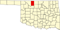
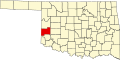
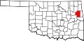
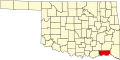
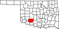
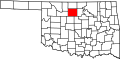
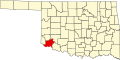
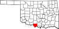
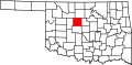
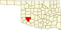
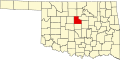
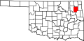
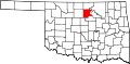
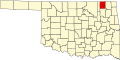
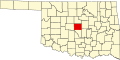
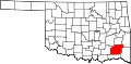
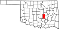
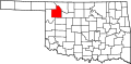
English: Locator maps for counties in Oklahoma.
Media in category "Locator maps of counties of Oklahoma"
The following 77 files are in this category, out of 77 total.
-
 Map of Oklahoma highlighting Adair County.svg 7,730 × 3,832; 57 KB
-
 Map of Oklahoma highlighting Alfalfa County.svg 7,730 × 3,832; 57 KB
-
 Map of Oklahoma highlighting Atoka County.svg 7,730 × 3,832; 57 KB
-
 Map of Oklahoma highlighting Beaver County.svg 7,730 × 3,832; 57 KB
-
 Map of Oklahoma highlighting Beckham County.svg 7,730 × 3,832; 57 KB
-
 Map of Oklahoma highlighting Blaine County.svg 7,730 × 3,832; 57 KB
-
 Map of Oklahoma highlighting Bryan County.svg 7,730 × 3,832; 57 KB
-
 Map of Oklahoma highlighting Caddo County.svg 7,730 × 3,832; 57 KB
-
 Map of Oklahoma highlighting Canadian County.svg 7,730 × 3,832; 57 KB
-
 Map of Oklahoma highlighting Carter County.svg 7,730 × 3,832; 57 KB
-
 Map of Oklahoma highlighting Cherokee County.svg 7,730 × 3,832; 57 KB
-
 Map of Oklahoma highlighting Choctaw County.svg 7,730 × 3,832; 57 KB
-
 Map of Oklahoma highlighting Cimarron County.svg 7,730 × 3,832; 57 KB
-
 Map of Oklahoma highlighting Cleveland County.svg 7,730 × 3,832; 57 KB
-
 Map of Oklahoma highlighting Coal County.svg 7,730 × 3,832; 57 KB
-
 Map of Oklahoma highlighting Comanche County.svg 7,730 × 3,832; 57 KB
-
 Map of Oklahoma highlighting Cotton County.svg 7,730 × 3,832; 57 KB
-
 Map of Oklahoma highlighting Craig County.svg 7,730 × 3,832; 57 KB
-
 Map of Oklahoma highlighting Creek County.svg 7,730 × 3,832; 57 KB
-
 Map of Oklahoma highlighting Custer County.svg 7,730 × 3,832; 57 KB
-
 Map of Oklahoma highlighting Delaware County.svg 7,730 × 3,832; 57 KB
-
 Map of Oklahoma highlighting Dewey County.svg 7,730 × 3,832; 57 KB
-
 Map of Oklahoma highlighting Ellis County.svg 7,730 × 3,832; 57 KB
-
 Map of Oklahoma highlighting Garfield County.svg 7,730 × 3,832; 57 KB
-
 Map of Oklahoma highlighting Garvin County.svg 7,730 × 3,832; 57 KB
-
 Map of Oklahoma highlighting Grady County.svg 7,730 × 3,832; 57 KB
-
 Map of Oklahoma highlighting Grant County.svg 7,730 × 3,832; 57 KB
-
 Map of Oklahoma highlighting Greer County.svg 7,730 × 3,832; 57 KB
-
 Map of Oklahoma highlighting Harmon County.svg 7,730 × 3,832; 57 KB
-
 Map of Oklahoma highlighting Harper County.svg 7,730 × 3,832; 57 KB
-
 Map of Oklahoma highlighting Haskell County.svg 7,730 × 3,832; 57 KB
-
 Map of Oklahoma highlighting Hughes County.svg 7,730 × 3,832; 57 KB
-
 Map of Oklahoma highlighting Jackson County.svg 7,730 × 3,832; 57 KB
-
 Map of Oklahoma highlighting Jefferson County.svg 7,730 × 3,832; 57 KB
-
 Map of Oklahoma highlighting Johnston County.svg 7,730 × 3,832; 57 KB
-
 Map of Oklahoma highlighting Kay County.svg 7,730 × 3,832; 57 KB
-
 Map of Oklahoma highlighting Kingfisher County.svg 7,730 × 3,832; 57 KB
-
 Map of Oklahoma highlighting Kiowa County.svg 7,730 × 3,832; 57 KB
-
 Map of Oklahoma highlighting Latimer County.svg 7,730 × 3,832; 57 KB
-
 Map of Oklahoma highlighting Le Flore County.svg 7,730 × 3,832; 57 KB
-
 Map of Oklahoma highlighting Lincoln County.svg 7,730 × 3,832; 57 KB
-
 Map of Oklahoma highlighting Logan County.svg 7,730 × 3,832; 57 KB
-
 Map of Oklahoma highlighting Love County.svg 7,730 × 3,832; 57 KB
-
 Map of Oklahoma highlighting Major County.svg 7,730 × 3,832; 57 KB
-
 Map of Oklahoma highlighting Marshall County.svg 7,730 × 3,832; 57 KB
-
 Map of Oklahoma highlighting Mayes County.svg 7,730 × 3,832; 57 KB
-
 Map of Oklahoma highlighting McClain County.svg 7,730 × 3,832; 57 KB
-
 Map of Oklahoma highlighting McCurtain County.svg 7,730 × 3,832; 57 KB
-
 Map of Oklahoma highlighting McIntosh County.svg 7,730 × 3,832; 57 KB
-
 Map of Oklahoma highlighting Murray County.svg 7,730 × 3,832; 57 KB
-
 Map of Oklahoma highlighting Muskogee County.svg 7,730 × 3,832; 57 KB
-
 Map of Oklahoma highlighting Noble County.svg 7,730 × 3,832; 57 KB
-
 Map of Oklahoma highlighting Nowata County.svg 7,730 × 3,832; 57 KB
-
 Map of Oklahoma highlighting Okfuskee County.svg 7,730 × 3,832; 57 KB
-
 Map of Oklahoma highlighting Oklahoma County.svg 7,730 × 3,832; 67 KB
-
 Map of Oklahoma highlighting Okmulgee County.svg 7,730 × 3,832; 57 KB
-
 Map of Oklahoma highlighting Osage County.svg 7,730 × 3,832; 57 KB
-
 Map of Oklahoma highlighting Ottawa County.svg 7,730 × 3,832; 57 KB
-
 Map of Oklahoma highlighting Pawnee County.svg 7,730 × 3,832; 57 KB
-
 Map of Oklahoma highlighting Payne County.svg 7,730 × 3,832; 57 KB
-
 Map of Oklahoma highlighting Pittsburg County.svg 7,730 × 3,832; 57 KB
-
 Map of Oklahoma highlighting Pontotoc County.svg 7,730 × 3,832; 57 KB
-
 Map of Oklahoma highlighting Pottawatomie County.svg 7,730 × 3,832; 57 KB
-
 Map of Oklahoma highlighting Pushmataha County.svg 7,730 × 3,832; 57 KB
-
 Map of Oklahoma highlighting Roger Mills County.svg 7,730 × 3,832; 57 KB
-
 Map of Oklahoma highlighting Rogers County.svg 7,730 × 3,832; 57 KB
-
 Map of Oklahoma highlighting Seminole County.svg 7,730 × 3,832; 57 KB
-
 Map of Oklahoma highlighting Sequoyah County.svg 7,730 × 3,832; 57 KB
-
 Map of Oklahoma highlighting Stephens County.svg 7,730 × 3,832; 57 KB
-
 Map of Oklahoma highlighting Texas County.svg 7,730 × 3,832; 57 KB
-
 Map of Oklahoma highlighting Tillman County.svg 7,730 × 3,832; 57 KB
-
 Map of Oklahoma highlighting Tulsa County.svg 7,730 × 3,832; 57 KB
-
 Map of Oklahoma highlighting Wagoner County.svg 7,730 × 3,832; 57 KB
-
 Map of Oklahoma highlighting Washington County.svg 7,730 × 3,832; 57 KB
-
 Map of Oklahoma highlighting Washita County.svg 7,730 × 3,832; 57 KB
-
 Map of Oklahoma highlighting Woods County.svg 7,730 × 3,832; 57 KB
-
 Map of Oklahoma highlighting Woodward County.svg 7,730 × 3,832; 57 KB


