Category:Maps of 13th-century France
Jump to navigation
Jump to search
| Preceded by: Maps of 11th-century France |
Maps of 13th-century France 1201 AD-1300 AD |
Succeeded by: Maps of 14th-century France |
Media in category "Maps of 13th-century France"
The following 18 files are in this category, out of 18 total.
-
 1200년대 앙주 제국 내 프랑스 영지 (간략화).png 990 × 1,241; 187 KB
-
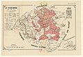
 England and France 1259.jpg 1,669 × 2,191; 1.34 MB
-

-
 Angevin empire in France c. 1200 (he).png 990 × 1,241; 185 KB
-
 Angevin empire in France c. 1200 (simplified)-es.svg 792 × 993; 14 KB
-
 Angevin empire in France c. 1200 (simplified)-pt.svg 792 × 993; 10 KB
-
 Angevin empire in France c. 1200 (simplified).png 990 × 1,241; 186 KB
-
 Carte de france 1223.png 1,078 × 1,371; 678 KB
-
 Carte France 1270.svg 461 × 645; 230 KB
-
 Conquetes Philippe Auguste.png 800 × 600; 101 KB
-
 Conquistas de Felipe Augusto es.svg 9,442 × 6,618; 304 KB
-
 Conquiste territoriali Filippo Augusto.png 796 × 596; 75 KB
-
 English and French holdings 1180-1223.png 800 × 515; 93 KB
-
 France1911dev.png 2,046 × 2,780; 3.94 MB
-
 Le Verdunois XIIIe-XVIe siecle.jpg 1,475 × 1,023; 496 KB
-
 Territoire de la ville libre impériale de Besançon en 1290.jpg 1,733 × 2,103; 867 KB
-
 Territorial Conquests of Philip II of France-nl.png 800 × 600; 426 KB
-
 Territorial Conquests of Philip II of France.png 800 × 600; 139 KB
.png)

%27_(11123129386).jpg)
.png)
-es.svg)
-pt.svg)
.png)


