Category:Maps of historic districts on the National Register of Historic Places in Iowa
Jump to navigation
Jump to search
States of the United States: Alaska · Arkansas · Connecticut · Georgia · Idaho · Illinois · Indiana · Iowa · Louisiana · Maryland · Massachusetts · Michigan · Mississippi · Nebraska · New Jersey · New York · North Carolina · Ohio · Oregon · Pennsylvania · Rhode Island · Texas · Virginia · Washington · West Virginia · Wyoming
Puerto Rico
Puerto Rico
Media in category "Maps of historic districts on the National Register of Historic Places in Iowa"
The following 9 files are in this category, out of 9 total.
-
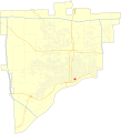
 Annie Wittenmyer district (Davenport).svg 1,000 × 1,104; 685 KB
-
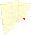
 Crescent district (Davenport).svg 1,000 × 1,104; 684 KB
-
 Heritage Hill-Snake Alley HDs boundary map.png 917 × 900; 462 KB
-
 Manufacturing and Wholesale HD boundary map.png 917 × 900; 465 KB
-
 Map of Davenport, Iowa Neighborhoods.png 1,688 × 829; 492 KB
-
 McClellan Heights district (Davenport).svg 1,000 × 1,104; 685 KB
-
 Prospect Park district (Davenport).svg 1,000 × 1,104; 684 KB
-
 Rose Hill Historic District Sioux City Map.png 626 × 800; 21 KB
-
 West Jefferson Street HD boundary map.png 917 × 900; 464 KB
.svg)
.svg)


.svg)
.svg)

