Category:Maps of historic districts on the National Register of Historic Places in Louisiana
Jump to navigation
Jump to search
States of the United States: Alaska · Arkansas · Connecticut · Georgia · Idaho · Illinois · Indiana · Iowa · Louisiana · Maryland · Massachusetts · Michigan · Mississippi · Nebraska · New Jersey · New York · North Carolina · Ohio · Oregon · Pennsylvania · Rhode Island · Texas · Virginia · Washington · West Virginia · Wyoming
Puerto Rico
Puerto Rico
Media in category "Maps of historic districts on the National Register of Historic Places in Louisiana"
The following 21 files are in this category, out of 21 total.
-
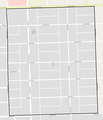
 Beauregard Town Historic District, LA.png 1,622 × 1,221; 878 KB
-
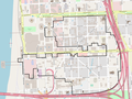
 Downtown Baton Rouge Historic District, LA.png 729 × 1,134; 220 KB
-
 Downtown Ruston Historic District, LA.png 1,482 × 1,484; 326 KB
-
 Drehr Place Historic District, LA.png 1,384 × 2,711; 259 KB
-
 Fairfield Historic District, LA.png 1,548 × 2,552; 561 KB
-
 Freetown-Port Rico Historic District, LA.png 1,888 × 2,081; 1.65 MB
-
 Gretna Historic District, LA.png 1,962 × 2,010; 969 KB
-
 Highland Historic District, LA.png 1,512 × 1,393; 590 KB
-
 Homer Historic District, LA.png 821 × 1,163; 137 KB
-
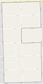
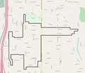
 Kleinert Terrace Historic District, LA.png 1,252 × 624; 149 KB
-
 Lake Charles Historic District, LA.png 1,474 × 1,631; 473 KB
-
 Louisiana State University, Baton Rouge, LA.png 2,067 × 1,890; 1.33 MB
-
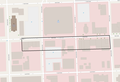 Main Street Historic District, LA.png 1,807 × 1,228; 283 KB
-
 Plaquemine Historic District, LA.png 1,995 × 2,001; 898 KB
-
 Roseland Terrace Historic District, LA.png 1,243 × 1,444; 234 KB
-
 Shreveport Commercial Historic District, LA.png 1,428 × 1,849; 989 KB
-
 South Highlands Historic District, LA.png 1,243 × 1,073; 347 KB
-
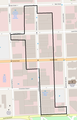
 Southern University Historic District, LA.png 1,046 × 993; 62 KB
-
 Spanish Town, LA.png 1,970 × 1,879; 510 KB
-
 St. Paul's Bottoms, LA.png 1,805 × 2,213; 900 KB
-
 Sterling Grove Historic District, LA.png 856 × 1,283; 162 KB


