Category:Maps of the Niagara River
Jump to navigation
Jump to search
Media in category "Maps of the Niagara River"
The following 57 files are in this category, out of 57 total.
-

-
 18 of 'Free Niagara' (11185423515).jpg 2,202 × 2,949; 1.57 MB
-
 1829 Black Rock Harbour map.jpg 3,662 × 2,227; 1.42 MB
-
 1843 Blackwell Map of Niagara Falls, New York - Geographicus - NiagaraFalls-haines-1843.jpg 4,000 × 2,348; 3.12 MB
-

-
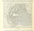
 US-NY(1891) p610 BUFFALO AND THE NIAGARA RIVER.jpg 1,741 × 933; 1.02 MB
-
 1904 NYCRR Buffalo.jpg 1,817 × 3,595; 1.05 MB
-
 241 of 'The History of Canada' (11192597644).jpg 1,590 × 2,619; 789 KB
-

-
-

-
-
 838 of 'Die Erde. Eine allgemeine Erd- und Länderkunde, etc' (11236945105).jpg 1,683 × 1,532; 803 KB
-

-
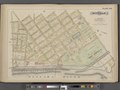 Buffalo, Double Page Plate No. 20 (Map bounded by Porter Ave., Niagara River, Ferry St.) NYPL2055436.tiff 7,102 × 5,327, 2 pages; 108.5 MB
-
 Buffalo, Double Page Plate No. 21 (Map bounded by Niagara River, Bradley St., Tryon Pl., Ferry St.) NYPL2055437.tiff 7,062 × 5,297, 2 pages; 107.29 MB
-

-
 Buffalo, Double Page Plate No. 24 (Map bounded by Grove St., Cass St., N. Elmwood Ave., Amherst St., Niagara River) NYPL2055440.tiff 7,096 × 5,322, 2 pages; 108.31 MB
-
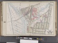 Buffalo, V. 1, Double Page Plate No.16 (Map bounded by Amherst St., Rees St., Bird Ave., Niagara River) NYPL2056899.tiff 7,094 × 5,321, 2 pages; 108.26 MB
-
 Buffalo, V. 1, Double Page Plate No.27 (Map bounded by Niagara River, Bird Ave., Grant St., Hampshire St.) NYPL2056910.tiff 7,057 × 5,292, 2 pages; 107.11 MB
-

-
 Buffalo, V. 1, Double Page Plate No.6 (Map bounded by Arthur St., Bush St., Amherst St., Niagara River) NYPL2056889.tiff 7,057 × 5,292, 2 pages; 107.11 MB
-
 Buffalo, V. 3, Double Page Plate No. 24 (Map bounded by Ferry Rd., E. Branch Niagara River, W. Branch Niagara River) NYPL2056970.tiff 7,196 × 5,397, 2 pages; 111.38 MB
-
 Buffalo, V. 3, Double Page Plate No. 8 (Map bounded by Niagara River, State Ditch, 10th Ave., Two mile Creek Rd.) NYPL2056954.tiff 7,145 × 5,359, 2 pages; 109.81 MB
-
 Buffalo, V. 3, Double Page Plate No.1 (Map of outline Greater Buffalo New York) NYPL2056947.tiff 7,163 × 5,372, 2 pages; 110.36 MB
-
 Bulletin of the Buffalo Society of Natural Sciences (1901) (20259157550).jpg 3,536 × 7,410; 10.74 MB
-
 Darlington map of the Niagra region 1680.png 782 × 497; 956 KB
-
-
 Diversion of water from the Great lakes and Niagara river (1921) (14784061535).jpg 4,782 × 3,074; 2.27 MB
-
 Fenian Raid of 1866.jpg 636 × 850; 110 KB
-

-

-

-
 Grand Island (Township); South Buffalo (Village); Buffalo Plains (Village) NYPL1584513.tiff 7,230 × 4,780; 98.88 MB
-
 Grand-River-Niagara-Part1.tif 4,685 × 3,986; 17.83 MB
-
 Grand-River-Niagara-Part2.tif 4,685 × 3,986; 17.83 MB
-
 Image taken from page 19 of 'Free Niagara' (15968072494).jpg 688 × 1,070; 173 KB
-
 Map of part of Niagara River NYPL435011.tiff 4,624 × 4,777; 63.2 MB
-
 Map of the Niagara Falls region, including the Niagara River and the Niagara Peninsula. LOC 74694649.jpg 17,240 × 12,359; 20.61 MB
-
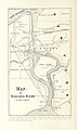
 Map of the Niagara Frontier, 1869.jpg 482 × 787; 325 KB
-
 Mouth of the Niagara River, 1798.jpg 5,909 × 4,716; 3.34 MB
-
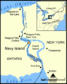 Navy Island map.png 478 × 600; 174 KB
-
 Niagara and Onondoga escarpments, 1825.jpg 567 × 360; 115 KB
-
 Niagara Falls Suspension Bridges.svg 1,295 × 985; 271 KB
-
 Niagara Gorge RGS map 1906 gscmcm 0926 e 1905 mn01.pdf 2,914 × 5,658; 2.94 MB
-
 Niagara map.jpg 2,205 × 1,319; 522 KB
-
 Niagara peninsula, 1827.png 1,069 × 768; 1,002 KB
-
 Niagara River 1812.jpg 1,527 × 858; 155 KB
-
 Niagra River and Territory, 1812.jpg 1,473 × 2,305; 550 KB
-
 Sketch of the Niagara River. NYPL435013.tiff 4,672 × 4,724; 63.15 MB
-
 Squaw & Bird Islands map.png 604 × 806; 21 KB
-

-
 The harbours and ports of Lake Ontario (1857) (14771547464).jpg 2,596 × 3,204; 892 KB
-

-
 Tuscarora Reservation.jpg 2,988 × 5,312; 4.83 MB
-
 Whirlpool River Map (22126795576).jpg 403 × 580; 76 KB
-
 Wpdms usgs photo lake tonawanda.jpg 400 × 300; 48 KB
%27_(11125830686).jpg)
.jpg)


.jpg)
_p610_BUFFALO_AND_THE_NIAGARA_RIVER.jpg)

.jpg)
%27_(11112592903).jpg)
.jpg)
.jpg)
.jpg)
.jpg)

_(20259157550).jpg)

_(14781663724).jpg)
_(14784061535).jpg)


_(14597981549)_(cropped).jpg)

.jpg)


_(14741116536).jpg)
_(14771547464).jpg)
_(14597542678).jpg)

.jpg)
