Category:Niehl II
Jump to navigation
Jump to search
| Object location | | View all coordinates using: OpenStreetMap |
|---|
Port in Cologne, Germany  | |||||
| Upload media | |||||
| Instance of | |||||
|---|---|---|---|---|---|
| Location | Merkenich, Chorweiler, Cologne, Cologne Government Region, North Rhine-Westphalia, Germany | ||||
| Operator | |||||
| Date of official opening |
| ||||
| official website | |||||
 | |||||
Media in category "Niehl II"
The following 7 files are in this category, out of 7 total.
-
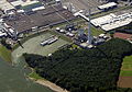 Aerial view of Heizkraftwerk Köln-Merkenich.jpg 2,643 × 1,850; 5.65 MB
-
 Gasometer im Kölner Hafen Niehl II-41070.jpg 5,409 × 4,057; 22.22 MB
-
 Hafeneinfahrt Köln-Niehl II-41077.jpg 6,565 × 3,693; 21.23 MB
-
 Hafeneinfahrt Köln-Niehl II-41078.jpg 6,387 × 3,593; 20.16 MB
-
 Hafeneinfahrt Köln-Niehl II-41079.jpg 4,480 × 4,480; 18.44 MB
-
 Heizkraftwerk Köln-Merkenich, Niehl II, Ford-Werke-3339.jpg 4,223 × 3,063; 10.32 MB
-
 Motortankschiff Aloo - ENI 02338434 - im Hafen Köln-Niehl II-41075.jpg 5,038 × 2,834; 10.48 MB


