Category:Old maps of Carinthia
Jump to navigation
Jump to search
Burgenland · Carinthia · Lower Austria · Salzburg · Styria · Tyrol · Upper Austria · Vienna · Vorarlberg
Use the appropriate category for maps showing all or a large part of Carinthia. See subcategories for smaller areas:
| If the map shows | Category to use |
|---|---|
| Carinthia on a recently created map | Category:Maps of Carinthia or its subcategories |
| Carinthia on a map created more than 70 years ago | Category:Old maps of Carinthia or its subcategories |
| the history of Carinthia on a recently created map | Category:Maps of the history of Carinthia or its subcategories |
| the history of Carinthia on a map created more than 70 years ago | Category:Old maps of the history of Carinthia or its subcategories |
Deutsch: Alte Karten von Kärnten, die älter als 70 Jahre sind und deren Urheberrecht abgelaufen ist (Landkarten, Kärntenkarten)
English: Maps of Carinthia older than 70 years, copyright expired.
Subcategories
This category has the following 2 subcategories, out of 2 total.
H
- Maps of Hebalm (29 F)
Media in category "Old maps of Carinthia"
The following 60 files are in this category, out of 60 total.
-
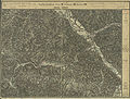
 Kärnten BV044693834.jpg 8,619 × 6,342; 8.91 MB
-

-

-

-
 Kärnten BV044689307.jpg 11,710 × 8,587; 11.21 MB
-
 Kärnten BV044689731.jpg 11,630 × 8,778; 11.24 MB
-
 Edlinger-Gerichtsbarkeit, Kataster Stand 1901, vermessen 1827.jpg 2,688 × 2,268; 1.12 MB
-
 Edlinger-Gerichtsbarkeit Kataster - Steuerkarte 1829 - NUK - Z 282.4-53.tif 1,646 × 2,028; 9.35 MB
-
 (1854) Karte von KRAIN im Mittelalter.jpg 2,699 × 2,105; 3.14 MB
-
 (1854) Diöcesankarte von KRAIN (1462-1787).jpg 2,655 × 2,181; 3.02 MB
-
 Stmk Ktn Krain Görz Meyer 3 Auflage ca 1880.jpg 6,019 × 7,649; 62.12 MB
-
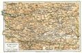
 Meyers leiner Hand-atlas 1893 (73136723).jpg 6,538 × 4,880; 6.72 MB
-
 Situationsplan des Kurortes Pörtschach am See (Oesterreich) - btv1b8459758v.jpg 10,516 × 7,351; 9.1 MB
-
 Völkermarkt BV043869460.jpg 14,406 × 11,102; 29.79 MB
-
 Übersichtskarte von Mitteleuropa N 47 Klagenfurt 1937.pdf 4,258 × 2,979; 426.85 MB
-

-
 Atlas Ortelius KB PPN369376781-060av-060br.jpg 3,000 × 2,194; 4.59 MB
-
 Atlas Ortelius KB PPN369376781-077av-077br.jpg 3,000 × 2,194; 4.58 MB
-
 Aufnahmeblatt 5254-3 1878 farbig Glashütten, Weineben, Wolfsberg bearbeitet.jpg 9,659 × 7,398; 28.93 MB
-
 Aufnahmeblatt 5354-1.jpg 9,668 × 7,316; 34.83 MB
-
 Aufnahmeblatt 5354-3.jpg 9,703 × 7,378; 35 MB
-

-
 Autriche. La Carinthie vous appelle et vous attend - btv1b52505256k (1 of 2).jpg 13,946 × 3,770; 11.78 MB
-
 AvI Provinz Innerösterreich.jpg 10,147 × 8,764; 30.99 MB
-
 Blaeu 1645 - Saltzburg Archiepiscopatus et Carinthia Ducatus.jpg 3,647 × 3,016; 1.62 MB
-
 Bleiberg und Tarvis. NYPL1226722.tiff 4,440 × 5,219; 66.3 MB
-
 Bodleian Libraries, Saltzburg archipiscopatus cum ducatu Carinthiae.jpg 1,000 × 675; 189 KB
-
 Bünker 1902 S 017 sw Karte Seeboden.jpg 2,782 × 3,026; 2.93 MB
-
 Bünker 1902 S 028 sw Kraut Rumpler Seeboden.jpg 1,247 × 1,045; 472 KB
-
 Bünker 1902 S 028 sw Pichler Gritschach Seeboden.jpg 1,330 × 1,170; 533 KB
-
 Bünker 1902 S 028 sw Sank Gritschach Seeboden.jpg 1,149 × 1,228; 591 KB
-
 Bünker 1902 S 028 sw Winkler Reich Seeboden.jpg 1,340 × 1,405; 691 KB
-
 Carinthia.jpg 2,607 × 1,670; 1.14 MB
-
 Charte Kärndten (Merian).jpg 1,566 × 1,206; 573 KB
-
 Duchy of Carinthia.jpg 1,276 × 1,062; 1,011 KB
-
 FK Sankt Ruprecht 1827 Ausschnitt Schmelzhuetten.jpg 2,075 × 1,332; 637 KB
-
 FK Sankt Ruprecht 1827 Papier Muehle orig..jpg 2,912 × 1,992; 1.16 MB
-
 Graz - 33-47.jpg 3,461 × 4,952; 5.15 MB
-
 Gurk-Thal. NYPL1226689.tiff 4,432 × 5,315; 67.4 MB
-
 Hofgastein - 31-47.jpg 3,474 × 4,972; 4.19 MB
-
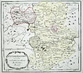
 Innerösterreich Sanson.jpg 11,811 × 8,659; 67.58 MB
-
 Klagenfurt - 32-47.jpg 3,444 × 4,984; 3.9 MB
-
 Klagenfurt map ca 1735.jpg 400 × 352; 265 KB
-
 Königreich Illyrien. Das Gebiet der Stadt Triest in grösserem Maasse.jpg 2,977 × 2,351; 841 KB
-
 Lazius - Carinthiae ducatus, et Goritiae palatinatus.jpg 1,610 × 2,187; 2.27 MB
-
 Meyers b9 s0550a.jpg 3,569 × 2,309; 6.68 MB
-
 Nova et accurata Carinthiae ducatus tabula geographica - CBT 5878278.jpg 5,566 × 4,668; 8.8 MB
-
 Oberkärnten Karte Surgant um 1750.jpg 2,388 × 2,008; 2.49 MB
-
 Reilly 136.jpg 1,310 × 777; 406 KB
-
 Reilly 137.jpg 1,106 × 972; 447 KB
-
 Reilly 138.jpg 1,121 × 1,012; 440 KB
-
 Reilly 139.jpg 1,335 × 962; 574 KB
-
 Saltzburg Archiepiscopatus et Carinthia Ducatus.jpg 834 × 650; 231 KB
-
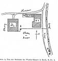
 Seeboden Flurkarte Wirlsdorf Reich Kraut Seebach J.R. Bünker 1902.jpg 2,701 × 3,129; 5.07 MB
-
 St. Jakob ob Gurk Franziszeischer Kataster 1828.jpg 554 × 642; 73 KB
-
 Steiermark Kaernten Celje Ottens.JPG 3,648 × 2,736; 3.15 MB
-
 Steiermark und Kärnten Danckert 1620.jpg 6,129 × 5,707; 31.8 MB
-
 Suedbahn 1899 Karte Muerzzuschlag-Marburg.jpg 4,035 × 1,980; 2.07 MB
-
 Upravni zemljevid Ilirskega kraljestva leta 1817.jpg 7,365 × 9,760; 9.56 MB
-
 Wolfgang Lazius, Carinthiae Ducatus, et Goritiae Palatinatus (FL37099015 2526777).jpg 13,289 × 10,419; 202.85 MB


.jpg)
.jpg)


_Karte_von_KRAIN_im_Mittelalter.jpg)
_Di%C3%B6cesankarte_von_KRAIN_(1462-1787).jpg)

.jpg)
_-_btv1b8459758v.jpg)

.jpg)


_(14756125086).jpg)


.jpg)


.jpg)
.jpg)