Category:Old maps of Georgia
Jump to navigation
Jump to search
Use the appropriate category for maps showing all or a large part of Georgia. See subcategories for smaller areas:
| If the map shows | Category to use |
|---|---|
| Georgia on a recently created map | Category:Maps of Georgia or its subcategories |
| Georgia on a map created more than 70 years ago | Category:Old maps of Georgia or its subcategories |
| the history of Georgia on a recently created map | Category:Maps of the history of Georgia or its subcategories |
| the history of Georgia on a map created more than 70 years ago | Category:Old maps of the history of Georgia or its subcategories |
Subcategories
This category has the following 7 subcategories, out of 7 total.
C
P
T
Media in category "Old maps of Georgia"
The following 14 files are in this category, out of 14 total.
-
 Armenia, Colchis, Iberia, Albania, Etc.jpg 3,231 × 2,079; 2.09 MB
-
 ARTAZ L' EMPIRE De PERSE 1779 d’Anville P.Santini ~3.jpg 503 × 692; 177 KB
-
 ARTAZ-AMATUNIK ARMENIA ADERBIJAN.jpg 693 × 1,262; 503 KB
-
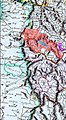
 Batumskaya oblast.jpg 512 × 507; 47 KB
-
 Califate 750.png 1,229 × 1,028; 1.93 MB
-

-
 CAUCASIA~Vegetation Land Cover with ethnic borders~2.jpg 1,080 × 1,799; 1.14 MB
-
 David Gareja monasteries, Georgia, 1723 map by De Lisle.jpg 1,863 × 1,288; 864 KB
-
 Georgia. Tartaria d'Europa - Tatars in Europe (1684) (cropped).jpg 3,114 × 2,597; 2.81 MB
-
 Karabakh Map (1856).jpg 1,200 × 937; 478 KB
-
 Kaukasus 1890 map.jpg 5,000 × 4,133; 9.93 MB
-
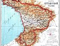 Kutais guberniya.jpg 3,346 × 2,552; 2.73 MB
-
 Le Tour du monde-04-p119.png 853 × 870; 76 KB
-


_(cropped).jpg)
.jpg)


