Category:Old maps of Manitoba
Jump to navigation
Jump to search
Provinces and territories of Canada: Alberta · British Columbia · Manitoba · New Brunswick · Newfoundland and Labrador · Nova Scotia · Ontario · Prince Edward Island · Quebec · Saskatchewan · Northwest Territories · Nunavut · Yukon
Subcategories
This category has the following 4 subcategories, out of 4 total.
G
Media in category "Old maps of Manitoba"
The following 30 files are in this category, out of 30 total.
-

-
 Cowan River Sectional Map 371 (1917).jpg 9,912 × 6,768; 8.24 MB
-

-

-

-
 A Plan of Lower Fort Garry (1928) (2196086650).jpg 3,531 × 2,048; 7.25 MB
-

-
 Annual report (1938) (18243213259).jpg 2,510 × 1,566; 1.47 MB
-

-

-
 Canadian forest industries 1901-1902 (1902) (19904795683).jpg 2,958 × 1,890; 1,002 KB
-
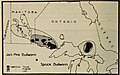
 CFBaieHudsonManitobaFig11933.jpg 1,481 × 1,024; 269 KB
-
 CFBaieHudsonManitobaFig21933.jpg 1,485 × 1,014; 213 KB
-
 Geological Map of portions of Saskatchewan, Athabaska, and Keewatin Districts 1902.pdf 5,022 × 4,256; 4.58 MB
-

-
 Hudsonbayrailway1.jpg 500 × 319; 25 KB
-
 Kississing Sectional Map 421 (1922) (3739448011).jpg 8,772 × 6,645; 7.28 MB
-

-
 Manitoba and Northwest Territories (1900).jpg 3,510 × 2,550; 9.76 MB
-

-
 Map of Manitoba shewing provincial government lands for sale (14304159767).jpg 2,000 × 1,275; 3 MB
-
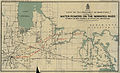
 Map of Manitoba Showing Vegetative Belts (1934).jpg 1,590 × 2,430; 2.47 MB
-
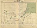
 Map of the mouths of the Nelson, Hayes and Fourteen Rivers (1912).jpg 3,581 × 2,051; 3.42 MB
-
 New dollar atlas of the United States and Dominion of Canada (1884) (14580638388).jpg 3,216 × 2,210; 695 KB
-
-

-
 Port Nelson Sectional Map 575 (1915).jpg 8,742 × 6,658; 11.24 MB
-
 Rand, Mac Nally & Co's Manitoba - btv1b53058145s.jpg 6,456 × 4,466; 4.84 MB
-
 Winnipeg LOC 99463757.jpg 12,168 × 9,144; 24.34 MB
-
 Winnipeg LOC 99463757.tif 12,168 × 9,144; 318.33 MB

.jpg)
)%27_(11164572003).jpg)
%27_(11157429405).jpg)
)%27_(11161718483).jpg)
_(2196086650).jpg)
.jpg)
_(18243213259).jpg)
_(14591291678).jpg)

_(19904795683).jpg)


.jpg)

_(3739448011).jpg)
_(14577752419).jpg)
.jpg)

.jpg)
.jpg)
.jpg)
_(14580638388).jpg)
.jpg)
_(14580823440).jpg)
.jpg)

