Category:Old maps of Quebec
Jump to navigation
Jump to search
Provinces and territories of Canada: Alberta · British Columbia · Manitoba · New Brunswick · Newfoundland and Labrador · Nova Scotia · Ontario · Prince Edward Island · Quebec · Saskatchewan · Northwest Territories · Nunavut · Yukon
Subcategories
This category has the following 10 subcategories, out of 10 total.
Media in category "Old maps of Quebec"
The following 16 files are in this category, out of 16 total.
-

-
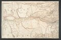
 A plan of part of His Majesty's Province of Quebec RMG K1013.jpg 1,280 × 769; 835 KB
-

-
 Baie des Chaleurs Québec Canada.jpg 604 × 234; 220 KB
-
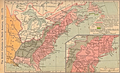 British colonies 1763-76 shepherd1923.PNG 1,651 × 1,010; 3.57 MB
-

-
 Iles de la Madeleine - btv1b530894439.jpg 6,488 × 4,640; 2.96 MB
-

-
-
-

-

-

-

-
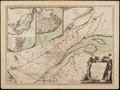
 Province of Quebec 1774.gif 506 × 448; 36 KB
-
 Tadoussac - circa 1612 - Project Gutenberg etext 20110.jpg 1,190 × 910; 317 KB
.jpg)


.jpg)

_(14767542495).jpg)

