Category:Old maps of Westleton
Jump to navigation
Jump to search
Media in category "Old maps of Westleton"
The following 2 files are in this category, out of 2 total.
-
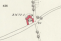 Highfields Barn, Westleton O. S. 1883 Suffolk XXXIX.11.png 503 × 344; 257 KB
-
 Map of Suffolk OS Map name 039-SE, Ordnance Survey, 1881-1893.jpg 5,391 × 3,602; 3.03 MB

