Category:Old maps of Suffolk
Jump to navigation
Jump to search
Ceremonial counties of England: Bedfordshire · Berkshire · Buckinghamshire · Cambridgeshire · Cheshire · Cornwall · Cumbria · Derbyshire · Devon · Dorset · Durham · East Riding of Yorkshire · East Sussex · Essex · Gloucestershire · Greater London · Greater Manchester · Hampshire · Herefordshire · Hertfordshire · Isle of Wight · Kent · Lancashire · Leicestershire · Lincolnshire · Norfolk · North Yorkshire · Northamptonshire · Northumberland · Nottinghamshire · Oxfordshire · Rutland · Shropshire · Somerset · South Yorkshire · Staffordshire · Suffolk · Surrey · Warwickshire · West Midlands · West Sussex · West Yorkshire · Wiltshire · Worcestershire
City-counties: Bristol · City of London
Former historic counties: Cumberland · Huntingdonshire · Middlesex · Sussex · Westmorland · Yorkshire
Other former counties:
City-counties: Bristol · City of London
Former historic counties: Cumberland · Huntingdonshire · Middlesex · Sussex · Westmorland · Yorkshire
Other former counties:
Subcategories
This category has the following 11 subcategories, out of 11 total.
- Old county maps of Suffolk (11 F)
*
I
O
- Old maps of Dunwich (2 F)
- Old maps of Westleton (2 F)
- Old maps of Weston, Suffolk (1 F)
Media in category "Old maps of Suffolk"
The following 39 files are in this category, out of 39 total.
-
 "The Map of the Great Levell drained" (1662).jpg 4,666 × 3,648; 12.37 MB
-
 ... Map of New Market Heath, of the adjacent villages... - J. Chapman - btv1b53119532x.jpg 12,436 × 8,174; 21.2 MB
-
 Suffolk - By H. Moll Geographer - btv1b53056965z.jpg 4,192 × 3,032; 2 MB
-
 Warren's map of Bury St Edmunds Suffolk.jpg 1,251 × 864; 871 KB
-

-
 Ordnance Survey Drawings - Feltwell, Norfolk (OSD 238).jpg 4,329 × 5,547; 4.32 MB
-

-
 19th Century Map of Frostenden.png 412 × 401; 295 KB
-
 20th Century map of Friston.png 609 × 379; 572 KB
-
 20th Century map of Ringshall, Suffolk.png 651 × 326; 411 KB
-

-
-

-

-
-

-
 Admiralty Chart No 1094 Outer Gabbard to Outer Dowsing, Published 1912.jpg 11,097 × 16,208; 55.23 MB
-
 Becclesmap 1921.jpg 2,544 × 3,504; 1.37 MB
-
 Belstead Map 1946.png 573 × 443; 464 KB
-
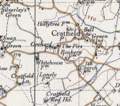 Cratfield 20th century map.PNG 318 × 281; 212 KB
-
 Filixstowmap1940.jpg 2,544 × 3,504; 1.58 MB
-

-
 Frostenden Seaport Map.png 1,260 × 924; 272 KB
-
 Gisleham.png 260 × 177; 121 KB
-
 Harwich Harbour 1804.png 2,498 × 3,331; 1,012 KB
-

-
 Lowestoft & Yarmouth RJD 43.jpg 1,688 × 2,707; 800 KB
-
 Ordnance Survey Drawings - Ipswich (OSD 145).jpg 4,000 × 3,832; 5.47 MB
-

-
 Ordnance Survey Sheet TM 17 (62 17) Eye, Published 1947.png 7,632 × 9,748; 89 MB
-
 Ordnance Survey Sheet TM 59 (62 59) Lowestoft, Published 1947.jpg 7,604 × 9,754; 16.86 MB
-
 OS old series 1 63360 50.jpg 7,090 × 5,021; 10.48 MB
-

-
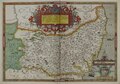 Suffolcia Atlas.tif 8,840 × 6,187; 98.08 MB
-
-

-

-
 Thingoe.jpg 1,677 × 2,223; 451 KB
-
 West Islip. (Village); North Babylon. (Village); Deer Park. (Village) NYPL1602995.tiff 5,428 × 7,230; 112.28 MB
.jpg)


.jpg)
.jpg)
.jpg)


.jpg)
.jpg)


_specially_drawn_for_the_work_(1902)_(14759016486).jpg)

.jpg)
_Eye,_Published_1947_cropped_to_show_Brome_and_Brome_Hall.png)
_Eye,_Published_1947.png)
_Lowestoft,_Published_1947.jpg)

.jpg)


