Category:OpenStreetMap maps of Paris 12e arrondissement
Jump to navigation
Jump to search
Media in category "OpenStreetMap maps of Paris 12e arrondissement"
The following 17 files are in this category, out of 17 total.
-
 12e Arrondissement, Paris, France - Open Street Map.png 1,329 × 1,082; 1.73 MB
-
 12th arrondissement of Paris - OSM 2020.svg 2,429 × 1,380; 5.99 MB
-
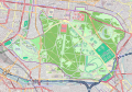
 Bois de Vincennes - OSM 2020.svg 2,460 × 1,650; 3.07 MB
-

-

-
 Hippodrome de Vincennes - OSM 2021.svg 1,500 × 1,200; 281 KB
-
 La Cartoucherie - colored OSM 2021.svg 512 × 457; 105 KB
-
 La Cartoucherie - OSM 2021.svg 512 × 457; 96 KB
-
 Lac des Minimes - OpenStreetMap 2017.svg 512 × 512; 32 KB
-
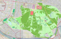
 Map of Bois de Vincennes - OpenStreetMap 1.svg 1,469 × 1,028; 8.68 MB
-
 Map of Bois de Vincennes.png 3,479 × 2,220; 4.71 MB
-
 Map of the 12th arrondissement of Paris - OSM 2020.svg 2,429 × 1,380; 6.06 MB
-
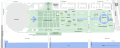
 Ministry of the Economy and Finance, Bercy - Plan OSM 2021.svg 512 × 355; 103 KB
-
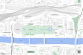
 Parc de Bercy, Paris - OSM 2021.svg 2,050 × 820; 291 KB
-
 Quarters of the 12th arrondissement of Paris - OSM 2020.svg 2,429 × 1,380; 6 MB
-
 Quartier de Bercy, Paris - OSM 2020.svg 1,428 × 951; 610 KB
-
 Vélodrome Jacques-Anquetil - OSM 2021.svg 512 × 333; 34 KB


