Category:OpenStreetMap maps of Paris 1er arrondissement
Jump to navigation
Jump to search
Media in category "OpenStreetMap maps of Paris 1er arrondissement"
The following 24 files are in this category, out of 24 total.
-
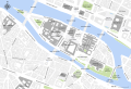
 1er Arrondissement, Paris, France - Open Street Map.png 1,259 × 1,011; 1.6 MB
-
 1st arrondissement of Paris - OSM 2020.svg 1,879 × 1,546; 1.25 MB
-
 Canal Saint-Martin, Paris - OSM 2022.svg 1,694 × 2,206; 7.59 MB
-
 Les Halles - OpenStreetMap 2020.svg 2,000 × 1,000; 230 KB
-
 Louvre Access Map.png 2,000 × 1,333; 2.17 MB
-
 Map of the 1st arrondissement of Paris - OSM 2020.svg 1,879 × 1,546; 1.28 MB
-
 Map of Île de la Cité - OpenStreetMap 2015.svg 2,000 × 1,050; 678 KB
-
 Map of Île de la Cité with monuments - OpenStreetMap 2015.svg 2,401 × 1,637; 564 KB
-
 OSM Paris sample.png 256 × 256; 133 KB
-
 Palais-Royal - OSM 2021 01.svg 1,800 × 1,050; 276 KB
-
 Palais-Royal - OSM 2021 02.svg 1,050 × 1,800; 281 KB
-
 Paris - Île de la Cité 2011.svg 2,670 × 1,841; 5.05 MB
-
 Paris 1st Arrondissement.png 1,257 × 859; 1.33 MB
-
 Paris 1st map.png 3,008 × 1,730; 501 KB
-
 Place Dauphine, Paris (EN) - OSM 2021.svg 512 × 349; 88 KB
-
 Place Dauphine, Paris (FR) - OSM 2021.svg 512 × 349; 88 KB
-
 Place Dauphine, Paris - OSM 2021.svg 1,600 × 1,200; 84 KB
-
 Place des Victoires, Paris - OpenStreetMap 2020.svg 512 × 346; 56 KB
-
 Place Vendôme - OpenStreetMap 2014.png 961 × 943; 200 KB
-
 Place Vendôme 2015.svg 2,100 × 1,880; 33 KB
-
 Place Vendôme, Paris - OSM 2021 01.svg 2,000 × 1,850; 106 KB
-
 Place Vendôme, Paris - OSM 2021 02.svg 512 × 422; 41 KB
-
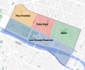 Quarters of the 1st arrondissement of Paris - OSM 2020.svg 1,879 × 1,546; 1.26 MB
-
 Île de la Cité and Île Saint-Louis - OSM 2021.svg 2,260 × 1,271; 1.26 MB


_-_OSM_2021.svg)
_-_OSM_2021.svg)


